Last updated: June 18, 2024
Article
NPS Geodiversity Atlas—Fort Matanzas National Monument, Florida
Geodiversity refers to the full variety of natural geologic (rocks, minerals, sediments, fossils, landforms, and physical processes) and soil resources and processes that occur in the park. A product of the Geologic Resources Inventory, the NPS Geodiversity Atlas delivers information in support of education, Geoconservation, and integrated management of living (biotic) and non-living (abiotic) components of the ecosystem.

Introduction
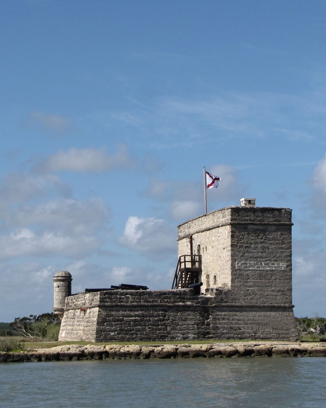
Fort Matanzas National Monument (FOMA) is located 23 km (14 mi) south of St. Augustine, on the northeast Atlantic coast of St. John’s County, Florida. Proclaimed on October 15, 1924, FOMA encompasses nearly 121 hectares (300 acres) with the purpose of preserving Fort Matanzas, an 18th century Spanish fortified watchtower. The national monument consists of two individual park units separated by the Matanzas River. The eastern portion of FOMA is located on the southern tip of Anastasia Island while western FOMA occupies the northern end of Rattlesnake Island and includes historic Fort Matanzas. Constructed by the Spanish from 1740–1742, Fort Matanzas is the bestpreserved component of the Spanish outer defense system that once protected St. Augustine from southern enemies (National Park Service 2016d). Besides safeguarding St. Augustine from enemy vessels, Fort Matanzas served a critical role in securing the Matanzas Inlet and functioned as a rest stop, coast guard station, and a place where vessels heading for St. Augustine could get advice on navigating the river.
Geologic Setting
FOMA is situated in the Atlantic Coastal Plain physiographic province, a region characterized by relatively flat terrain that slopes gently seaward in a series of well-developed marine terraces. These marine terraces record the positions of relict shorelines that developed in response to sea level fluctuations that occurred from the Pleistocene to the present (Colquhoun 1969; Richards et al. 1971). The geology of FOMA is composed of Quaternary-age deposits of the Pleistocene Anastasia Formation and undifferentiated Holocene sediments. Depositional settings represented by these units include beaches, swamps, and dunes (Scott et al. 1986). Fort Matanzas is built of coquina sourced from the Anastasia Formation; nearby Castillo de San Marcos (CASA) is also constructed of the same fossiliferous material.
Regional Geology
Fort Matanzas National Monument is a part of the Coastal Plain Physiographic Province and shares its geologic history and some characteristic geologic formations with a region that extends well beyond park boundaries.
- Scoping summaries are records of scoping meetings where NPS staff and local geologists determined the park’s geologic mapping plan and what content should be included in the report.
- Digital geologic maps include files for viewing in GIS software, a guide to using the data, and a document with ancillary map information. Newer products also include data viewable in Google Earth and online map services.
- Reports use the maps to discuss the park’s setting and significance, notable geologic features and processes, geologic resource management issues, and geologic history.
- Posters are a static view of the GIS data in PDF format. Newer posters include aerial imagery or shaded relief and other park information. They are also included with the reports.
- Projects list basic information about the program and all products available for a park.
Source: NPS DataStore Saved Search 2859. To search for additional information, visit the NPS DataStore.
A NPS Soil Resources Inventory project has been completed for Fort Matanzas National Monument and can be found on the NPS Data Store.
Source: NPS DataStore Saved Search 2927. To search for additional information, visit the NPS DataStore.

Related Links
Related Articles
Fort Matanzas National Monument
National Park Service Geodiversity Atlas
The servicewide Geodiversity Atlas provides information on geoheritage and geodiversity resources and values within the National Park System. This information supports science-based geoconservation and interpretation in the NPS, as well as STEM education in schools, museums, and field camps. The NPS Geologic Resources Division and many parks work with National and International geoconservation communities to ensure that NPS abiotic resources are managed using the highest standards and best practices available.
