Last updated: June 17, 2024
Article
NPS Geodiversity Atlas—Delaware Water Gap National Recreation Area, New Jersey and Pennsylvania
Geodiversity refers to the full variety of natural geologic (rocks, minerals, sediments, fossils, landforms, and physical processes) and soil resources and processes that occur in the park. A product of the Geologic Resources Inventory, the NPS Geodiversity Atlas delivers information in support of education, Geoconservation, and integrated management of living (biotic) and non-living (abiotic) components of the ecosystem.

Geologic Features and Processes
Delaware Water Gap National Recreation Area encompasses the namesake gap and upstream valley of the Delaware River in northeastern Pennsylvania and northwestern New Jersey. From American Indians to the resort community of the late 1800s to the modern-day transportation corridor, Delaware Water Gap has funneled humans through the otherwise-imposing Kittatinny Mountain for centuries. Today the park also provides a natural area for outdoor recreation that is accessible from New York City and Philadelphia. Approximately 5 million people visit the park annually.
The park’s 27,009 ha (66,740 ac) of rolling hills, ridges, and valleys lies along 64 km (40 mi) of the Middle Delaware National Scenic and Recreational River—the longest free-flowing river in the eastern United States. The valley lies between Kittatinny Mountain to the east and the Pocono (Allegheny) Plateau to the west. The 1.6- km- (1-mi-) wide, 370-m- (1,200-ft-) deep water gap cuts through Kittatinny Mountain, located in the Valley and Ridge province of the Appalachian Mountains. Mount Minsi (in Pennsylvania) and Mount Tammany (in New Jersey) flank the Gap. The Gap has been called “the most attractive in the United States.”
The bedrock underlying Delaware Water Gap National Recreation Area was deposited during the Ordovician, Silurian, and Devonian periods, about 450 to 359 million years ago. The rocks were originally sediments (lime, mud, sand, and gravel) deposited in a basin west of the highlands that formed during Appalachian mountainbuilding events along the eastern margin of North America. Much more recently, during the past 2 million years, ice age glaciers beveled highlands, carved troughs, and deposited outwash, till, and moraines. Younger surficial units consist of unconsolidated alluvium (gravel, sand, silt, and clay) deposited by streams, colluvium collecting at the bases of slopes, and swamp and marsh deposits. These rocks and unconsolidated deposits underlie the landforms that influence ecosystems and historical development at Delaware Water Gap National Recreation Area.
Delaware Water Gap
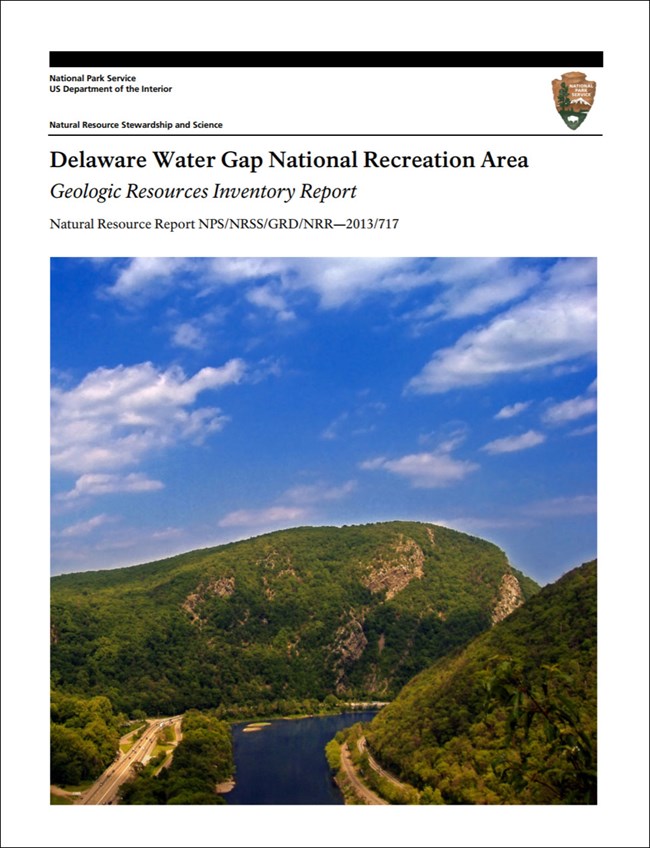
The Delaware River flows through the spectacular Delaware Water Gap near the southern boundary of the park. The approximately 370-m- (1,200-ft-) deep, 1.6-km- (1-mi-) wide Vshaped notch in the narrow ridgeline of Kittatinny Mountain displays deformed erosion-resistant bedrock. Delaware Water Gap formed through a process of headward erosion and stream capture. Deformation of the bedrock during Appalachian mountain-building episodes hundreds of millions of years ago created an area of structural weakness in the rock. Erosion was concentrated at this weaker area, leading to the formation of the Gap. Other gaps in the region formed in a similar manner but lack the scale and grandeur of the park’s namesake feature.
Folds and Faults
Hundreds of millions of years of mountain-building events deformed rocks in the park into folds or fractured them along faults. Folds in the park and surrounding area include both anticlines (“A”-shaped folds) and synclines (“U”-shaped folds). All three major types of faults (normal, reverse, and thrust) are documented in the area. Limbs of major folds support the high ridges of Kittatinny Mountain and are visible in the Gap. Folds and faults from later mountain-building events “overprint” folds and faults from earlier events.
Sedimentary Features
The sedimentary rocks of the park contain evidence of the environments in which they were deposited. Examples of such features include:
- Turbidites from Submarine Landslides
- Mudcracks
- Soft Sediment Deformation
- Concretions
Unconformities mark breaks in the stratigraphic record. The Taconic Unconformity is a regionally significant break marking the boundary between Ordovician and Silurian-aged rocks and the uplift and erosion of an ancient mountain range.
Waterfalls
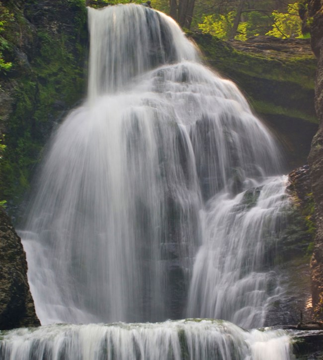
The high relief of the park hosts many waterfalls, including the particularly scenic Raymondskill and Dingmans falls—the two tallest waterfalls in Pennsylvania—and Buttermilk Falls, which is among the tallest in New Jersey. Other waterfalls, including Bushkill Falls (the “Niagara of Pennsylvania”) are located near the park. Waterfalls are indicators of geologic change. They record where rock types change from more resistant to less resistant. They also record a river’s adjustment to a change in base level or major increase in flow. Over time, waterfalls recede upstream, forming a canyon or gorge, while carving deeper into the resistant bedrock ridge.
Factory, Fulmer, Deer Leap, and Dingmans falls are successive “knickpoints” (sharp changes in channel slope) within the park along Dingmans Creek, west of Dingmans Ferry, Pennsylvania. They were created not by glacial ice but by meltwater erosion during deglaciations (Sevon and Inners 2001). Via quarrying and plucking, the creek cut distinctive and successive notched patterns into the bedrock at the lips of the falls. The “faces” of the falls represent pre ice age knickpoints (Sevon and Inners 2001). The successive notches in the lips formed during high meltwater flow following three or four deglaciations during the Pleistocene.
Pinchot, Raymondskill, and Bushkill falls formed in a similar manner (Sevon and Inners 2001). Water exploited a narrow rock fracture (joint) to form Silverthread Falls, also near Dingmans Creek.
Glacial Features and Landforms
Repeated glaciations (ice ages) during the Pleistocene Epoch (2 million to approximately 20,000 years ago) scoured and reshaped the landscape of northeastern United States, including Delaware Water Gap National Recreation Area. Thick sheets of ice advanced and retreated over the park throughout the Pleistocene, culminating in the most recent “Wisconsinan” glaciation when the Laurentide Ice Sheet covered northern North America. During this event, the Kittatinny and Minisink Valley lobes of the Laurentide Ice Sheet reached their maximum extents just 4 km (2 mi) south of the park’s southern boundary. Glacial deposits and features within and surrounding the park are well exposed and wellstudied. They include those deposited or carved by moving ice, those deposited by rivers flowing out of the glacier (termed “glaciofluvial”) or deposited in lakes near the glacier (termed “glaciolacustrine”). Following the most recent glacial retreat, the area’s geomorphology changed considerably.
Paleontological Resources
Delaware Water Gap National Recreation Area contains a rich Paleozoic fossil record from Ordovician, Silurian, and Devonian rocks. These fossils range in age from more than 480 million to about 360 million years old. Fossils in the Paleozoic clastic (claystone, siltstone, and sandstone, and conglomerate) and carbonate (limestone and dolomite) rocks of the park are primarily marine invertebrates.
More than a century of fossil resource investigation has taken place within and surrounding what is now the park. In 1903, paleontologist Stuart B. Weller of the New Jersey Geological Survey discovered, collected, and described fossils from many localities in the area (Parris et al. 1990). Weller’s specimens are curated at the New Jersey State Museum in Trenton, as part of more than 1,300 paleontological specimens from park collections housed there. Subsequent investigations have been conducted by Parris and others (Parris and Albright 1979a, 1979b; Parris et al. 1990; Parris and Cruikshank 1984). A non-technical guide to the fossils of New Jersey was published by Pallis et al. (2012). Common fossils of Pennsylvania are described and illustrated in Hoskins (1999).
All NPS fossil resources are protected under the Paleontological Resources Preservation Act of 2009 (Public Law 111-11, Title VI, Subtitle D; 16 U.S.C. §§ 470aaa - 470aaa-11).
Cave and Karst
Karst is not widespread within Delaware Water Gap National Recreation Area. It is limited to limestonebearing Silurian to Ordovician bedrock units as well as other rock units containing carbonate minerals or carbonate-cemented sandstone (see Map Unit Properties Table). On the New Jersey side of the park, Witte and Monteverde (2006) described dozens of small sinkholes, sinking streams, springs, and small caves along Wallpack Ridge, mostly within the Devonian Onandaga Limestone (Dou and Db). Dingmans Ferry Spring and Brau Kettle are two springs typical of karst landscape (Witte and Monteverde 2006). For many years, all caves and mines have been closed to public access to minimize the spread of white-nose syndrome among bat populations.
Cold Air Cave
Cold Air Cave is a talus cave, rather than a solution (karst) cave. The cave is an open space formed by large, jumbled sandstone boulders of the Shawangunk Formation that fell from overlying slopes. The cave is capped by large blocks approaching 9 m (30 ft) long and misleadingly appears stable (Epstein 2001b). Talus deposits (Qta) above and around the cave attest to the potential for rockfall during freeze–thaw cycles (Witte and Epstein 2005; Pristas 2007; Epstein 2010b).
The cave was discovered and named around 1870, when very cold air (temperatures approaching –1°C, approximately 30°F) was reported from an opening in rocks along present-day State Highway 611 (Snyder 1989). The opening, became a tourist attraction during the late 19th and early 20th centuries. The cave may reach up to 21 m (70 ft) in length, although only about 9 m (30 ft) is accessible to adults (Snyder 1989; Epstein 2001b). The cave temperature fluctuates significantly, depending on the direction of air flow. Wind blowing out of the cave is cooler than air blowing in the opposite direction, suggesting that a supply of cold air exists in void spaces throughout the scree system and potentially the bedrock above the cave (Epstein 2010b).
All NPS cave resources are protected under the the Federal Cave Resources Protection Act of 1988 (FCRPA)(16 U.S.C. § 4301 et seq.).
Abandoned Mineral Lands
Mining and quarrying in the area that would later become Delaware Water Gap National Recreation Area extends back at least to the 1750s. One mine in the park, the Pahaquarry mine, may have been the first copper mine in the United States. Several other quarries and sand and gravel pits are also located within what is now the park (e.g., Epstein 1974).
Pahaquarry Copper Mine
The origins of the Pahaquarry copper mine are the subject of lore; one story credits a Dutch operation of the 1600s with the construction of the 167-km- (104-mi-) long Old Mine Road (Kopczynski 2004). Although the mine operated sporadically in three different centuries, it was never economically viable. The mine is located within the Bloomsburg Red Beds and targeted diffuse copper in the disseminated chalcocite beds.
NPS AML sites can be important cultural resources and habitat, but many pose risks to park visitors and wildlife, and degrade water quality, park landscapes, and physical and biological resources. Be safe near AML sites—Stay Out and Stay Alive!
Regional Geology
Delaware Water Gap National Recreation Area is a part of the Valley and Ridge Physiographic Province and shares its geologic history and some characteristic geologic formations with a region that extends well beyond park boundaries.
- Scoping summaries are records of scoping meetings where NPS staff and local geologists determined the park’s geologic mapping plan and what content should be included in the report.
- Digital geologic maps include files for viewing in GIS software, a guide to using the data, and a document with ancillary map information. Newer products also include data viewable in Google Earth and online map services.
- Reports use the maps to discuss the park’s setting and significance, notable geologic features and processes, geologic resource management issues, and geologic history.
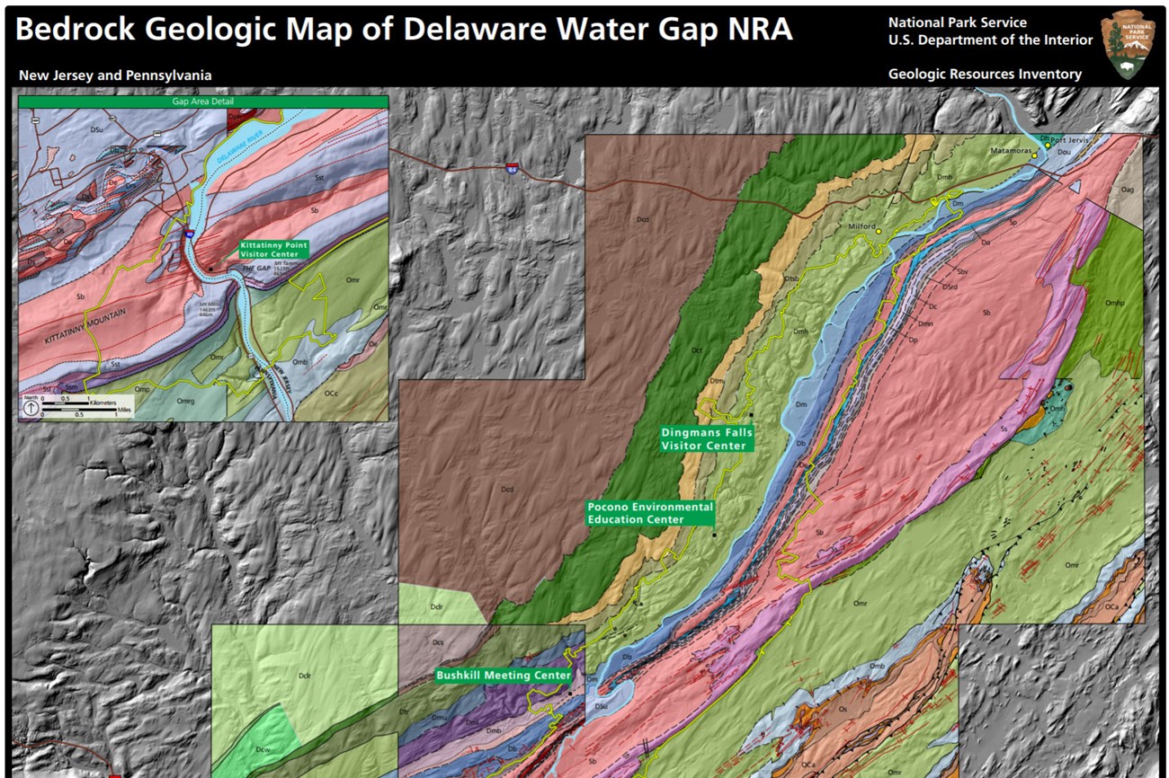
- Posters are a static view of the GIS data in PDF format. Newer posters include aerial imagery or shaded relief and other park information. They are also included with the reports.
- Projects list basic information about the program and all products available for a park.
Source: NPS DataStore Saved Search 2808. To search for additional information, visit the NPS DataStore.
A NPS Soil Resources Inventory project has been completed for Delaware Water Gap National Recreation Area and can be found on the NPS Data Store.
Source: NPS DataStore Saved Search 2831. To search for additional information, visit the NPS DataStore.

Related Links

