Last updated: June 17, 2024
Article
NPS Geodiversity Atlas—Death Valley National Park, California and Nevada
Geodiversity refers to the full variety of natural geologic (rocks, minerals, sediments, fossils, landforms, and physical processes) and soil resources and processes that occur in the park. A product of the Geologic Resources Inventory, the NPS Geodiversity Atlas delivers information in support of education, Geoconservation, and integrated management of living (biotic) and non-living (abiotic) components of the ecosystem.

Introduction
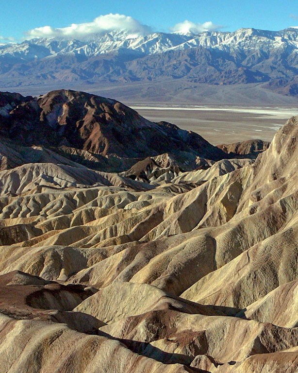
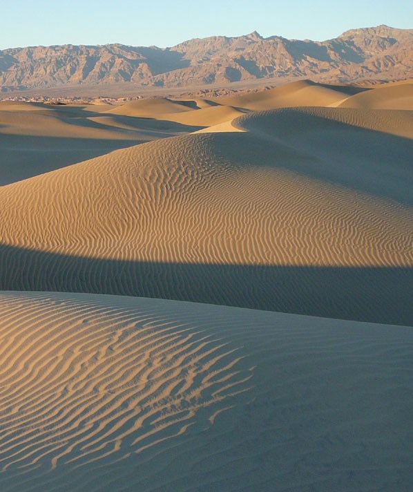
Death Valley National Park (DEVA), the largest national park of the lower 48 states, is situated in the Great Basin province in California (Inyo and San Bernardino Counties) and Nevada (Esmeralda and Nye Counties). The park was proclaimed a national monument on February 11, 1933 and was re-designated as a national park on October 31, 1994 (Anderson 2017). Encompassing approximately 1,365,030 hectares (3,373,063 acres), the landscape of DEVA is host to numerous mountain ranges, rock formations, sand dunes, dry lake playas, canyons, craters, desert springs, and a great diversity of life. DEVA is home to the endemic Devils Hole pupfish, a tiny desert fish protected in its desert spring habitat. The wildflower bloom is a spectacular draw for visitors to the park, especially in years where a superbloom creates carpets of flowers that decorate the horizon. The vast natural resources of DEVA are world-renowned, leading to the park being designated a Biosphere Reserve in 1984.
Geologic Setting
The geology of DEVA consists of some of the world’s best surficial rock exposures that showcase complex, unique tectonics and diverse geologic resources. Contained within the boundaries of the park is an expansive rock record that stretches back over a billion years and records evidence of ancient depositional environments that include shallow seas, lakes, and volcanic fields. The vast geologic history of DEVA ranges from Mesoproterozoic (~1.8 billion years old) metamorphic rocks exposed in the Black Mountains to recent playa sediments found in the valley basins. Plate tectonic and erosional processes have played a major role in shaping the rugged topography of the park and continue to do so today. Badwater Basin is the lowest point in North America at 86 m (282 ft) below sea level, yet it sits adjacent to and within the shadow of Telescope Peak at 3,368 m (11,049 ft) due to regional extensional faulting that causes the basins to sink and mountains to rise.
Regional Geology
Death Valley National Park is a part of the Basin and Range Physiographic Province and shares its geologic history and some characteristic geologic formations with a region that extends well beyond park boundaries.
- Scoping summaries are records of scoping meetings where NPS staff and local geologists determined the park’s geologic mapping plan and what content should be included in the report.
- Digital geologic maps include files for viewing in GIS software, a guide to using the data, and a document with ancillary map information. Newer products also include data viewable in Google Earth and online map services.
- Reports use the maps to discuss the park’s setting and significance, notable geologic features and processes, geologic resource management issues, and geologic history.
- Posters are a static view of the GIS data in PDF format. Newer posters include aerial imagery or shaded relief and other park information. They are also included with the reports.
- Projects list basic information about the program and all products available for a park.
Source: NPS DataStore Saved Search 2807. To search for additional information, visit the NPS DataStore.
A NPS Soil Resources Inventory project has not been completed for Death Valley National Park. General information can be found on the NPS Data Store.
Source: NPS DataStore Saved Search 2832. To search for additional information, visit the NPS DataStore.

Related Links
-
Death Valley—Natural Features and Ecosystems (Faults, Formations, Geology, Sand Dunes, etc.)
