Last updated: June 14, 2024
Article
NPS Geodiversity Atlas—Congaree National Park, South Carolina
Geodiversity refers to the full variety of natural geologic (rocks, minerals, sediments, fossils, landforms, and physical processes) and soil resources and processes that occur in the park. A product of the Geologic Resources Inventory, the NPS Geodiversity Atlas delivers information in support of education, Geoconservation, and integrated management of living (biotic) and non-living (abiotic) components of the ecosystem.

Introduction
Congaree National Park (CONG) is situated along the north shore floodplain of the Congaree River, extending northwest from the confluence of the Congaree and Wateree Rivers in Richland County, South Carolina. Originally authorized as Congaree Swamp National Monument on October 18, 1976, CONG was redesignated as a national park on November 10, 2003. Encompassing approximately 10,633 hectares (26,276 acres), CONG protects the nation’s largest remaining contiguous tract of southern old-growth bottomland forest and its associated ecological resources (National Park Service 2016a). The floodplain topography of CONG is surprisingly varied and complex, featuring flats, forested wetlands, ridges, levees (natural and man-made), deep-water sloughs, oxbow lakes, and intermittent and permanent streams (National Park Service 2014a). The national park is home to a rich diversity of flora and fauna species, including several champion trees (the largest known tree of a particular species) that hold national and state records. Due to its rich biodiversity, CONG has earned several important designations, including National Natural Landmark, Ramsar Convention Wetland of International Importance, International Biosphere Reserve, and Globally Important Bird Area.
Geologic Setting
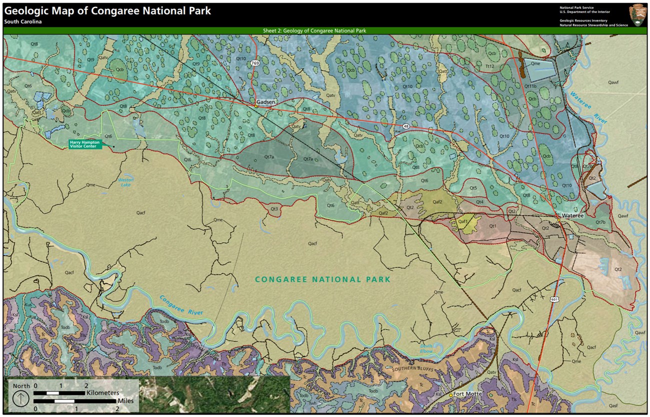
Located within the inland edge of the upper Coastal Plain Province, the regional geology of CONG consists of a thick, wedge-shaped package of rocks and unconsolidated deposits ranging in age from the Late Cretaceous to the present (Rankin 1977; Willoughby et al. 2005). Mapped units within CONG consist of young, Quaternary-age units including alluvial fan deposits, dune sands, terrace complexes, and alluvium associated with the Congaree River and Wateree River valleys. Quaternary floodplain deposits underlie the majority of CONG and record the dynamic, geologically recent movements of the Congaree River and, on a much broader scale, fluctuations of past sea levels. Congaree River valley terraces in the northern area of the park developed during the Pleistocene and consist of multiple sequences of estuarine to fluvial sand and clay.
Geologic Features and Processes
Congaree National Park protects a complex and diverse mosaic of floodplain geology and hydrology, including land forms, water bodies, and ecosystems. The park’s landscape features, topography, and soil types have been shaped by past migrations of the Congaree and Wateree rivers, historic climate change, the existence of geologic faults, the forest itself, and human activities. These elements in turn affect the distribution of plant and animal species in the park, as well as human interactions with the landscape.
Periodic floodwaters from the Congaree and Wateree rivers sweep through the bottomland forest, carrying nutrients and sediments that nourish and rejuvenate the rich floodplain ecosystem. Twenty-two distinct plant associations have been classified in the floodplain portion of the park, with an additional five associations located on the low bluffs to the north. The location of wetland plant communities is dictated in large part by subtle topographic gradients in the floodplain, including elevation changes wrought by meandering river channels, large woody debris, and sedimentation from large drainages that stretch into North Carolina and drain a 14,000-square-mile watershed.
Despite having an elevation change of only 20 feet in almost 15 miles, the floodplain has a surprisingly varied and complex topography, featuring flats, ridges, levees (natural and man-made), deep-water sloughs, oxbow lakes, and intermittent and permanent streams. The characteristic vegetation of individual communities is determined by soil texture and the duration of saturated soil conditions in the growing season. Due to the minimal relief in the floodplain, even slight elevation changes affect the duration and frequency of flooding, and thus the composition of plant communities.
Regional Geology
Congaree is a part of the Coastal Plain Province and shares its geologic history and some characteristic geologic formations with a region that extends well beyond park boundaries.
- Scoping summaries are records of scoping meetings where NPS staff and local geologists determined the park’s geologic mapping plan and what content should be included in the report.
- Digital geologic maps include files for viewing in GIS software, a guide to using the data, and a document with ancillary map information. Newer products also include data viewable in Google Earth and online map services.
- Reports use the maps to discuss the park’s setting and significance, notable geologic features and processes, geologic resource management issues, and geologic history.
- Posters are a static view of the GIS data in PDF format. Newer posters include aerial imagery or shaded relief and other park information. They are also included with the reports.
- Projects list basic information about the program and all products available for a park.
Source: NPS DataStore Saved Search 2793. To search for additional information, visit the NPS DataStore.
A NPS Soil Resources Inventory project has been completed for Congaree National Park and can be found on the NPS Data Store.
Source: NPS DataStore Saved Search 2841. To search for additional information, visit the NPS DataStore.

Related Links

