Last updated: June 14, 2024
Article
NPS Geodiversity Atlas—Colonial National Historical Park, Virginia
Geodiversity refers to the full variety of natural geologic (rocks, minerals, sediments, fossils, landforms, and physical processes) and soil resources and processes that occur in the park. A product of the Geologic Resources Inventory, the NPS Geodiversity Atlas delivers information in support of education, Geoconservation, and integrated management of living (biotic) and non-living (abiotic) components of the ecosystem.

Introduction
Colonial National Historical Park (COLO) is situated in the Coastal Plain physiographic province and spans the Virginia Peninsula between the James and York Rivers in Williamsburg City and James and York Counties, Virginia. Originally established as Colonial National Monument on December 30, 1930, COLO was re-designated as a park on June 5, 1936 (Anderson 2017). The park encompasses approximately 3,511 hectares (8,677 acres) of significant historic resources that commemorate the origins of America as well as natural resources that include wetlands, upland forests, bluffs, fields, streams, and shorelines. Seven historic units comprise COLO: 1) historic Jamestown, the site of America’s first permanent English settlement in 1607; 2) Yorktown Battlefield, the backdrop of the 1781 culminating battle of the American Revolutionary War; 3) the 37 km (23 mi)-long Colonial Parkway; 4) Green Spring Plantation; 5) Cape Henry Memorial, the first landing site of the Jamestown colonists in 1607; 6) Tyndall’s Point; and 7) Swann’s Point (Thornberry-Ehrlich 2016).
Geologic Setting
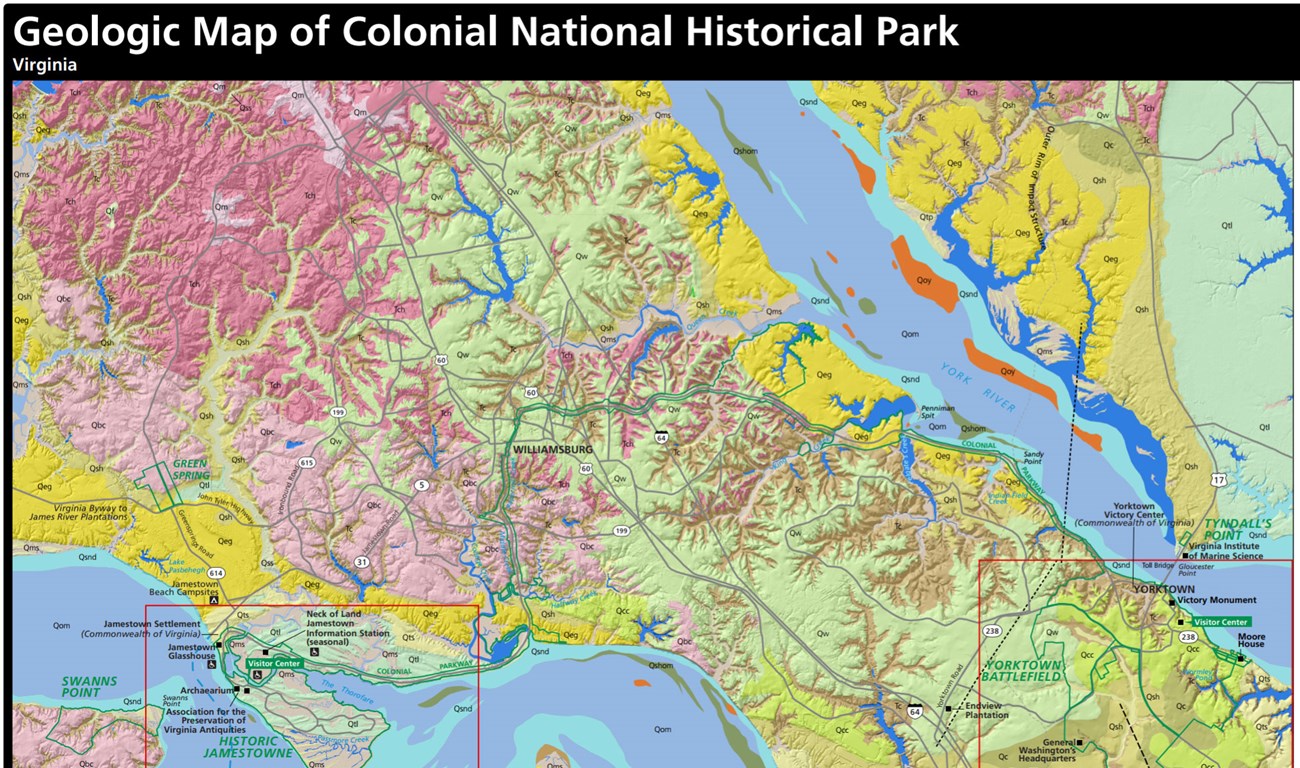
The geology of COLO is representative of the Coastal Plain province and predominantly consists of soft, mostly unconsolidated to partially consolidated sediments that were shed from the Appalachian Mountains to the west (Bailey 1999). The eroded sediments form a thick wedge of sediments that extend the plain eastward and are dominated by a series of step-wise river terraces that locally decrease in elevation toward the Chesapeake Bay (Thornberry-Ehrlich 2016). Geologic units of COLO range in age from the Miocene Eastover Formation (~11 million years old) to recent deposits associated with salt marshes, swamps, and rivers (Figure 10; Ward and Blackwelder 1980). The geologic foundations of COLO have strongly influenced the history of the region, from the prehistoric American Indian inhabitants to the early European settlements and American struggles for independence and unity during the American Revolutionary and Civil wars (Thornberry-Ehrlich 2016).
Paleontological Resources
All NPS fossil resources are protected under the Paleontological Resources Preservation Act of 2009 (Public Law 111-11, Title VI, Subtitle D; 16 U.S.C. §§ 470aaa - 470aaa-11).
Cave and Karst
All NPS cave resources are protected under the the Federal Cave Resources Protection Act of 1988 (FCRPA)(16 U.S.C. § 4301 et seq.).
Abandoned Mineral Lands
NPS AML sites can be important cultural resources and habitat, but many pose risks to park visitors and wildlife, and degrade water quality, park landscapes, and physical and biological resources. Be safe near AML sites—Stay Out and Stay Alive!
Regional Geology
Colonial National Historical Park is a part of the Coastal Plain Physiographic Province and shares its geologic history and some characteristic geologic formations with a region that extends well beyond park boundaries.
- Scoping summaries are records of scoping meetings where NPS staff and local geologists determined the park’s geologic mapping plan and what content should be included in the report.
- Digital geologic maps include files for viewing in GIS software, a guide to using the data, and a document with ancillary map information. Newer products also include data viewable in Google Earth and online map services.
- Reports use the maps to discuss the park’s setting and significance, notable geologic features and processes, geologic resource management issues, and geologic history.
- Posters are a static view of the GIS data in PDF format. Newer posters include aerial imagery or shaded relief and other park information. They are also included with the reports.
- Projects list basic information about the program and all products available for a park.
Source: NPS DataStore Saved Search 2791. To search for additional information, visit the NPS DataStore.
A NPS Soil Resources Inventory project has been completed for Colonial National Historical Park and can be found on the NPS Data Store.
Source: NPS DataStore Saved Search 2843. To search for additional information, visit the NPS DataStore.
GRI Geology Image Gallery

Related Links

