Last updated: June 14, 2024
Article
NPS Geodiversity Atlas—Cedar Breaks National Monument, Utah
Geodiversity refers to the full variety of natural geologic (rocks, minerals, sediments, fossils, landforms, and physical processes) and soil resources and processes that occur in the park. A product of the Geologic Resources Inventory, the NPS Geodiversity Atlas delivers information in support of education, Geoconservation, and integrated management of living (biotic) and non-living (abiotic) components of the ecosystem.

Geologic Features and Processes
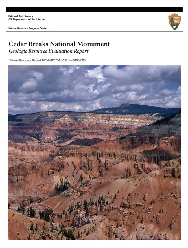
Located in south-central Utah, Cedar Breaks National Monument encompasses about 6,155 acres of high desert landscape. The elevation in the park averages about 3,353 m (11,000 ft). The monument contains an erosional landscape modified by glacial and periglacial processes. The erosional amphitheatre of Cedar Breaks lies on the western rim of the Markagunt Plateau at 3,170 m (10,400 ft) elevation. The Markagunt Plateau contains the highest elevations in southwestern Utah. A few miles north of Cedar Breaks, the basalt-capped Brianhead Peak reaches 3,449 m (11,315 ft) in elevation.
In the 1870s, Major John Wesley Powell began regional geological studies of the four corners area. One of the premier geologists with the Powell Survey, Clarence Dutton, recognized the Grand Staircase, a stair-step arrangement of cliff-forming rock layers that became progressively younger northward from the Grand Canyon (figure 3). The Tertiary-age Claron Formation that forms the majority of the rocks exposed at Cedar Breaks is one of the younger formations exposed in this Grand Staircase.
Geologic Setting
Mesozoic rocks underlie Cedar Breaks National Monument almost entirely. Capping the high points are Tertiary and Quaternary rocks. Because of intense erosion, these rocks are on striking display.
The Upper Cretaceous Straight Cliffs Formation, the oldest formation in Cedar Breaks, is derived from a mixture of sand, mud, limy ooze, and organic matter which lithified into a coal- rich unit. The sandstones, mudstones, and siltstones of the Grand Castle and Wahweap Sandstones followed this deposition.
The Tertiary Claron Formation is the result of local basins filling with sediments. The Brian Head Formation was deposited over the Claron. Erosion of these units during uplift formed the spindly hoodoos, amphitheatres, klippes, and other fantastic geomorphological shapes discussed above.
Volcanic eruptions throughout the area are responsible for the tuffaceous layers of the Oligocene Isom Formation and Miocene Leach Canyon Formations. The mysterious, intensely deformed, chaotic mass of the Markagunt Megabreccia, also of Miocene age, lies above the tuff deposits preceding another volcanic event. This event left basalt and other mafic lava flows in the area. Pleistocene glaciation and other geomorphological agents, such as streams and landslides, have left recent Quaternary age deposits on the landscape of Cedar Breaks National Monument.
Erosion of the landscape
Multicolored cliffs, spires, pinnacles, and other unique features at Cedar Breaks were carved by erosion, weathering, and mass wasting on the western edge of the Markagunt Plateau. Headward erosion of the Ashdown Creek drainage cutting into the rim of the Markagunt Plateau created much of the topography we see today. The freezing and thawing of water in fractures and joints breaks rock down by acting as a wedge to pry the rocks apart. Chemical alteration and dissolution of the minerals in the rock due to percolating groundwater or surface water has carved out intricate steps in the Claron Formation. With intense rainstorms, weakened and loosened rocks move downslope either by gravity alone (e.g., talus at the base of cliffs) or by sheetwash and flash flooding.
Rivers on the Colorado Plateau cut through essentially horizontal sedimentary rocks, creating steep cliffs and terraces. Resistant rocks such as the Claron Formation cap the plateau and overly the softer formations. The underlying less resistant rocks are eroded back under the lip of the cap rock. Eventually, erosion removes enough of the underlying material that the cap rock collapses, moving the cliff face ever backward. The rate of cliff face retreat at Cedar Breaks is astonishing. This rapid retreat is attributed to several factors: 1) the rate of weathering is high, 2) the amount of protective vegetative cover is low, 3) the erosion of soft rocks is rapid, and 4) the rapid undercutting of the red limestone member of the Claron Formation where the white limestone member acts as a cap rock (Lindquist 1980).
Hoodoo Formation
This erosional process is responsible for the formation of hoodoos at Cedar Breaks. Hoodoos are formed when more resistant rock acts as a cap on top of less resistant rock forming a column, pinnacle or pillar of rock. The formation of hoodoos is in part a function of joints and fractures, which accelerates the erosion process. The trends of walls and ridges found in Cedar Breaks closely follow the trends of the dominant joints within the intact rock units (Brox 1961).
Jointing is not the only control on hoodoo formation, especially if the rock is not hard and competent. This absence joint control is thought to result from the combination of weak beds and the overall rapid rate of wall retreat. Because of the extremely high rates of erosional retreat and bedrock weathering, it is unlikely that the joints offer much added weakness. Hoodoos tend to form on the crest of ridges between gullies in the red limestone member of the Claron Formation near the head of the escarpment.
Separating the hoodoo from the gully slopes are sharp weathering transitions from rapid slope weathering to the much slower weathering of the bedrock surfaces (Lindquist 1980). Any hoodoo formation in the slopeforming member is thus a self- enhancing mechanism (Engineers International Inc. 1980). The presence of sedimentary layers of alternating resistance to erosion appears to be crucial in hoodoo development. This variation and alternation of resistant layers is a primary feature of the Claron Formation (Lindquist, 1980).
As in nearby Bryce Canyon National Park, the pinnacles of Cedar Breaks vary in height from less than 12 m (40 ft) to 61 m (200 ft) or more. The eroded limestone forms an intricate landscape of arches, spires, pinnacles, and natural bridges (Engineers International, Inc. 1980). Some hoodoos extend from the escarpment at right angles and are like walls. Lindquist (1980) called these “primary hoodoos.” Secondary hoodoos extend at various angles from primary hoodoos or slopes leading to primary hoodoos. Ridge hoodoos form on ridge crests some distance (100’s of meters) from the primary escarpment. Hoodoos can form complexes as clusters of shapes with a radiating configuration.
Paleontological Resources
Fossils found in geologic formations exposed within or near the monument include corals, gastropods (snails), pelecypod bivalves (clams, oysters), vertebrates (fish, turtles, dinosaurs, birds, and mammals), plants, and petrified wood.
All NPS fossil resources are protected under the Paleontological Resources Preservation Act of 2009 (Public Law 111-11, Title VI, Subtitle D; 16 U.S.C. §§ 470aaa - 470aaa-11).
Regional Geology
Cedar Breaks National Monument is a part of the Colorado Plateaus Physiographic Province and shares its geologic history and some characteristic geologic formations with a region that extends well beyond park boundaries.
- Scoping summaries are records of scoping meetings where NPS staff and local geologists determined the park’s geologic mapping plan and what content should be included in the report.
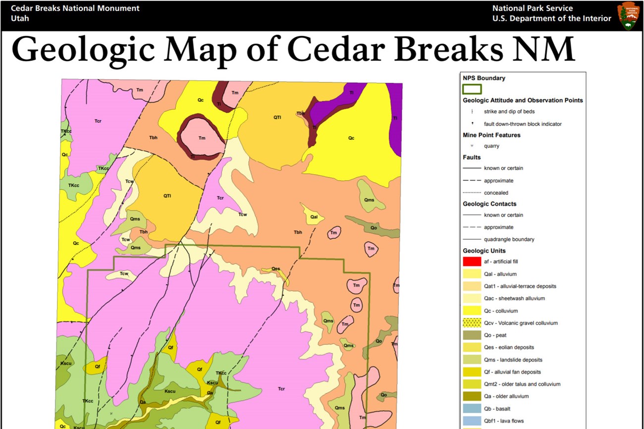
- Digital geologic maps include files for viewing in GIS software, a guide to using the data, and a document with ancillary map information. Newer products also include data viewable in Google Earth and online map services.
- Reports use the maps to discuss the park’s setting and significance, notable geologic features and processes, geologic resource management issues, and geologic history.
- Posters are a static view of the GIS data in PDF format. Newer posters include aerial imagery or shaded relief and other park information. They are also included with the reports.
- Projects list basic information about the program and all products available for a park.
Source: NPS DataStore Saved Search 2804. To search for additional information, visit the NPS DataStore.
A NPS Soil Resources Inventory project has been completed for Cedar Breaks National Monument and can be found on the NPS Data Store.
Source: NPS DataStore Saved Search 2755. To search for additional information, visit the NPS DataStore.

Related Links

