Last updated: June 14, 2024
Article
NPS Geodiversity Atlas—Cabrillo National Monument, California
Geodiversity refers to the full variety of natural geologic (rocks, minerals, sediments, fossils, landforms, and physical processes) and soil resources and processes that occur in the park. A product of the Geologic Resources Inventory, the NPS Geodiversity Atlas delivers information in support of education, Geoconservation, and integrated management of living (biotic) and non-living (abiotic) components of the ecosystem.

Introduction
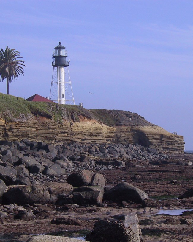
Cabrillo National Monument (CABR) is located at the southern end of Point Loma Peninsula, approximately 8 km (5 mi) southwest of downtown San Diego in San Diego County, California (Figure 5). Established on October 14, 1913, CABR memorializes Iberian explorer Juan Rodriguez Cabrillo and his 1542 voyage, during which he claimed the coastal region for Spain. The monument encompasses ~65 hectares (160 acres) and 49 offshore hectares (120 acres) that preserve rare natural and cultural resources on the peninsula. The Old Point Loma Lighthouse in CABR serves as a cultural centerpiece and has become a landmark symbol of the city of San Diego (KellerLynn 2018). CABR provides on-land opportunities to view marine life and is a popular whale-watching location from December through February when Pacific gray whales migrate by to the monument. The monument is also a popular birding destination as CABR is an important stopover site for birds along the Pacific Flyway. The monument boasts one of the world’s most spectacular harbor views while also providing scenic panoramas that stretch from Mexico to the mountains east of Los Angeles. Historically, Point Loma has been used for observation of the Pacific Ocean and San Diego Bay, serving strategic military, navigational, and recreational purposes (KellerLynn 2018).

Geologic Setting
The geology of CABR is represented by a small number of geologic units; these units date back to the Late Cretaceous (100–66 million years ago) and were originally deposited in the Pacific Ocean at great depth (Figure 6). These rocks do not represent the entire Late Cretaceous. Sediments shed from the Peninsular Ranges were transported through a submarine fan system that would later be uplifted due to tectonic deformation and faulting related to the Rose Canyon fault zone (KellerLynn 2018). These uplifted submarine fan deposits form the bedrock of CABR and are known as the Rosario Group. The Point Loma and Cabrillo Formations of the Rosario Group crop out at the monument in an area of marine terraces and wave-cut platforms. The Old Point Loma Lighthouse is partly constructed of locally sourced sandstone of the Cabrillo and Point Loma Formations. The offshore area west of the Point Loma Peninsula consists of undivided rocks of the Rosario Group, and the eastern offshore area consists of Holocene (less than 11,700 years old) marine deposits that make up the seafloor of the Pacific Ocean and San Diego Bay (KellerLynn 2018).
Regional Geology
Cabrillo National Monument is a part of the Lower Californian Physiographic Province (Fenneman, 1917), also called the Peninsular Ranges, and shares its geologic history and some characteristic geologic formations with a region that extends well beyond park boundaries.
- Scoping summaries are records of scoping meetings where NPS staff and local geologists determined the park’s geologic mapping plan and what content should be included in the report.
- Digital geologic maps include files for viewing in GIS software, a guide to using the data, and a document with ancillary map information. Newer products also include data viewable in Google Earth and online map services.
- Reports use the maps to discuss the park’s setting and significance, notable geologic features and processes, geologic resource management issues, and geologic history.
- Posters are a static view of the GIS data in PDF format. Newer posters include aerial imagery or shaded relief and other park information. They are also included with the reports.
- Projects list basic information about the program and all products available for a park.
Source: NPS DataStore Saved Search 2758. To search for additional information, visit the NPS DataStore.
A NPS Soil Resources Inventory project has been completed for Cabrillo National Monument and can be found on the NPS Data Store.
Source: NPS DataStore Saved Search 2740. To search for additional information, visit the NPS DataStore.
GRI Geology Image Gallery

Related Links

