Last updated: June 17, 2024
Article
NPS Geodiversity Atlas—Buck Island Reef National Monument, Virgin Islands
Geodiversity refers to the full variety of natural geologic (rocks, minerals, sediments, fossils, landforms, and physical processes) and soil resources and processes that occur in the park. A product of the Geologic Resources Inventory, the NPS Geodiversity Atlas delivers information in support of education, Geoconservation, and integrated management of living (biotic) and non-living (abiotic) components of the ecosystem.

Geologic Features and Processes
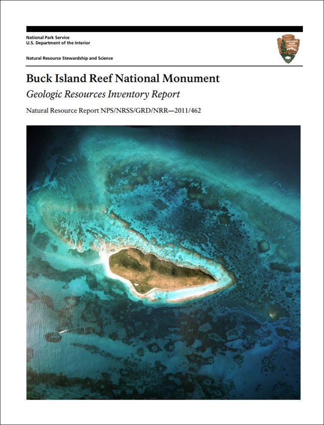
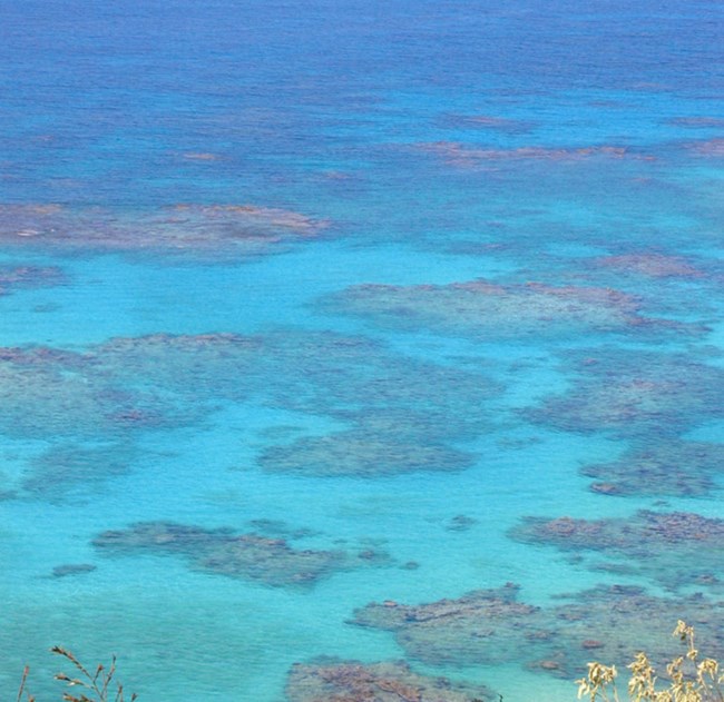
Buck Island Reef National Monument preserves 70 million years of geologic history, ranging from Upper Cretaceous deep-marine sediments to modern-day reefs. The main feature is an emergent linear reef with some of the finest coral gardens in the Caribbean. The park's interpretive snorkeling trail, the “underwater trail,” provides an uncommon opportunity for discovery of a submerged, offshore world. The reef began developing on a preexisting carbonate platform during lower sea level about 7,700 years ago (Hubbard et al. 2005). The modern reef is dominated by the threatened elkhorn coral (Acropora palmata) (Bythell et al. 1989).
Buck Island rises in a single east-west ridge to an elevation of 104 m (340 ft) above sea level. It is 1,830 m (6,000 ft) long and 670 m (2,200 ft) wide at its widest point. Most of the island consists of steep slopes, 90% of which are steeper than 30%. There are two fairly level areas with sandy beaches—Diedrichs Point on the south side of Buck Island, and West Beach on the western end of the island.
Geologic Setting
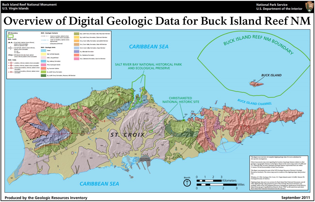
Buck Island is composed of the Upper Cretaceous (99.6 million to 65.5 million years ago) Caledonia Formation (map unit symbol Kc), which originated as sediments in a deep-marine setting at the base of an island-arc volcano. These sediments were later reworked by deep-ocean currents.
Since deposition of the Caledonia Formation, Buck Island has been pushed eastward, squeezed upward, and tilted to its present position. Exposures of Caledonia Formation occur along much of the coast of Buck Island, except along the west end. Holocene beach rock composed of consolidated carbonate sand also rings much of the island (Whetten 1966; Bythell et al. 1989).
The monument’s modern carbonate environment is composed of a variety of benthic habitats, including coral reef, hardbottom, unconsolidated sediment, and submerged vegetation. These habitats accumulated on an ancient reef platform composed of limestone, which was exposed to subaerial weathering during the Pleistocene ice ages.
Sea Level Rise
Sea level rise is a significant issue for coastal processes and the sustainability of coral reefs and other habitats at Buck Island Reef National Monument. Future sea level rise also will affect recreational activities by impacting beaches and the underwater trail.
Hurricanes
Hurricanes affect both marine and terrestrial resources in both positive and negative ways at the national monument. Scouring and pounding from storm waves can reduce reefs to pavement and rubble. Swells and surging can undercut and temporarily alter beach dynamics and result in deposition of sediment on fragile coral populations. Changes in the landscape and beach profiles can affect
nesting turtles. Flooding associated with storm surge can be extensive. Positive aspects of storms include the rapid recycling of nutrients and the removal of excess sediment that could otherwise overwhelm a reef system.
Seismic Activity
The Caribbean is a seismically active region with periodic earthquakes, submarine slides, submarine volcanic eruptions, subaerial pyroclastic flows, and tsunamis. The location of Buck Island Reef, off the northeast coast of St. Croix, and between the Greater and Lesser Antilles, is an important tectonic position in the Caribbean region. It marks a transition from transform (strike-slip) to convergent (subduction) plate motion. The U.S. Geological Survey monitors seismic activity in the U.S. Virgin Islands at a seismic station in Puerto Rico.
Paleontological Resources
Toscano et al. (2010) completed a paleontological resource inventory and monitoring report for the South Florida/Caribbean Network. Fossils within Buck Island Reef National Monument are known from the reefs, not from the Upper Cretaceous Caledonia Formation. However, the Caledonia Formation is known to host fossils elsewhere. Therefore, future field investigations at the national monument may recover fossils from the Upper Cretaceous Period (99.6 million to 65.5 million years ago) (Toscano et al. 2010).
Fossil Coral
Hubbard et al. (2005) provided detailed logs for seven cores from the main reef around Buck Island and two cores from Buck Island Bar to the north. All but one of the cores penetrated through the entire Holocene section of reef and into the Pleistocene strata. Fossil coral species documented in the cores include A. cervicornis, Diploria spp., Millepora annularis, and Porites astreoides (Hubbard et al. 2005).
All NPS fossil resources are protected under the Paleontological Resources Preservation Act of 2009 (Public Law 111-11, Title VI, Subtitle D; 16 U.S.C. §§ 470aaa - 470aaa-11).
- Scoping summaries are records of scoping meetings where NPS staff and local geologists determined the park’s geologic mapping plan and what content should be included in the report.
- Digital geologic maps include files for viewing in GIS software, a guide to using the data, and a document with ancillary map information. Newer products also include data viewable in Google Earth and online map services.
- Reports use the maps to discuss the park’s setting and significance, notable geologic features and processes, geologic resource management issues, and geologic history.
- Posters are a static view of the GIS data in PDF format. Newer posters include aerial imagery or shaded relief and other park information. They are also included with the reports.
- Projects list basic information about the program and all products available for a park.
Source: NPS DataStore Saved Search 2730. To search for additional information, visit the NPS DataStore.
A NPS Soil Resources Inventory project has been completed for Buck Island Reef National Monument and can be found on the NPS Data Store.
Source: NPS DataStore Saved Search 2738. To search for additional information, visit the NPS DataStore.

Related Links

