Last updated: June 17, 2024
Article
NPS Geodiversity Atlas—Booker T Washington National Monument, Virginia
Geodiversity refers to the full variety of natural geologic (rocks, minerals, sediments, fossils, landforms, and physical processes) and soil resources and processes that occur in the park. A product of the Geologic Resources Inventory, the NPS Geodiversity Atlas delivers information in support of education, Geoconservation, and integrated management of living (biotic) and non-living (abiotic) components of the ecosystem.

Introduction
Booker T. Washington National Monument (BOWA) is located about 35 km (22 mi) south of the major town of Roanoke just east of the Blue Ridge Parkway in Franklin County, Virginia. Authorized on April 2, 1956, BOWA encompasses about 97 hectares (239 acres) and preserves the tobacco plantation setting of the birthplace of Booker T. Washington (National Park Service 2016). Born into slavery in 1856, Booker T. Washington was freed at the age of nine and became one of the most influential African Americans of the late 19th and early 20th centuries. The monument commemorates the achievements and legacy of Washington, who rose from slavery and poverty to serve as an educator, orator, and presidential advisor. Many cultural resources are preserved at BOWA, including replica slave quarters, plantation outbuildings (smoke house, blacksmith shop, privy, hog pen, duck lot, chicken house), a 20th century segregated schoolhouse, and three small cemeteries (Thornberry-Ehrlich 2010a).
Geologic Setting
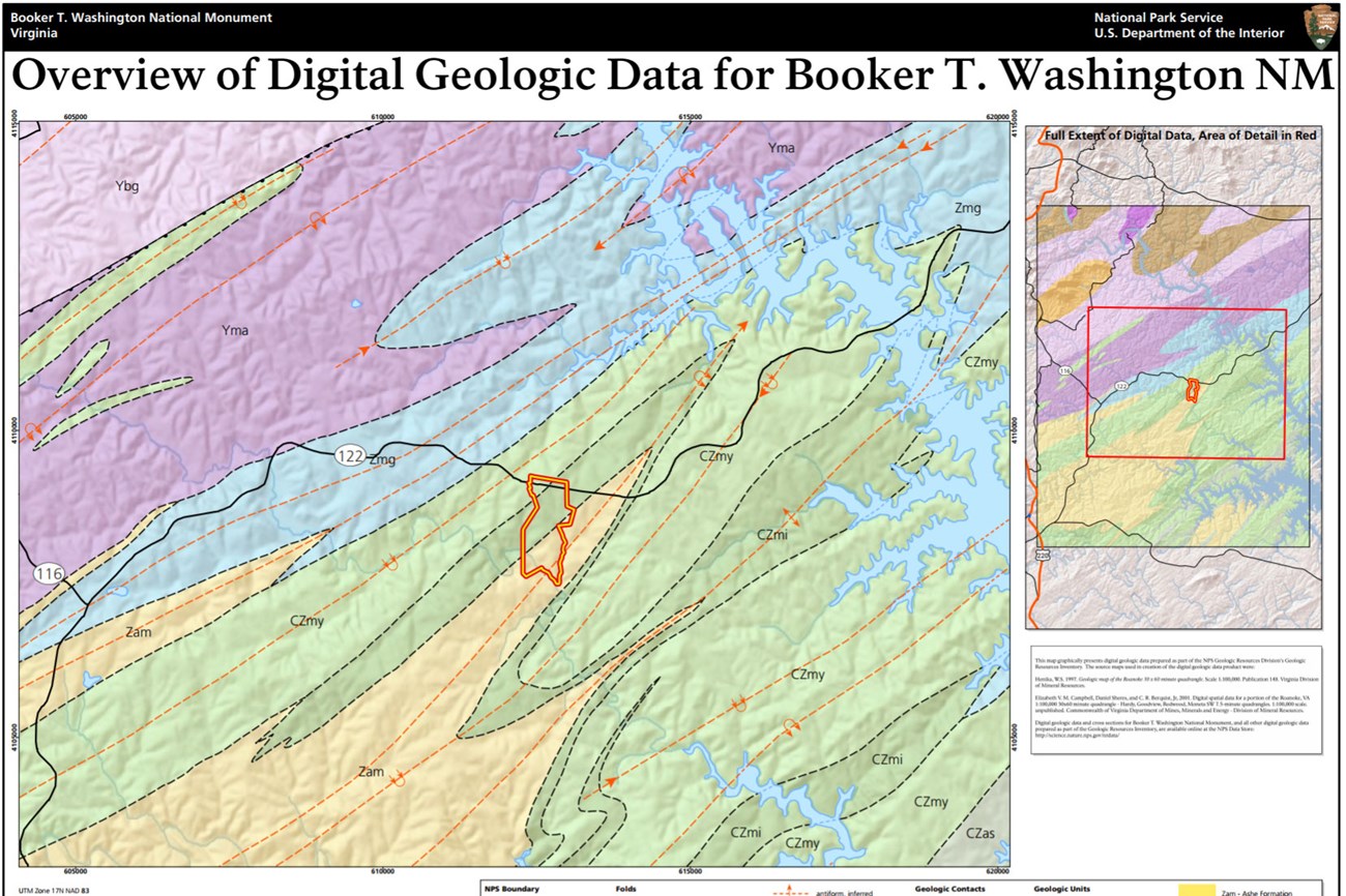
Located in the Piedmont physiographic province near the Piedmont–Blue Ridge transitional zone, the geology of BOWA consists of elongate parallel belts of crystalline rock that reflect multiple orogenic events related to the formation of the Appalachian Mountains. The bedrock within BOWA consists of late Proterozoic–Cambrian-age metamorphic rocks. Most of the ancient metamorphic units in the BOWA area are deeply weathered and overlain by a thick blanket of regolith. The oldest exposures in the monument include gneiss, schist, and amphibolite of the Ashe Formation. Younger units within BOWA include Cambrian-age amphibolite and laminated mica gneiss. Cutting through these rocks are small-scale faults, fractures, joints, mylonite zones, and minor folds that formed due to tectonic collisional processes (Thornberry-Ehrlich 2010a). The regional geologic history spans more than 700 million years through the present regime of weathering, erosion, and anthropogenic land use patterns.
Geologic Features and Processes
This area of Virginia was accreted onto the North American continent during repeated continental collisions and mountain building (orogenic) events, culminating in the formation of the Appalachian Mountain chain. Large thrust sheets slid atop one another along major faults such as the Fries Fault, located just to the west of the monument.
Geology forms the foundation of the ecosystem at Booker T. Washington National Monument and has influenced historical events, and continues to influence processes and features including:
-
Surface Water Quality
-
Water Supply
-
Sediment Load
-
Channel Morphology
-
Erosion
-
Seismicity
-
Adjacent Development
-
Seeps and Springs
-
Shrink-and-Swell Clays
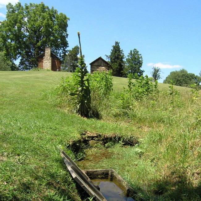
The landscape within the monument is gently sloping with rolling hills and valleys. In general, large terrace and alluvial fan deposits cap the interfluve highlands and active stream valleys are commonly filled with unconsolidated alluvium (William S. Henika, geologist, Virginia Department of Natural Resources, written communication 2009). Elevations range from the low point of less than 260 m (840 ft) near the confluence of Gills Creek and Jack-O-Lantern Branch to just over 300 m (1,000 ft) near the monument entrance road. These two streams are the only perennial waterways at the monument and are part of the larger Roanoke River watershed. Two unnamed streams, and numerous seeps and springs also occur within the monument, some of which form the source of Jack-OLantern Branch (GRI scoping notes 2009).
Rocks in the Booker T. Washington National Monument area typically occur in elongated parallel belts trending northeast-southwest reflecting the orogenic processes that occurred during the accretion of terranes and the mountain building events of the Paleozoic Era. These large belts or thrust sheets of rocks are separated by major faults. The rocks of this area reflect a complex deformational and metamorphic history. The park sits atop Late Proterozoic- to early Cambrian-age bedrock that includes biotite gneiss and schist, metaconglomerate, amphibolite, mica schist, quartzite, marble, and actinolite schist. Cutting through these rocks are small-scale faults, fractures, mylonite zones, foliation, and minor folds; small-scale joints and fractures are ubiquitous. Most joints and fractures follow the northeast-southwest regional structural trend. Parallel thrust faults cut through the monument area, and may still be accommodating crustal stresses.
Bedrock outcrops are not common in the monument. Where present they occur as ledges in streams. Rocks derived from weathering and mass wasting litter the landscape. Early settlers piled larger rocks into irregular mounds and straight lines that run through the woods of the monument. The purpose of these stone lines is unknown, but may have been to delineate different fields, property lines, or to act as fences. Local rocks also likely formed the source for building foundations and chimneys and were probably reused and recycled during the long history at the monument. An old stone foundation for a barn or tobacco building exists within the monument. Evidence from old stonewalls in a dam structure near the monument boundary suggests the rock was mined; however, no local quarry sites have been identified (William S. Henika, geologist, Virginia Department of Natural Resources, written communication 2009).
Regional Geology
Booker T. Washington National Monument is a part of the Piedmont Physiographic Province, and influenced by the adjacent Blue Ridge Physiographic Province. The Monument shares its geologic history and some characteristic geologic formations with a region that extends well beyond park boundaries.
- Scoping summaries are records of scoping meetings where NPS staff and local geologists determined the park’s geologic mapping plan and what content should be included in the report.
- Digital geologic maps include files for viewing in GIS software, a guide to using the data, and a document with ancillary map information. Newer products also include data viewable in Google Earth and online map services.
- Reports use the maps to discuss the park’s setting and significance, notable geologic features and processes, geologic resource management issues, and geologic history.
- Posters are a static view of the GIS data in PDF format. Newer posters include aerial imagery or shaded relief and other park information. They are also included with the reports.
- Projects list basic information about the program and all products available for a park.
Source: NPS DataStore Saved Search 2727. To search for additional information, visit the NPS DataStore.
A NPS Soil Resources Inventory project has been completed for Booker T Washington National Monument and can be found on the NPS Data Store.
Source: NPS DataStore Saved Search 2735. To search for additional information, visit the NPS DataStore.

Related Links

