Last updated: June 17, 2024
Article
NPS Geodiversity Atlas—Bandelier National Monument, New Mexico
Geodiversity refers to the full variety of natural geologic (rocks, minerals, sediments, fossils, landforms, and physical processes) and soil resources and processes that occur in the park. A product of the Geologic Resources Inventory, the NPS Geodiversity Atlas delivers information in support of education, Geoconservation, and integrated management of living (biotic) and non-living (abiotic) components of the ecosystem.

Geologic Features and Processes
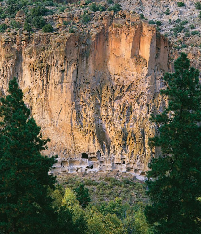
The prehispanic culture that occupied Bandelier National Monument was strongly influenced by the geologic features and processes of the area. The rock that forms the majority of the mesas and sheer-walled canyons within the monument erupted from nearby Valles Caldera one to two million years ago and was a well-suited home for the Ancestral Puebloans. The volcanic tuff rock is strong enough to support steep canyons but also weak enough for the ancient people to excavate dwellings with hand tools. These canyons and mesas also supported a rich ecosystem that provided water and food. The geologic history of the area resulted in the landscape of the monument that allowed for successful early human settlement.
Bandelier is located on the west side of the Rio Grande Rift, a fault zone that is the center of both earthquake and volcanic activity.
Volcanic Landforms: Extrusive Igneous
Bandelier National Monument hosts a world-class example of welded tuff volcanic rock (National Park Service, 2005). Bandelier is located on the Pajarito Plateau and is part of a volcanic complex that has been active for over 13 million years. This volcanic complex is situated at the intersection of the Rio Grande rift and the Jemez Mountains volcanic field.
Geologically recent, large and violent volcanic eruptions dominate the geologic story of Bandelier. Between 1.61 and 1.25 million years ago, two massive explosive eruptions spewed out a combined 160 cubic miles of rock, ash, pumice, and tuff over Bandelier and the surrounding region (National Park Service, 2005).
The Bandelier Tuff - a deposit composed primarily of volcanic ash hardened by superheated gas - is the most significant rock unit at the Monument, because it is widespread and forms its unique canyon and mesa topography that was so well suited for early human occupation. The Bandelier Tuff contributed to the development of the Puebloan civilization at Bandelier, because the people were able to carve into this rock to create dwellings, they utilized its water retaining properties for farming, and the unique topography formed in this rock supports a thriving ecosystem and associated food and water resources.
Related Links
Paleontological Resources
Paleontological resources at Bandelier National Monument occur in the rocks and sediments that postdate the Bandelier Tuff. Holocene terraces in the Frijoles Canyon have limited in situ fossils in these deposits, which include a packrat midden and detrital charcoal. Many packrat middens exist in the park, but the maximum ages are not completely known. One midden found in the Frijoles Canyon yielded a calibrated age of between 3,680 and 3,290 years old (Tweet et al., 2012).
All NPS fossil resources are protected under the Paleontological Resources Preservation Act of 2009 (Public Law 111-11, Title VI, Subtitle D; 16 U.S.C. §§ 470aaa - 470aaa-11).
Geohazards
Natural geologic processes continue to shape the park on time scales ranging from seconds to years. Natural materials and processes can create geologic hazards and associated risks. Be cautious and alert to geohazards that may be present in the park, including:
Flash Flooding and Debris Flows
Fire has had a tremendous effect on the landscape of Bandelier. Fires over the last two decades have led to extraordinary flooding and debris flow events that have impacted park staff, visitors, and resources such as trails, bridges, and buildings.
Rockfall
Rockfall is an ongoing process in the canyons of Bandelier and can occur sporadically or be triggered by earthquakes, frost weathering, diurnal heating and cooling cycles, or precipitation events that generally are accentuated for a time following wildfires. Rockfall could impact virtually all park facilities located in canyons, could impact cultural resources and is a significant safety concern.
Seismic Activity
The Pajarito Fault is a major active fault located within Bandelier. This fault and others located along the western margin of the Rio Grande Rift are capable of generating earthquakes greater than magnitude 5.0. The U.S. Geological Survey estimates the probability of a magnitude 5.0 earthquake or greater in the next century at more than 50%. An earthquake of this size or greater near Bandelier would cause significant damage to park facilities and likely widespread rockfall in the canyons.
Regional Geology
Bandelier is a part of the Rocky Mountain System Physiographic Province and shares its geologic history and some characteristic geologic formations with a region that extends well beyond park boundaries.
- Scoping summaries are records of scoping meetings where NPS staff and local geologists determined the park’s geologic mapping plan and what content should be included in the report.
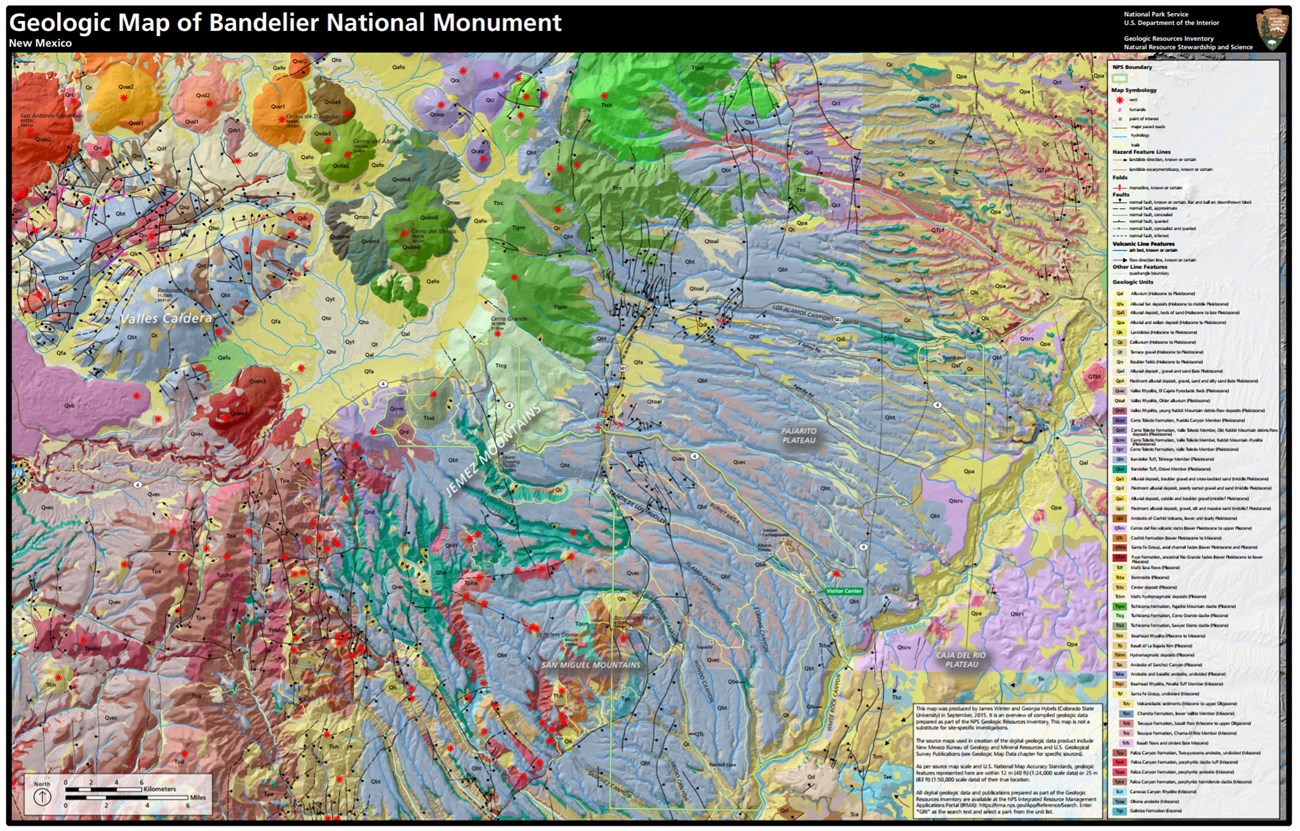
- Digital geologic maps include files for viewing in GIS software, a guide to using the data, and a document with ancillary map information. Newer products also include data viewable in Google Earth and online map services.
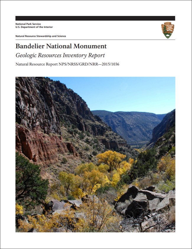
- Reports use the maps to discuss the park’s setting and significance, notable geologic features and processes, geologic resource management issues, and geologic history.
- Posters are a static view of the GIS data in PDF format. Newer posters include aerial imagery or shaded relief and other park information. They are also included with the reports.
- Projects list basic information about the program and all products available for a park.
Source: NPS DataStore Saved Search 2714. To search for additional information, visit the NPS DataStore.
A NPS Soil Resources Inventory project has been completed for Bandelier National Monument and can be found on the NPS Data Store.
Source: NPS DataStore Saved Search 2781. To search for additional information, visit the NPS DataStore.

Related Links

