|
Name: Light Fire The Light Fire burned 5.6 acres at the end of the Point Reyes peninsula, on a north-facing slope that was very close to the lighthouse apartments. The fire was reported at 10:35 am on the morning of Sunday, September 27, 2020, and was apparently caused by a downed power line. Map of the Light Fire (2,775 KB PDF) 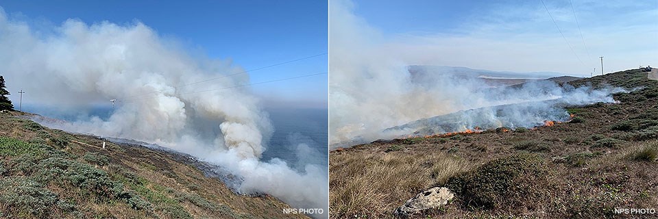
Fire OperationsSunday, September 27Park rangers, the park Fire Management Officer (FMO), and engines from Inverness Volunteer and Marin County fire departments responded to the fire. The drive to the fire's location on the end of the point is a long journey at any time, but with the road work which is now in progress the trip was made even slower. The fire started only about 700 feet from the four-unit lighthouse apartment building that sits on the top of the cliffs. With winds from the northeast pushing the fire toward it, this structure was threatened. So an air tanker was brought in to drop retardant, without which the structure would probably have been lost. A helicopter also made bucket drops, dipping out of a nearby ranch pond. Firefighters cut line around the fire, and were able to hold it at less than six acres. The lower edge of the fire was on near-vertical cliffs above the crashing ocean waves. Fortunately though, the fire hung up and did not spread even farther down the cliffs, where inaccessible, it could've hooked around and spread back uphill. PG&E came out and re-strung the power lines, minus the broken pole, which remained on the ground. Monday, September 28The crews from the two type six engines that were staffing the Woodward Fire (seven people) came out to the Light Fire to mop up the smokes that still dotted the burned area. At 6 pm, the fire was declared contained and controlled. The plan was to check on it the next day, as there were still hots spots in the interior. 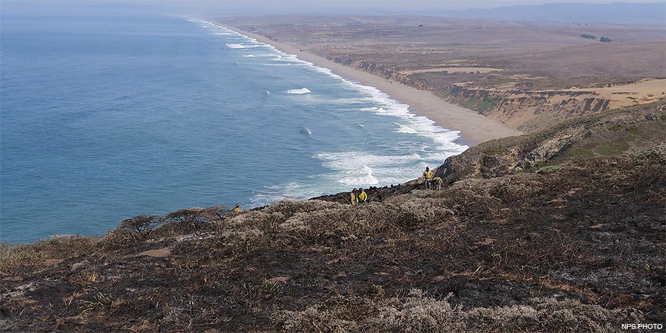
Vegetation and Burn SeverityThe fire burned a paleodune (ancient dune) plant community that comprised low scrubby vegetation. Most species were native, with the exception of large patches of iceplant. The iceplant didn't burn except for bits at patch edges. Common species inside the fire perimeter were bush lupine (Lupinus arboreus), gumplant (Grindelia), blackberry, iris (Iris douglasiana), salal (Gaultheria shallon), bracken fern, and the bunch grass Calamagrostis nutkaensis. Overall, the burn severity was light, though there were some patches of gray ash where the fire burned hotter. The iceplant was too thick and moist to burn, and the patches of it remained green. Curiously, the low-lying bush lupine plants didn't seem to carry fire, and were left more or less intact. On the other end of the spectrum, the Calamagrostis clumps were burned until all that was left were small black hillocks. 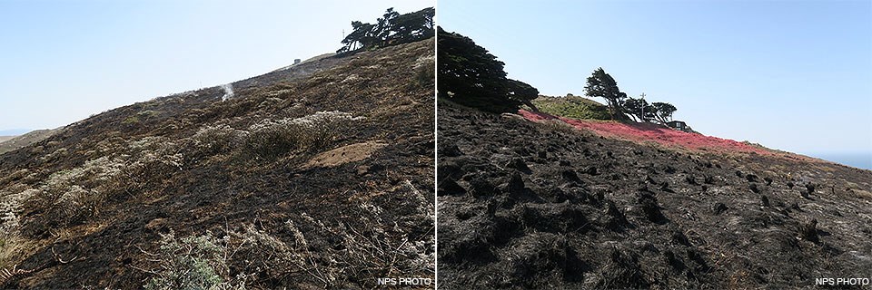
The end of the peninsula is an area full of rare plants. However, the only rare species known to occur in the burned area was Lasthenia californica ssp. macrantha, or goldfields. This taxon does not have federal or state status. It is on the California Native Plant Society's List 1B.2, "rare, threatened or endangered in California and elsewhere." Fortunately, it is an annual herb. It blooms throughout most of the year (January to November), so probably had already set some seed for the year. The soils were even more lightly burned than the vegetation was, so it's likely that any Lasthenia seeds in the soil would have survived the fire. Just outside the fire were mapped populations of Arabis blepharophylla (List 4.3, "limited distribution") and Stellaria littoralis (List 4.2, "limited distribution"). Suppression ImpactsThe fire came to within roughly less than 200 feet of the apartments, and the retardant was crucial in saving this structure. Fire retardant is made of compounds containing nitrogen, phosphorous, and sulfur (in addition to inert clay and guar gum); these can act as fertilizer after the fire. The Light Fire was small, and the dense vegetation in the area mostly native, so the likelihood that the fertilizer would stimulate the growth of non-native plants seems low. Handline was cut through the soft sandy soil; this will be rehabbed. 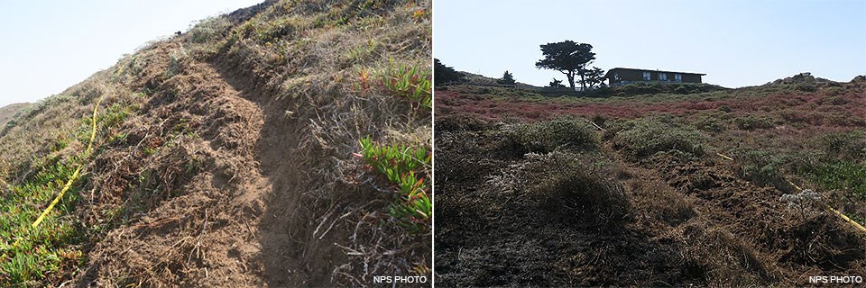
Written by Wende Rehlaender, Lead Fire Effects Monitor |
Last updated: January 28, 2024