|
For visitors looking for their own copy, the park's official brochure is available at park visitor centers, the administrative office, or by contacting us. The maps on this website are for trip planning purposes only. They should not be used for navigation or backpacking. Use a navigational chart and tide tables for navigation on the water. Topographic maps of the park, such as the National Geographic Trails Illustrated map (available in park bookstores) provide a broad view of the park. Various maps and guidebooks are available through Alaska Geographic or in the park bookstore. Check out more detailed directions and learn about getting around the park. 
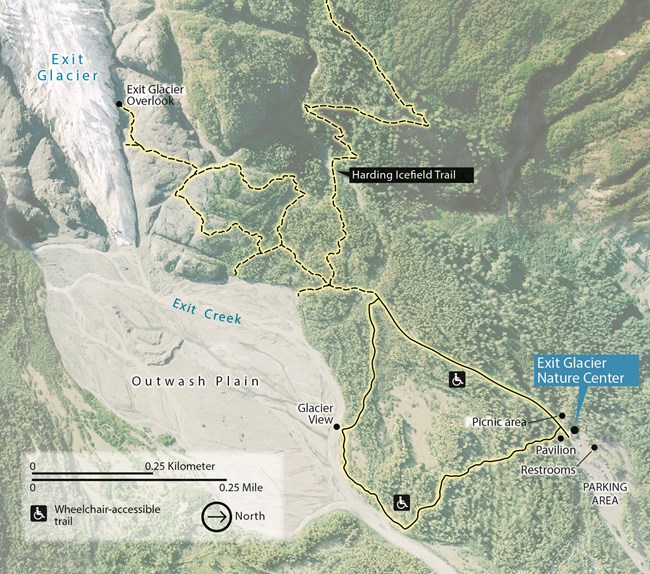
Exit GlacierThe Exit Glacier area is the only part of the park accessible by road during the summer, located about 12 miles from the Seward small boat harbor. Parking is available for automobiles and RVs, though it can be limited during midday. Shuttle and taxi service is also available. This map gives an overview of the area trails and amenities which can be found here:
Camping and Landing BeachesCamping in the coastal fjords can be challenging. The fjords can be a harsh environment with only a few protected coves. These coves can provide an accessible area for landing or camping and are only accessible by boat, kayak, or water taxi. Using a navigational chart and tide tables is vital for navigation, trip planning and safety. Learn about Camping & Landing Beaches, detailed information about many locations, food storage lockers, and more. 
National Parks of Alaska |
Last updated: April 4, 2024
