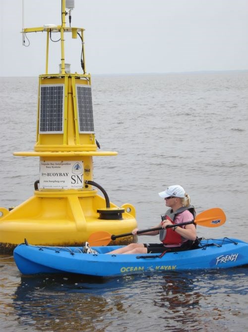
Instead of the signposts and tree blazes you would find on a land-based trail, our water trail is marked by floating buoys!
Weather Station
Water Quality Sensors
Current Profiler
Acoustic Receiver
Wave Measurement System
Visitors to the TrailThe buoys help modern trail explorers learn more about the environment of the Bay while discovering what Captain Smith might have seen as he passed near a buoy location 400 years ago. In addition to marking locations and transmitting observations, the buoys offer descriptions of geography and history. Because the buoys are accessible to anyone with a phone or internet connection, both water and land-based travelers can use them. Take a virtual trip to any buoy location from your computer or mobile device. Also along the trail are land-based interpretive kiosks and exhibits that complement the geographic and historical information the buoys provide. Boaters and FishermanRecreational and commercial boaters rely on the buoys for real-time data on wind, weather, wave height, and currents. Data from the buoys help boaters make safe choices before venturing into the open waters of the Bay. Educators and StudentsCBIBS is a valuable tool for teachers and students in many subject areas, such as science, biology, mathematics, and history. CBIBS is especially useful in teaching estuarine concepts for better understanding the Chesapeake Bay - North America's largest estuary. The historical adventures of Captain John Smith interest students in learning how the Bay has changed since the time of Smith's explorations. This provides educators with exciting new ways to prepare the next generation of Bay stewards. The NOAA Chesapeake Bay Office has developed educational content based on real-time observational data from CBIBS. "Chesapeake Explorations" offers online activities for middle and high school students that bring the science of the Chesapeake Bay to life. Scientific Research and Bay RestorationCBIBS buoys collect data on meteorological (wind speed and direction, air temperature, barometric pressure, relative humidity); GPS (horizontal position); near-surface water quality (water temperature, conductivity, dissolved oxygen, Chlorophyll A, turbidity); wave height (significant and maximum), direction, and period. The real-time and stored data from these measures help scientists analyze changes in the Bay over time. This information is critically important to Bay restoration efforts coordinated through the Chesapeake Bay Program and to various partners in monitoring and raising awareness for Bay health. |
Last updated: April 27, 2022
