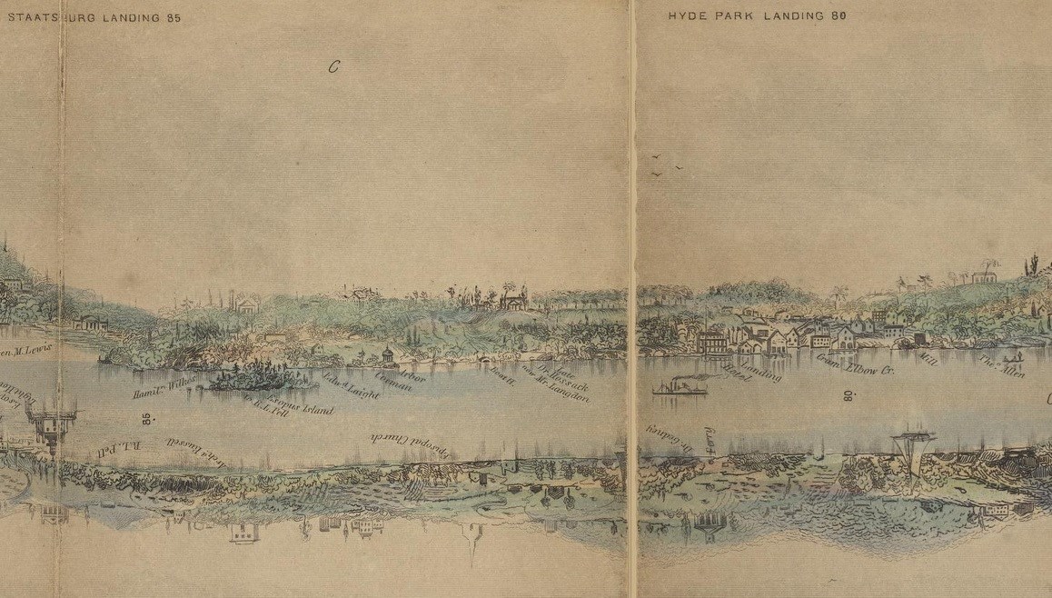
In 1704 four men petitioned the Governor of New York, Sir Edward Hyde, Lord Cornbury (1661–1723), for a grant of land along the east side of the Hudson River in Dutchess County. Among them was Cornbury’s secretary, the French Huguenot Peter (Pierre) Fauconnier (1659–1746), who received a 3,600-acre tract of valuable river-front property, that he named Hyde Park in his patron’s honor. The undeveloped property descended through Fauconnier’s family until 1764 when it was inherited by his granddaughter, Suzanne Valleau (1720–1784), and her husband, the surgeon John Bard (1715–1799). Dr. Bard contemplated developing Hyde Park as a country seat and settling there after retiring from his medical practice in New York City. Persistent financial difficulties prevented Bard from pursuing such ambitious plans. Instead, he focused on the agricultural value of the property, establishing a farm and an orchard of several hundred apple trees. In 1768 he attempted to sell Hyde Park, advertising it as a good source of timber, arable fields, and convenient water transport. Of three river landings, the best was “a large flat rock, which forms a natural wharf” capable of accommodating large sloops. Known as Bard Rock, it was located near the farm at the north end of the property. Although Bard ultimately decided against selling Hyde Park, over the next three decades financial necessity required piecemeal sales of nearly half of the original 3,600 acres. In 1890, the Bard Rock parcel was acquired by Samuel B. Sexton, where he lived until the main house was consumed by fire in 1899. In 1905, Frederick Vanderbilt purchased this tract reuniting it to Hyde Park estate grounds as it had been during earlier ownership. Vanderbilt removed numerous buildings from the area, including the Boat Captain’s cottage, a pumphouse, and several buildings along the hill to the east. Vanderbilt retained only a Boat House (removed by the National Park Service in 1953). 
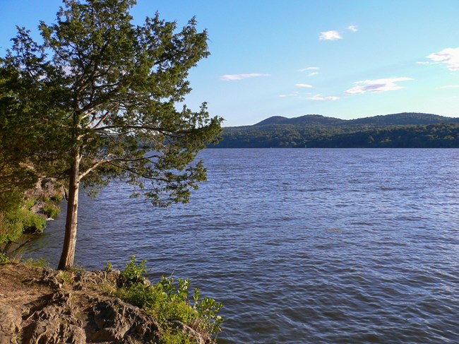
The Hudson RiverMillions of years of dynamic geologic forces have stimulated human encounters with the Hudson River landscape. The mountains, valleys, ridges, and plateaus framing the Hudson River create one of the most spectacular landscape settings in the world. The natural beauty inspired a mid-19th century American art movement, known as the Hudson River School, a group of landscape painters whose work often depicts the Hudson River Valley and the surrounding area, including views from Hyde Park, and the Catskill Mountains, visible to the north of Bard Rock. The river has been known by many names. This area is claimed as the ancestral homeland of several Algonquin speaking tribes. Some indigenous people inhabiting this area called it Mahicannituck ("river that flows two ways”), relying on the river and its tributaries for transportation and fishing. The river supports a variety of fresh water fish, including striped bass, American eels, sturgeon, herring, and shad. Early Dutch explorers called it the North River. But it was later named after Henry Hudson, who explored the river in 1609 under the Dutch East India Company in his search for the Northwest Passage. The Hudson River formed the spine of the Dutch colony of New Netherland. Its strategic importance as the gateway to the American interior led to years of competition between the English and the Dutch over control of the river and colony. The Hudson River flows 315 miles from north to south primarily through eastern New York. The river originates in the Adirondack Mountains of Upstate New York and flows southward through the Hudson Valley to the Upper New York Bay between New York City and Jersey City. It eventually drains into the Atlantic Ocean at New York Harbor. The lower half of the river is a tidal estuary—tidal waters influence the Hudson's flow from as far north as the city of Troy. There are about two high tides and two low tides per day. The river is a central feature of The Hudson River Valley National Heritage Area, designated by Congress in 1996 and one of the now fifty-five federally-recognized National Heritage Areas throughout the United States. Today, Bard Rock is a picnic area and hiking destination and one of the only places within the park that visitors can gain such proximity to the Hudson River. 
Sources National Park Service, Hudson River Valley Special Resource Study Report (Boston: National Park Service, New England System Support Office, 1996). Patricia M. O’Donnell, Charles A. Birnbaum, and Cynthia Zaitzevsky, Cultural Landscape Report for Vanderbilt Mansion National Historic Site, Volume I: Site History, Existing Conditions, and Analysis (Boston: U.S. Department of the Interior. National Park Service, 1992). Abraham Ernest Helffenstein, Pierre Fauconnier and His Descendants: With Some Account of the Allied Valleaux (Philadelphia: Press of S. H. Burbank & Company, 1911). Frederick E. Hoxie, ed., Encyclopedia of North American Indians: Native American History, Culture, and Life from Paleo-Indians to the Present (New York: Houghton Mifflin Co., 1996). Anton Treuer, Atlas of Indian Nations (Washington DC: National Geographic, 2014). |
Last updated: June 25, 2021
