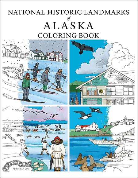
This National Park Service publication was produced in collaboration with Kristin Link Illustrations, who retains ownership of the original artwork as well as the licensing rights.
Welcome!
We are excited to present the National Historic Landmarks of Alaska Coloring Book, a new and engaging way of learning about Alaska's history. We hope the pages within spark curiosity about Alaska's National Historic Landmarks (NHLs) while encouraging creative fun. The coloring book features 35 of Alaska's 50 NHLs with a unique illustration and brief summary of their historic significance, covering a range of Alaska's unique cultural lineage, achievements, conflicts, commerce, architecture, and more.
Explore the Coloring Book Online or Download Your Own Copy
You can explore Alaska's NHLs using the interactive map below, which groups the numbered landmarks by geographic region. Clicking on a cluster of similarly colored landmarks will direct you to that region's dedicated page where you can download individual coloring pages for those NHLs and learn more about their unique history. Use the map to find the NHL closest to you, or discover something new just around the corner.
Alternatively, all download options can be found in the dropdown list below for both the full coloring book as well as the individual coloring pages. If you know exactly what you're looking for, this is the fastest way to get coloring! The coloring book and individual page downloads can be reproduced for non-commercial, educational purposes without penalty.
Download and print your own copy today for that upcoming road trip, lesson plan, or rainy day stress reliever!
Full Coloring Book:
National Historic Landmarks of Alaska Coloring Book (PDF 8.35 MB)Individual Coloring Book Pages (in order of appearance):
-National Historic Landmarks in Alaska, numbered list (PDF <1 MB)-Map of National Historic Landmarks in Alaska (PDF <1 MB)
-Alaska Native Brotherhood Hall National Historic Landmark Sitka, Alaska (PDF <1 MB)
-Walrus Islands Archeological District National Historic Landmark Bristol Bay, Alaska (PDF <1 MB)
-Adak Army Base and Adak Naval Operating Base National Historic Landmark Adak Island, Alaska (PDF <1 MB)
-Bering Expedition Landing Site National Historic Landmark Kayak Island, Alaska (PDF <1 MB)
-Skagway Historic District and White Pass National Historic Landmark Skagway, Alaska (PDF <1 MB)
-Ladd Field National Historic Landmark Fort Wainwright, Alaska (PDF <1 MB)
-Russian Bishop's House National Historic Landmark Sitka, Alaska (PDF <1 MB)
-Saint Michael's Cathedral National Historic Landmark Sitka, Alaska (PDF <1 MB)
-Birnirk National Historic Landmark Utqiagvik, Alaska (PDF <1 MB)
-Onion Portage Archeological District National Historic Landmark Kobuk Valley, Alaska (PDF 1 MB)
-Kennecott Mines National Historic Landmark Kennecott, Alaska (PDF <1 MB)
-Russian-American Company Magazin National Historic Landmark Kodiak, Alaska (PDF <1 MB)
-Sitka Spruce Plantation National Historic Landmark Unalaska, Alaska (PDF <1 MB)
-Japanese Occupation Site National Historic Landmark Kiska Island, Alaska (PDF <1 MB)
-Wales Sites National Historic Landmark Kiŋigin, Wales, Alaska (PDF <1 MB)
-George C. Thomas Memorial Library National Historic Landmark Fairbanks, Alaska (PDF <1 MB)
-Sheldon Jackson School National Historic Landmark Sitka, Alaska (PDF <1 MB)
-Anangula Archeological District National Historic Landmark Anangula, Alaska (PDF <1 MB)
-SS Nenana National Historic Landmark Fairbanks, Alaska (PDF <1 MB)
-Kodiak Naval Operating Base and Forts Greely and Abercrombie National Historic Landmark Kodiak, Alaska (PDF <1 MB)
-Yukon Island Main Site National Historic Landmark Kachemak Bay, Alaska (PDF <1 MB)
-Russian-American Building No. 29 National Historic Landmark Sitka, Alaska (PDF <1 MB)
-Holy Assumption Orthodox Church National Historic Landmark Kenai, Alaska (PDF <1 MB)
-Fort William H. Seward National Historic Landmark Haines, Alaska (PDF <1 MB)
-Eagle Historic District National Historicl Landmark Eagle, Alaska (PDF <1 MB)
-Attu Battlefield and U.S. Army and Navy Airfields National Historic Landmark Attu Island, Alaska (PDF <1 MB)
-Chilkoot Trail and Dyea National Historic Landmark Skagway, Alaska (PDF <1 MB)
-Church of the Holy Ascension National Historic Landmark Unalaska, Alaska (PDF <1 MB)
-Dutch Harbor Naval Operating Base and Fort Mears, U.S. Navy National Historic Landmark Unalaska, Alaska (PDF 1.2 MB)
-Kijik Archeological District National Historic Landmark Lake Clark, Alaska (PDF <1 MB)
-Cape Nome Mining District and Discovery Sites National Historic Landmark Nome, Alaska (PDF <1 MB)
-Kake Cannery National Historic Landmark Kake, Alaska (PDF <1 MB)
-Seal Islands National Historic Landmark St. George and St. Paul Islands, Alaska (PDF <1 MB)
-Sitka Naval Operating Base and U.S. Army Coastal Defenses National Historic Landmark Sitka, Alaska (PDF <1 MB)
-Gallagher Flint Station Archeological Site National Historic Landmark North Slope, Alaska (PDF 2.3 MB)

Original artwork by Kristin Link Illustrations and modified by NPS for this interactive web map.
Last updated: July 31, 2023
