Last updated: November 27, 2020
Place
Walla Walla River Confluence
Quick Facts
Location:
Washington
MANAGED BY:
Lewis and Clark NHT Visitor Centers and Museums
This map shows a range of features associated with the Lewis and Clark National Historic Trail, which commemorates the 1803-1806 Lewis and Clark Expedition. The trail spans a large portion of the North American continent, from the Ohio River in Pittsburgh, Pennsylvania, to the mouth of the Columbia River in Oregon and Washington. The trail is comprised of the historic route of the Lewis and Clark Expedition, an auto tour route, high potential historic sites (shown in black), visitor centers (shown in orange), and pivotal places (shown in green). These features can be selected on the map to reveal additional information. Also shown is a base map displaying state boundaries, cities, rivers, and highways. The map conveys how a significant area of the North American continent was traversed by the Lewis and Clark Expedition and indicates the many places where visitors can learn about their journey and experience the landscape through which they traveled.
On April 27, 1806, Lewis and Clark reunited with Wallulapum Chief Yelleppit, whom they first met on October 19, 1805, during their voyage down the Columbia. Yelleppit invited them to spend several days at his village near the confluence of the Walla Walla River. Receiving a warm welcome, the expedition spent the next few days engaging in trade, council, and socializing with the Wallulapum. Receiving confirmation of the overland route east and assistance in ferrying horses and supplies across the Columbia in canoes, Lewis and Clark “took leave of these friendly honest people” on April 30, 1806.
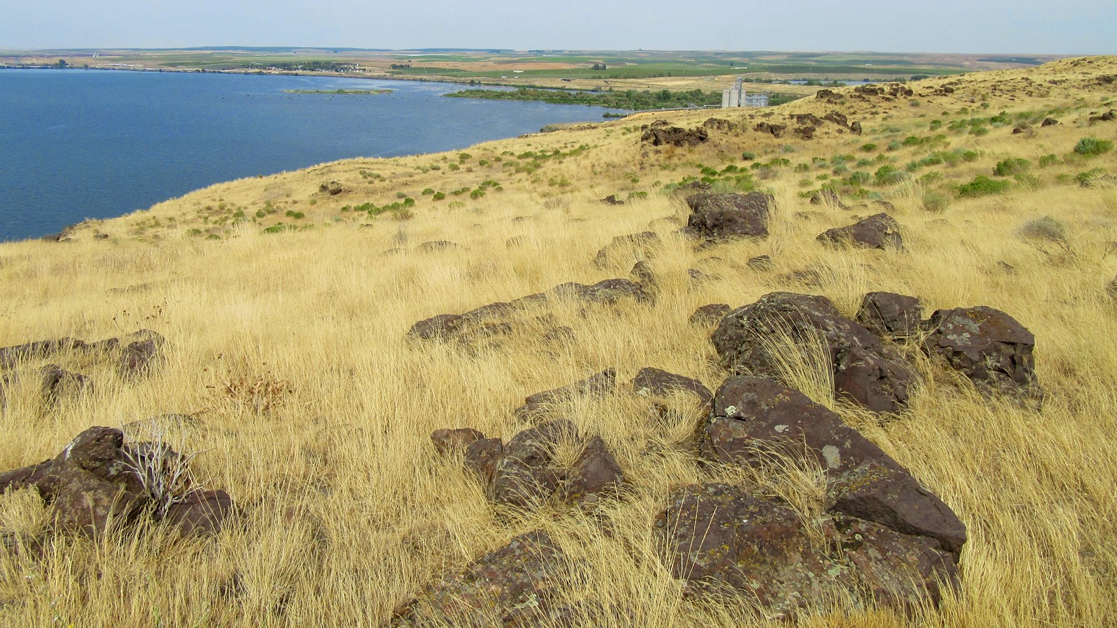
The immediate natural setting of the Walla Walla River confluence is impacted by railroad and highway crossings, as well as a grain elevator complex. However, much of the adjacent area is publicly accessible through the 15,000-acre McNary National Wildlife Refuge and 46-acre Madame Dorian Memorial Park. Hiking trails that climb into the highlands south of the confluence offer panoramic views of the Wallula Gap, a dramatic landscape formed by eroded basalt anticlines that was first documented by Lewis and Clark as they canoed downriver on October 18, 1805. Clark described it as a “range of high Countrey at which place the rocks project into the river from the high clifts.” Away from the infrastructure congested about the mouth of the confluence, much of the natural landscape retains the historic appearance witnessed by the expedition.