Last updated: January 8, 2025
Place
Fort Independence - Castle William

NPS Photo
Benches/Seating, Historical/Interpretive Information/Exhibits, Parking - Auto, Restroom, Scenic View/Photo Spot
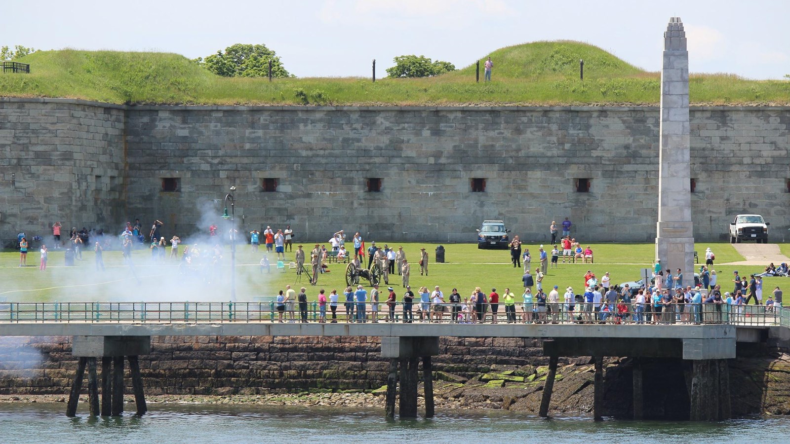
Fort Independence, formerly known as Castle William, sits on top of Castle Island. Due to its strategic location on Boston Harbor, this site has served as the home to military fortifications for hundreds of years. It is considered the "oldest fortified military site in British North America."1
The first known fort at this site dates back to the 1630s, when Governor John Winthrop ordered the construction of a fort on Castle Island.2 The fort expanded in the 1640s and in the 1690s due to the constant fear of attacks by French naval forces. In 1701, the fort became officially known as Castle William, named after William II of England.3
Castle William's role shifted from protecting against potential attacks from European powers to providing a refuge for British soldiers facing colonial upheaval in Boston. After the Boston Massacre in 1770, Bostonians called for British troops stationed in the city to be removed to Castle William.4 British forces maintained their presence at Castle William for the next six years.
In the beginning of March 1776, the Continental Army fortified nearby Dorchester Heights in the dead of night. British forces from Castle William witnessed this fortification and organized an attack. General William Howe, with 11,000 soldiers at his command, ordered an attack on Dorchester Heights.5 However, due to poor weather, British forces had to return to the safety of the fort.6
With George Washington's Continental Army surrounding Boston, General Howe and his troops prepared to leave the city. In one final act of aggression against the enemy, British forces fired upon the Continental Army as they constructed new fortifications on Dorchester Point.7 This attack proved unsuccessful, injuring British soldiers due to a misfired cannon. Documenting the events of the day in his diary, British Lieutenant General Archibald Robertson wrote,
20th [March]… Between one and two found the Rebels had begun a new Work on Dorchester Point opposite Castle William. We fired at them from the Castle and by a Gun bursting had 7 men wounded.8
Hours later, British forces evacuated Boston and set Castle Island, including the fort, on fire.9 Robertson noted the General's order to load mines at the Castle and the following destruction:
Accordingly at 8 o'clock 6 Companies Embark’d and the Boats lay off untill the mines were fired, which was done 1/2 an hour Afterwards and they had a very good Effect. The Barracks and other houses were then set on fire and at 9 ... we got all safe on board the Transports.10
After the smoke cleared, Continental forces quickly rebuilt the fortifications at Castle William into a star-shaped fort.11 Lieutenant Colonel Paul Revere led the troops stationed here.12
When the war ended, the Commonwealth of Massachusetts used the fort as a state prison. In the late 1790s, the federal government took command of the fort, repairing and expanding it. In 1799, President John Adams renamed Castle William to Fort Independence.13
When the country faced times of war, the US Military prepared Fort Independence for battle. During the War of 1812, and later from 1834 to 1851, the fort was repaired and expanded.14 Fort Independence served as an armory during the Civil War, with the Fourth Battalion of Massachusetts Infantry stationed here.15 The Fort also remained active during the World Wars in case of a coastal attack.16
Today, Fort Independence is part of a state park on Castle Island. Throughout the warmer months of the year, the Castle Island Association provides free tours of Fort Independence in partnership with the Massachusetts Department of Conservation and Recreation.
Footnotes
- "A plan of Fort Independence," Collections Online, Massachusetts Historical Society (MHS), accessed February 8, 2022, https://www.masshist.org/database/418.
- Olmsted Center for Landscape Preservation and National Park Service, "Cultural Landscape Report for the Boston Harbor Islands," Boston Harbor Islands National & State Park vol 1 (Boston, Massachusetts: 2000/2017), http://npshistory.com/publications/boha/clr-v1.pdf, 84.
- "Cultural Landscape Report for the Boston Harbor Islands," 85.
- "Cultural Landscape Report for the Boston Harbor Islands," 86; Richard Frothingham, "History of the siege of Boston" (Boston: C. C. Little and J. Brown, 1851), 6-7, Archive.org.
- "Cultural Landscape Report for the Boston Harbor Islands," 86.
- "Nation Park Service Cultural Landscapes Inventory: Dorchester Heights National Historic Site," Boston NHP - Dorchester Heights, 2010 https://irma.nps.gov/DataStore/DownloadFile/449583, 29
- "A plan of Fort Independence."
- Archibald Robertson, "Archibald Robertson: His Diaries And Sketches In America, 1762-1780" (New York: New York Public Library, 1971), 80, HathiTrust.
- Frothingham, "History of the siege of Boston," 312.
- Robertson, "Archibald Robertson: His Diaries And Sketches In America, 1762-1780," 81.
- "Nation Park Service Cultural Landscapes Inventory."
- "A plan of Fort Independence," (MHS); "Cultural Landscape Report for the Boston Harbor Islands," 76.
- "A plan of Fort Independence," (MHS); "Cultural Landscape Report for the Boston Harbor Islands," 88.
- "Nation Park Service Cultural Landscapes Inventory;" "A plan of Fort Independence," (MHS).
- "Cultural Landscape Report for the Boston Harbor Islands," 92.
- "Castle Island/Fort Independence," The Cultural Landscape Foundation, accessed February 9, 2022, https://www.tclf.org/castle-island-fort-independence.
