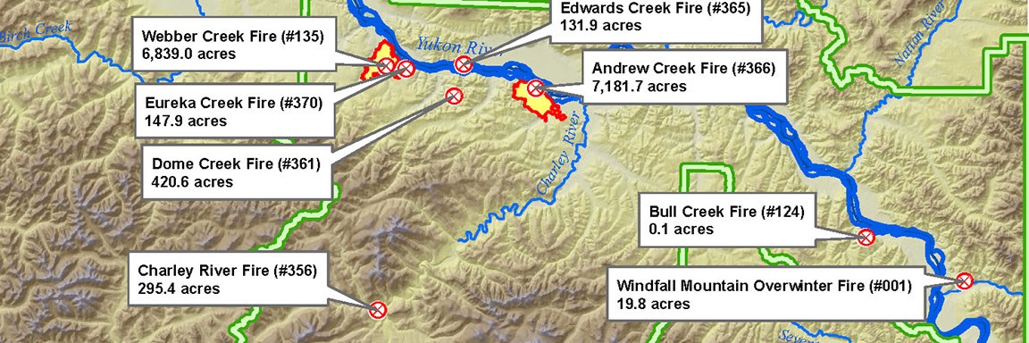
NPS GIS map/B. Sorbel
Putting fire management on the map!
When a wildfire starts in a national park, several questions arise. Where is the fire located? How big is it? Where is it likely to spread? Are there values at risk near the fire?
These questions, and several others, can be answered using Geographic Information Systems (GIS). When a fire is discovered, its location and perimeter can be captured using a Global Positioning System (GPS) and then plotted in a GIS in order to generate fire maps. Geospatial data also enables fire managers to predict the extent of future fire spread based on the outputs from fire behavior modeling programs. After a fire is declared out, the National Park Service uses satellite imagery to generate maps displaying its final acreage and burn severity in order to better understand the effects of the fire on park resources. Geographic Information Systems also play a role in several other aspects of wildland fire management such as generating maps for fire management plans and aiding in planning for fuel treatments.
Last updated: December 20, 2018
