After a long winter hiatus, the Notes From 800 Feet blog is back and excited about a summer full of seeing Kobuk Valley National Park, Noatak National Preserve and Cape Krusenstern National Monument from the sky! Last week, rangers Julia Schock and Emily Mesner caught a ride to Radio Hill to spend a week gathering photos, footage and observations of Cape Krusenstern National Monument. (Check out our
website and
Facebook page in the coming weeks to see some of the results of the project!)
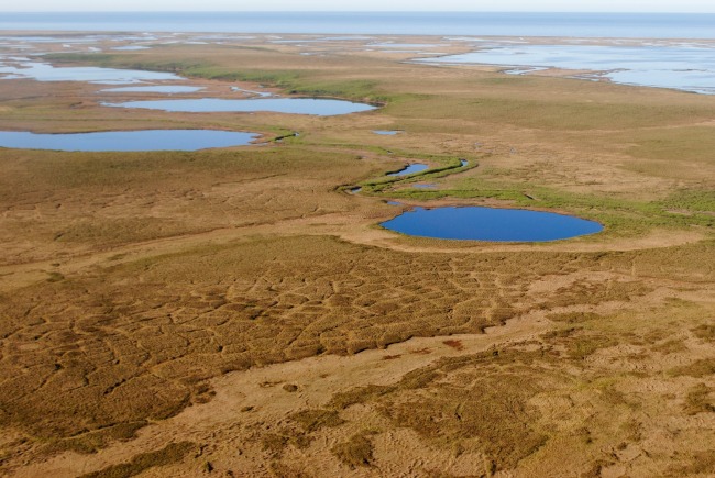
It was a quick, half hour flight from our home base in Kotzebue over the mouth of the Noatak River and across the rolling tundra of the monument. The ice is gone from the river and ocean, but patches of snow still remain in sheltered hollows along the sides of the hills and river. The ice wedge polygons were clearly visible on the open tundra.

Ice wedge polygons are one of the most distinctive geological features of the tundra when seen from above. During the winter months, the cold causes the frozen permafrost to shrink, creating tiny cracks in the soil. As the snow melts during spring, water seeps into the cracks, then refreezes and expands in the frozen ground, creating wedges of ice in the permafrost. During the summer, the top layer of soil and ice melts, leaving the ice wedges buried in the ground. The cracks continue to form in the same spots every winter and the process repeats itself until the ice wedges grow large enough to displace the soil above it, forming ridges that create blocky, polygonal patterns ranging from 15 to 150 feet wide.
Our friends over at the Arctic National Wildlife Refuge have created a
great animation showing the steps in the cycle.

