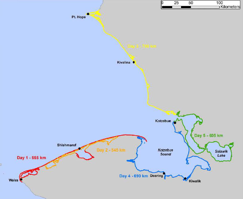
Though the view from the Nome Convention and Visitors Bureau's "Nome Cam" yesterday morning explained the late start, we are excited to announce that the ShoreZone imaging project is now underway. The ShoreZone coastal inventory and mapping project will cover 1,900 kilometers between the communities of Wales and Point Hope, including 1,150 km along the margins of Bering Land Bridge National Preserve and 450 km of Cape Krusenstern National Monument's boundary.

"I'm not lost. Why do we need a map?"
The maps produced by this project aren't intended for nautical navigation. Instead, they provide a detailed reference that will tell us if a particular stretch of beach has a gravel or sand substrate, where eelgrass beds can be found, etc. As development of oil and gas in the north increases and arctic shipping routes open due to reduced summer sea ice extent, efforts to prepare organizations, agencies, and communites for oil spill response require these such resources to prepare and mobilize. The maps will also be useful for numerous ecological, biological, and archaeological inquiries, identifying areas that may trap marine debris, and assisting with community planning.
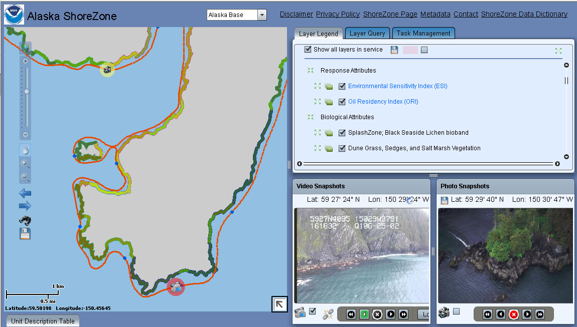
Similar in concept to the Google Earth "fly-through" tours of the Bering Land Bridge National Preserve and Cape Krusenstern National Monument coastline produced by the University of Colorado as part of the NPS Inventory & Monitoring Program's coastal erosion project, the ShoreZone video and photographic imagery provides anyone with internet access an "armchair view" of this remote and rugged landscape. As you can see in the screenshot below, the three viewing windows allow you to simultaneously review the video, photographs, and the physical and biological characteristics along the route.

The survey is being conducted with a heliopter flying at approximately 300' AGL at 60 knots. As they work north toward Point Hope they will be documenting the coastline's beaches, headlands, estuaries, barrier islands, deltas, and lagoons. Once the filming is completed a small crew will spend a few days visiting selected sites on the ground to more closely examine geophysical and biological features.
This project is led by the National Park Service with additional funding by the U.S. Fish and Wildlife Service's Arctic Landscape Conservation Cooperative and the Alaska Department of Natural Resources. An additional component supported by the U.S. Fish and Wildlife's Western Alaska Landscape Conservation Cooperative, NOAA, and the Northwest Arctic Borough will provide an assessment of coastal hazards, particularly addressing coastal erosion around communities at risk.
There are several ways to learn more, stay updated, or pose a question, including:
1. Explore the official ShoreZone website that includes updates from the field in the right margin, tutorials, and the "Fly the Coastline" feature.
2. "Like" ShoreZone on Facebook where they are sharing photos, maps, and updates from the field.
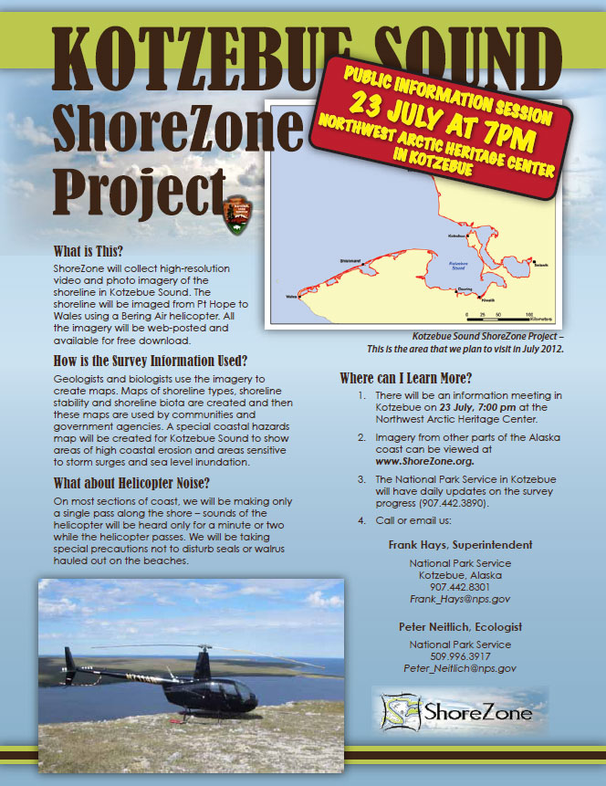
3. Attend a technical meeting about the applications of these data for agencies and organizations at the Northwest Arctic Borough assembly chambers (163 Lagoon Street, Kotzebue, AK) between 10am and noon on Friday, July 20th. If you're unable to attend in person you may participate via teleconference by dialing toll-free 866-385-9623 (conference code: 5906745872) or online via WebEx (password: T1n2C3).
4. Attend a more general public meeting at 7pm on Monday, July 23rd at the NPS' Northwest Arctic Heritage Center (171 3rd Avenue, Kotzebue, AK).
5. Call the National Park Service offices in Kotzebue (907-442-3890 or 800-478-7252) or Nome (907-443-2522 or 800-471-2352).

