Glacier Terminology

Glaciers are incredibly dynamic formations of ice. At Kenai Fjords National Park, visitors may see and experience glacial features and landscapes they have never seen before. The following are some examples of these features with that are found in the park. Technical reference for terminology can be found from the National Snow & Ice Data Center (NSIDC) glossary, and U.S. Geological Survey (USGS) glossary.
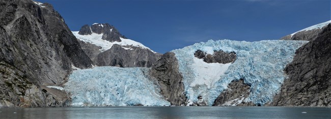
 
A blue glacier is in the valley between two mountainsides.  There are patchs of rock showing underneath the glacier.  In the background is a mountain with snow near the top.
Northwest Glacier at the head of Northwestern Fiord

NPS Photo/ D Kurtz

Glacier- a mass of ice that originates on land, usually having an area larger than one tenth of a square kilometer. Many believe that a glacier must show some type of flow or internal movement; others believe that a glacier can show evidence of past or present movement.
 
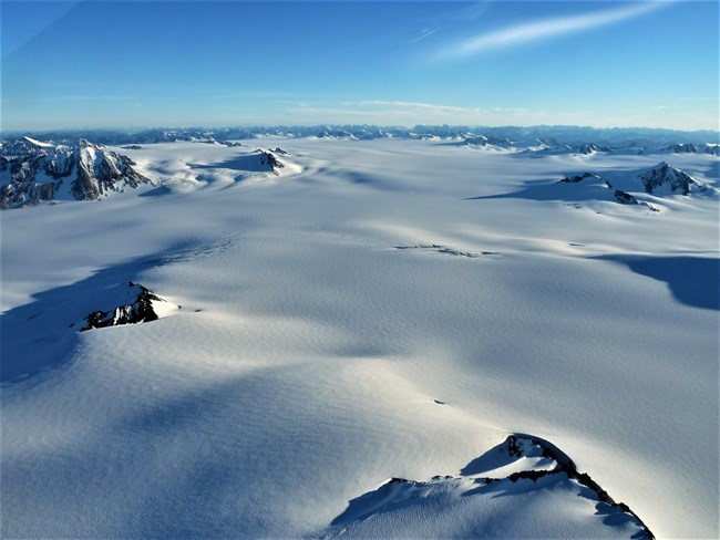
a large area of ice that is covered by snow.  Mountain peaks appear through the snow and ice.
The Harding Icefield above Tustamena Glacier.

NPS Photo

Icefield- a large area of interconnected glaciers. Icefields form in colder climates and higher altitudes where there is enough precipitation for them to form.
 
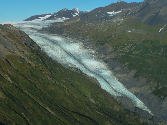
A white glacier flowing between two plant covered mountainsides. The glacier has a dark stripe down its center. The glacier narrows near the bottom right of the picture.
Exit Glacier in 2016

NPS Photo/ D Kurtz

Valley Glacier- a glacier whose flow is confined by valley walls and flows through a valley.
 
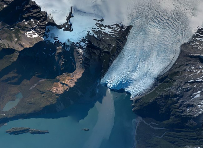
An aerial view of  Aialik Glacier.  The glacier starts from the Harding Icefield in the top right of the picture, and flows to the middle.  The glacier is surround by land on the right and left, and water at the bottom of the image.
An aerial image of Aialik Glacier flowing into Aialik bay.

NPS Photo/ D Kurtz

Tidewater glacier- a glacier that terminates in the ocean.
 
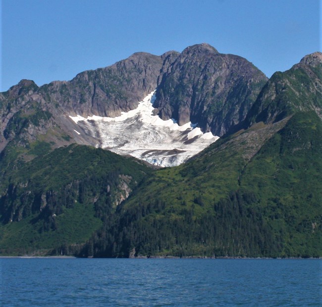
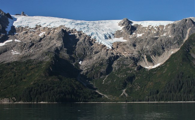
A mountain with a white patch of ice in the middle of it's side.  Trees and plants are on the lower half of the mountain.  At the bottom of the mountain it ends by water.
A cirque glacier on the side of a mountain.

NPS Photo/ D Kurtz

Cirque glacier- a glacier that occupies basins near ridge crests. Most cirque glaciers have a characteristic circular shape, with their width as wide or wider than their length.
 
A mountain rises above a small beach and the ocean.  The bottom third of the mountain is trees and plants.  Above that the mountain is a gray rock.  Glacier ice flows over the top of the mountain and a third of the way down.
A hanging glacier flows over the top of a mountain in Holgate Arm and ends on the mountainside.

NPS Photo/ A Collins

Hanging glacier- a glacier that terminates at or near the top of a cliff. They sometimes appear to be hanging from the cliffside. Hanging Glaciers sometimes look like frozen waterfalls.
 
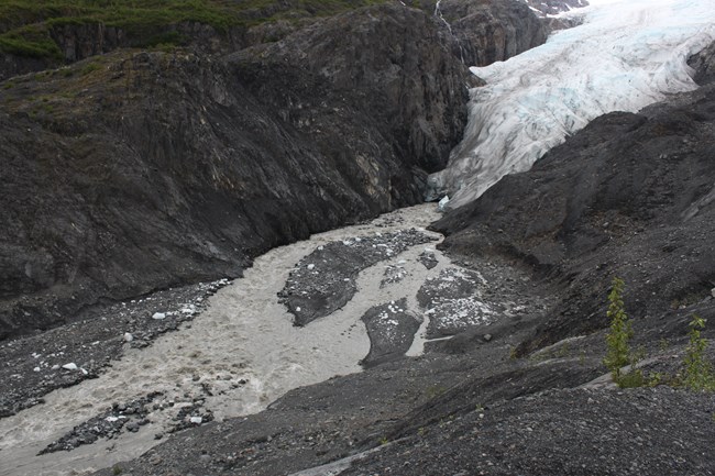
A glacier flows from the upper right of the image towards the bottom left.  The glacier ends in the middle of the image, and a river of meltwater continues to the bottom left.  Above and below the glacier is a rocky mountainside
The terminus of Exit Glacier and its meltwater stream

NPS Photo/ A Collins

Drift- all types of sediment deposited by a glacier, regardless of the size or amount of sorting. The term includes all sediment that is transported by a glacier, whether it is deposited directly by a glacier or indirectly by running water that originates from a glacier.
 
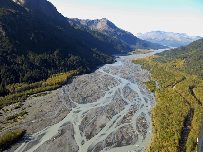
An area of rocks and sand in between two mountains covered in trees.  The sandy area has a river that runs through it.  The river is braided in many different channels.
Resurrection River outwash plain

NPS Photo/ D Kurtz

Outwash Plain- A broad, low-slope alluvial plain. Outwash plains are composed of glacially eroded and sorted sediment that we call outwash. This outwash has been transported by meltwater from the glacier. The outwash plain begins at the foot of a glacier and may extend for miles. Typically, the sediment becomes finer grained the further one gets from the glacier terminus.
 
Glacial Till- Sediment material that has been directly deposited by glacier ice. Glacial till is mixed together, it is not sorted or layered by size.
 
Moraine- a mound, ridge, or other distinct accumulation of glacial till.
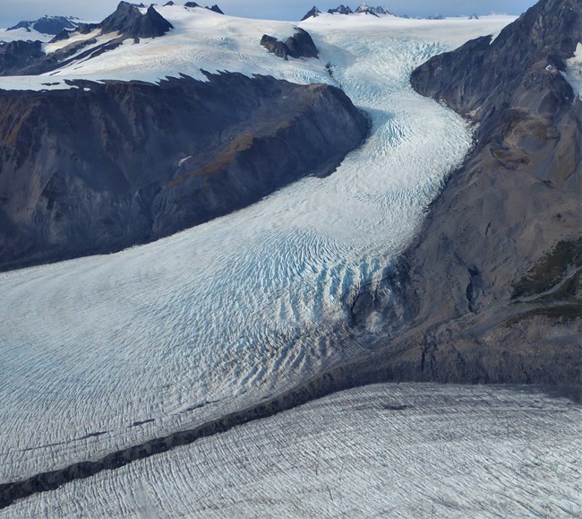
 
A brown line of sediment from a mountain sits between two glaciers
Medial moraine on Bear Glacier

NPS Photo/D Kurtz

Medial moraine- a ridge-shaped moraine in the middle of a glacier originating from a rock outcrop, nunatak, or the converging lateral moraines of two or more ice streams.
 
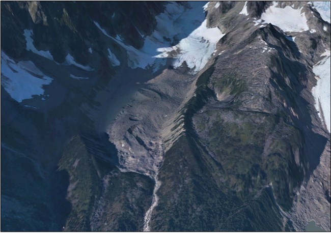
an aerial view of a glacier and some mountain ridges.  A pile of dirt and debris that has been lift by the glacier sits at its toe
Lateral moraines along Sunset Glacier.  Parts of the lateral moraines are vegetated.

NPS Orthophoto from 2016

Lateral moraine- a ridge-shaped moraine deposited at the side of a glacier and composed of material eroded from the valley walls by the moving glacier.

Last updated: October 30, 2020

Park footer

Contact Info

Mailing Address:

PO Box 1727
Seward, AK 99664

Phone:

907 422-0500

Contact Us