At the base of the Alaska Peninsula is a landscape defined by a spine of volcanoes rising from the sea in one direction, dipping gently toward Bristol Bay in the other direction. It's been 50 million years since those volcanoes roared to life. It's been 20,000 years since this land was entirely covered by glaciers. It's been 9,000 years since humans first lived on this land. It's been 105 years since the largest volcanic eruption of the 20th century tore through these mountains. And it's been 99 years since this land received a new name: Katmai National Monument.
On September 24, 1918, President Woodrow Wilson proclaimed the formation of the monument, noting the region's scenic and scientific potential. With that, this landscape was added to the nascent National Park Service family decades before Alaska became a state of the Union. Since then, Katmai’s identity has evolved, and, like a one-name celebrity, its identity is likely to evolve again.
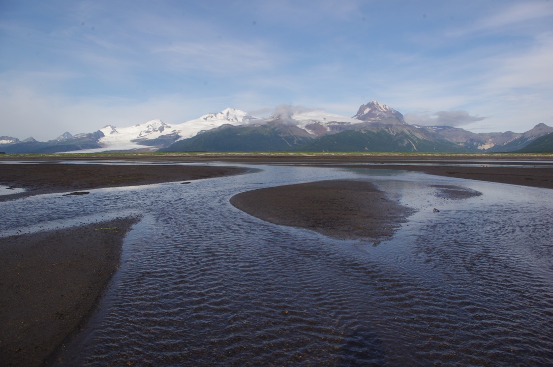
 A volcanic landscape meets the ocean at Hallo Bay, on Katmai’s coast. NPS Photo/M. Saxton.
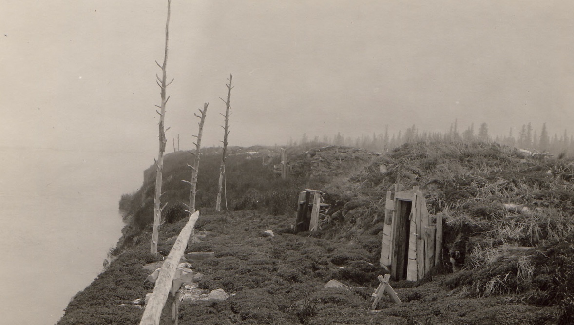
Before 1912, the people who knew about Katmai knew it as home. For at least 9,000 years, humans have lived on this landscape. In the wake of the 1912 Mt. Katmai/Novarupta eruption — the largest volcanic eruption of the 20th century — huge deposits of ash forced residents of year-round villages to abandon their homes. Shortly thereafter, two families tried moving back to their homes near Naknek Lake, but found there to be too much ash — up to three feet covering some villages. One resident, American Pete, proclaimed: “Never can go back to Savonoski to live again. Everything ash.” They did, however, continue returning to the area to hunt in the years after the eruption. The Brooks River also remained a salmon harvesting area for Katmai descendants for several decades. Today people with historic ties to Katmai, mostly of Alutiiq descent, still call southwest Alaska home.
 After Novarupta erupted, people were forced to abandon their homes at Svonoski, pictured here. National Geographic Photo.
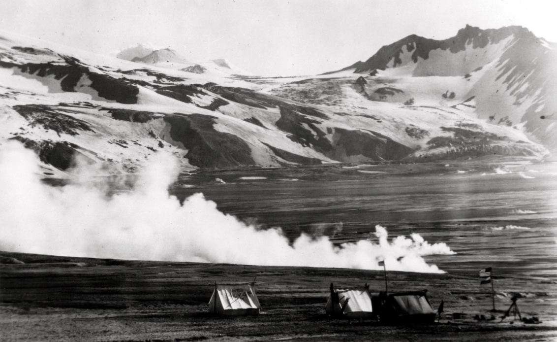
After 1912, this landscape drew the attention of people from around the world—people who had never visited southwest Alaska, and who had varied (and sometimes competing) ideas of what the landscape should be. Word of an awe-inspiring volcanic landscape to rival Yellowstone first reached a national audience through articles in National Geographic Magazine in 1917. Written by Robert F. Griggs, who explored the volcanoes and valleys near Katmai’s coast in 1916, the article described a wonderland of geologic features. Griggs advocated for Katmai’s transformation into “a great national park accessible to all the people.” President Wilson's Proclamation in 1918 honored Griggs's wish for the landscape, but disappointed Americans who had hoped to explore mining Katmai's geologic resources. In fact, in 1918 the governor of Alaska Territory, Thomas Riggs, Jr., wrote: “For the sake of the future of Alaska, let there at least be no more reservations without a thorough investigation on the ground by practical men and not simply on the recommendation of men whose interest in the Territory is merely academic or sentimental.”
 Robert Griggs led several expeditions to Katmai’s landscape in the wake of the 1912 Mt Katmai/Novarupta eruption. National Geographic Photo.
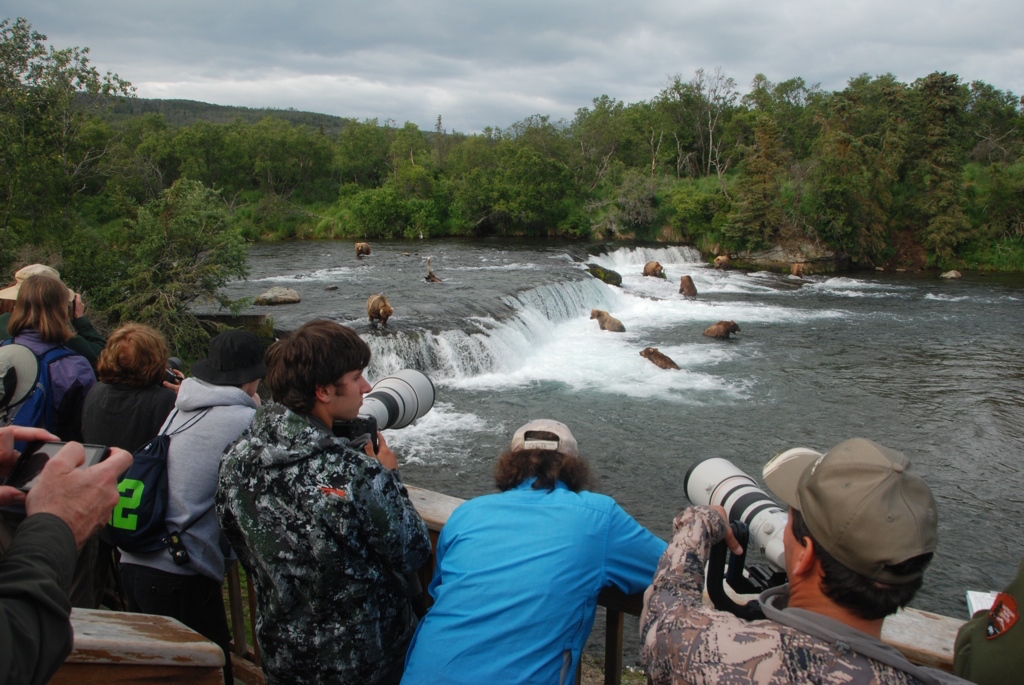
As word of Katmai spread, and as transportation to its remote location became easier, tourism emerged as a practical commercial pursuit. In the 1940s, fly-in fishing groups began visiting the sparkling rivers of Katmai’s landscape. Pilots and guides shared Katmai’s abundant natural resources with groups of visitors, and catch-and-release ethics helped the National Park Service promote its mission to preserve those resources for future generations. Additionally, clean-up efforts in the wake of the 1989 Exxon Valdez oil spill drew attention to Katmai's coast as a prime bear-viewing area (and a commercial opportunity to transport visitors to its remote shores).
 Today, Katmai is known as a prime bear-viewing destination. NPS Photo.
The National Park Service preserves and protects Katmai’s multi-faceted identity. Balancing each facet is no simple task; Katmai’s administrative history notes: “In order to manage [Katmai] effectively, the NPS has had to be sensitive to the changing expectations which people have had for that area, and has attempted to reconcile those expectations with broad mandates, issued from Washington, regarding how all national park units should be maintained. The job, to be sure, has not been easy....” Those changing expectations will likely continue to evolve as Katmai ages. Since becoming a National Monument meant to protect a unique geologic landscape, Katmai has gone through several legal re-definitions, so now it is also mandated to protect spawning grounds for one of the largest salmon runs in the world, habitat for dense populations of brown bears, one of the densest concentrations of archaeological sites in North America, and nearly 3.4 million acres of unspoiled wilderness. Katmai Preserve also supports subsistence activities, thus perpetuating one of the landscape’s oldest uses.
One year from today, Katmai National Park will celebrate its 100th birthday. The end of one century of changing identity will mark the beginning of another. What would you like to see in Katmai's second century? What do you see as the most brilliant facet of its identity?
