Archeology is an inherently destructive process. The moment we excavate the earth is the moment the physical context of an archeological site is forever altered. This is why archeologists so meticulously record artifacts, features, soil strata, and thoroughly note everything in the surrounding environment with possible association to the cultural context. We must gather as much as possible with the few resources available in the depositional record. There is very little ‘going back’ in archaeology; you need to do it right the first time.
Luckily for us, we live in the age of technology. We archaeologists jump on any new method that could possibly save us from unnecessarily shoving trowels and shovels into the earth. This summer at Katmai National Park we employed data from laser survey (LiDAR) and geophysical analyses such as ground-penetrating radar (GPR) and magnetometry. We were able to engage investigative techniques for several projects with few physical impacts to our sites. These results provided precise areas to focus future excavations.

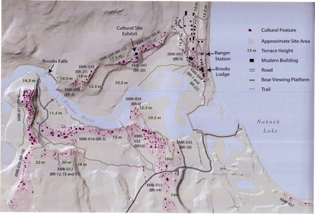
Cultural features around the mouth of Brooks River; today mainly bears use the area, but for thousands of years humans took advantage of the bountiful natural resources.
LiDAR is aerial imagery that uses lasers to create accurate high definition depictions of a landscape. These images revealed ground depressions that were determined to be prehistoric sod house features that were unrecorded in Katmai’s cultural resource inventory. If you keep up with the Terrane blog, you may remember Ranger Daniel’s post “Bear Bones”. We investigated the depression areas in June, and upon returning to perform a geophysical survey in August, discovered a bear skeleton on the edge of one of the newly discovered sod houses. It was an ominous sight to stumble upon, but the good news is the skeleton proved harmless and little of an obstacle, and also kept us good company during our survey.
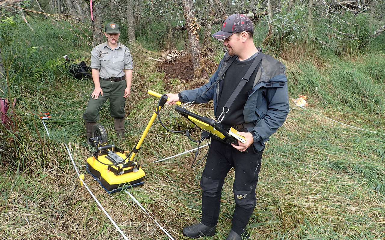
Our geophysical investigation of the “bear house” and other house depressions involved the use of the GPR and a magnetometer. The magnetometer can detect trace magnetic materials from ancient burn areas or hearth features from within a house depression. The GPR identifies a change in soil layers by transmitting a signal at a known rate and depth through the ground surface, and measuring the velocities and hyperbolas of that signal. The signal will produce a reflection whenever it encounters a change, suggesting a disturbance within the sediments. This data is processed into an image using colors to represent positive or negative changes. In this way, the GPR is able to provide a clear picture of the house feature itself, including its depth below ground surface, and structural elements like large support posts, tunnels and entryways.

Although a little odd looking in the wilderness, the GPR and magnetometer help provide archeologists with a "picture" of what the soils looks like underneath the ground surface. NPS Photo/L. Chisholm
Using this information, we later returned to the house depressions for what we call ground-truthing—excavating potential features and recording the source of the signal, then determining whether the observed signal was the result of cultural or natural processes. We excavated a few probable hearth features. Hearths contain charcoal and other materials that can provide a timeline for the long record of human habitation within Katmai National Park. We were successful in these endeavors, in that we extracted charcoal samples and anthropogenic soil samples to send to the University of Georgia for testing. We also discovered a couple of diagnostic artifacts, which will give us a contextual time-based range for the site.
Our non-invasive techniques helped with practical decision making for the park as well. One contemporary issue involves park housing, specifically the Brooks Lake (BL) housing complex. The BL buildings are slated for removal because of their impact on nearby cultural resources, however, BL housing is historically relevant to the park and is considered another cultural resource. So, in addition to the potential effect moving would have on the historic structures, how much was the housing’s current position harming the surrounding resources, and would the moving process be just as damaging to those nearby resources? With GPR we were able to detect if there were anomalous features abutting the Brooks Lake buildings. Once we ground-truth these anomalies and determine their cultural nature, we can then decide whether moving the historic structures is beneficial to either of these resources.
October 15th is the 50th Anniversary of the National Historic Preservation Act of 1966. This act stands as the backbone of preservation law within the United States and supports a wide variety of activities and projects. The projects here in Katmai fall under the NHPA through its archaeological resources, structures, cultural landscapes, ethnographic resources and more. Learn more about the National Historic Preservation Act and it’s 50th Anniversary.
