Black Rock Area Hiking

The Black Rock Backcountry information board is in the foreground on the left. Hikers and a Joshua Tree are seen on the background on the right.

NPS / Anna Cirimele


Black Rock Area

The Black Rock area of Joshua Tree National Park is isolated and not connected by roads to other areas of the park. Visitors must leave the park through the North or West Entrance and re-enter the park south of Yucca Valley. Plan your driving time accordingly to make the most out of your visit.

Parking is limited in the Black Rock area. Hikers should park at the Backcountry trailhead, the Black Rock Nature Center, or the horse parking area. See the campground map to find parking locations.

Know Before You Go

Please remember, pets are not permitted on any trails in the Black Rock Area. For more information, visit the Pets page.

Desert hiking and exploration requires unique considerations compared to other popular hiking destinations in California. Read up on on the Safety page and the Hiking page before you visit.

Leave information about your planned route and expected return time with a friend or family member before hiking. Check in with this person when you return. In an emergency, call 909-383-5651 or 911.


Backcountry Hiking

To learn more about backcountry hiking opportunities, such as Boy Scout Trail or California Riding and Hiking Trail, visit our backpacking page.

Other Hiking Options

For information about hiking in other areas of the national park see the main hiking webpage.


Black Rock Area Hiking Map

 
A map of the hiking trails in the Black Rock area of Joshua Tree National Park. West Side Loop, High View, Waren Peak, Burnt Hill, Short Loop, and Panorama Loop/Morongo View trails are recommended.
 

Moderate Hikes

These hikes may not be recommended for summer. Use caution when hiking in the desert in the heat.
Trail Trailhead Location Distance Estimated Time Description
Hi-View Nature Trail Hi-View Nature Trailhead or between campsites 20 and 21. 1.4 miles (2.3 km) from trailhead.

2.1 miles (3.3 km) from visitor center.

400 feet (122 m)
45 min.–1.5
hours
Loop. Spelled High View on map. Hike a steep ridge on the western side of the park and take in panoramic views. View Joshua trees! No horses allowed on this trail.
Short Loop Trail Black Rock Backcountry Trailhead or near campsite 30. 4 miles (6.4 km)
522ft (159m)
2–3 hours Loop. The trail passes through hills, washes, ravines, and valleys.
West Side Loop Trail High View Nature Trailhead, near campsite 30, or between campsites 20 and 21.
4.7 miles (7.6 km)
785 feet (239 m)
2.5–4 hours Loop. Hike ridges and washes with views of Joshua trees and mountains.
 

Strenuous Hikes - Do Not Attempt in the Heat


The following trails should not be attempted during the summer or whenever it is hot out, because they are extremely dangerous due to sun exposure, temperatures, and dehydration risks. Every year visitors have to be rescued and sometimes perish on these hikes.
Trail Trailhead Location Distance
Elevation
Estimated Time Description
Burnt Hill Trail Black Rock Backcountry
Trailhead or near campsite 30.
7.3mi (11.7km)
910ft (277m)
4–5 hours Loop. Travel through low hills, pinyon trees, Joshua trees, a wash, a narrow canyon, and an open valley.
California Riding and Hiking Trail Several. 36.6 miles (58.9 km) 2-3 days to hike entire length One way. Shorter hikes possible on sections of this long trail. Travel from Black Rock Canyon to the North Entrance of the park, passing through a variety of Mojave Desert landscapes.
Eureka Peak Trail Black Rock Backcountry
Trailhead.
9.6mi (15.6km)
1748ft (533m)
6–8 hours Out and back. The excellent views from the peak are the goal and reward for hiking uphill through a sandy wash.
Panorama Loop/
Morongo View Trail
Black Rock Backcountry
Trailhead or near campsite 30.
6.6mi (10.6km)
1100ft (336m)
3–5 hours Loop. Hike up a sandy wash, then follow the ridgeline of the Little San Bernardino Mountains. Enjoys scenic views, dense Joshua tree forest and pinyon-juniper woodland.
Warren Peak Trail Black Rock Backcountry
Trailhead or near campsite 30.
6.3 miles (10.1 km)
1110ft (338m)
3–5 hours Out and back. Hike to the summit of Warren Peak to enjoy panoramic views of the quiet western part of Joshua Tree National Park.
 
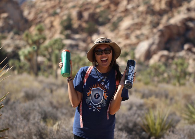
A happy hiker holding two water bottles

NPS/ Hannah Schwalbe

Safety Tips

  • Tell someone where you are going and when you plan to be back

  • Bring plenty of food and water—even on short hikes

  • Don’t force fluids—drink when you are thirsty

  • Eat often—salty snacks are key for salt loss from sweating

  • Rest in the shade

  • Plan ahead and avoid hiking between 10am and 4pm during the summer
  • Read more safety tips here before visiting Joshua Tree

Last updated: February 5, 2024

Park footer

Contact Info

Mailing Address:

74485 National Park Drive
Twentynine Palms, CA 92277-3597

Phone:

760 367-5500

Contact Us