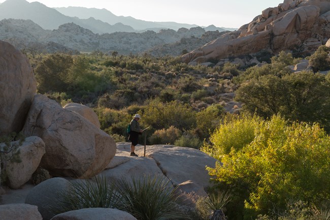
NPS / Hannah Schwalbe Plan Your HikeTrail Highlights & ExperienceEncounter rock climbers, spot wildlife big and small, scramble over boulders, and walk along desert washes. Catch a glimpse of the far-off San Gorgonio Mountain. View the plant life of the Mojave Desert, including Joshua trees, creosote, Mojave yucca, pinon pines, and more. This trail is ideal for short visits, families, wildlife enthusiasts, rock art and history enthusiasts, photographers, and novice scramblers.

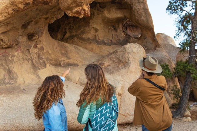
NPS / Alison Taggart-Barone Quick FactsTrail BasicsLENGTH: 1.1 mile loop (1.8 km) Surface DetailsWIDTH: ~1.5 ft to ~5 ft (0.5 m to 1.5 m) DescriptionOne of the milder trails in the park, Barker Dam Trail travels only 1.1 miles (1.8 km) in a single loop with very little elevation gain and no intense rock scrambling required. The trail covers many of the highlights of the Mojave Desert, offering a broad look at the plantlife that comprises the ecosystem and monzogranite boulders of all shapes and sizes. The dam itself offers a closer look at the history of the park's early ranching efforts. Rainfall affects the presence of water in Barker Dam, but after a rainy day or season, visitors may experience this precious desert commodity. The lush vegetation surrounding Barker Dam makes it an ideal spot for wildlife viewing, including many species of birds, reptiles, and even desert bighorn.Interpretive exhibits along the trail tell the history of Barker Dam and provide insight to the plants, animals, and people that call the desert home. The rock art site, a highlight of the trail, tells a story of the desert's human history. Do not climb on or otherwise disturb the rock art and the boulder the rock art lives on. Rock art may not be immediately visible and may exist on any portion of the rock, so please refrain from stepping on, climbing on, or touching any part of the rock formation. View the rock art from a respectable distance at the signage for the site.
Getting ThereParking at Barker Dam Trail can be scarce during peak season from September to May. Please plan accordingly, and be prepared with backup trail options in case a spot is not available. Echo T parking lot, just to the west of the Barker Dam parking area, offers alternative parking. The Echo T Connector Trail adds appropximately 0.6 miles (1 km) to the trail length when combined with the Barker Dam Trail loop, making the total length 1.7 miles (2.7 km).Arriving from West Entrance in Joshua TreeTravel to Barker Dam from the northwest by driving into the park until reaching the Intersection Rock area (approximately 11.6 miles, or 18.6 km). Turn left after the sign reading "Hidden Valley Campground, Key's Ranch, Barker Dam, Ranch Tours." Follow this road until its conclusion at the Barker Dam parking lot (approximately 1.5 miles, or 2.4 km).
NPS / Emily Hassell Arriving from North Entrance in Twentynine PalmsTravel to Barker Dam from the northeast by driving into the park, remaining straight (bearing right) at the turnoff which shows signage for "Cottonwood / Interstate 10, left; Keys View, straight" (approximately 4.5 miles, or 7.2 km). Continue along the main park road towards the Hidden Valley area for approximately 11.9 miles, or 19.2 km. Pass by areas such as Jumbo Rocks Campground, Hall of Horrors, and Cap Rock. Take the first right after the sign reading "Hidden Valley Campground, Key's Ranch, Barker Dam, Ranch Tours." Follow this road until its conclusion at the Barker Dam parking lot (approximately 1.5 miles, or 2.4 km). Visitors who reach the intersection of Hidden Valley Nature Trail and Intersection Rock parking lot have traveled slightly too far.Arriving from Cottonwood Visitor Center and Interstate 10Travel to Barker Dam from the south by driving into the park along Cottonwood Springs Road as it changes to Pinto Basin Road at the Cottonwood Visitor Center (approximately 5.8 miles, or 9.3 km). Follow Pinto Basin Road until its conclusion at the turnoff for Park Boulevard (approximately 29.7 miles, or 47.8 km). Turn left, toward the town of Joshua Tree, as the sign indicates. Continue along the main park road towards the Hidden Valley area for approximately 11.9 miles, or 19.2 km. Pass by areas such as Jumbo Rocks Campground, Hall of Horrors, and Cap Rock. Take the first right after the sign reading "Hidden Valley Campground, Key's Ranch, Barker Dam, Ranch Tours." Follow this road until its conclusion at the Barker Dam parking lot (approximately 1.5 miles, or 2.4 km). Visitors who reach the intersection of Hidden Valley Nature Trail and Intersection Rock parking lot have traveled slightly too far. |
Last updated: November 22, 2020
