|
Sunset Trail is the longest trail in Hot Springs National Park, covering approximately 10 miles one-way. Crossing all types of terrain, the trail makes its way through the most remote areas of the park. This trail is divided into three sections: West Mountain (2.8 miles), Sugarloaf Mountain (2.6 miles), and Stonebridge Road (3.8 miles). Sunset Trail can be combined with Hot Springs and North Mountain trails and West Mountain trails to complete a strenuous 15-17-mile loop hike. 
NPS West Mountain SectionThe West Mountain section of Sunset Trail runs 2.8 miles between the West Mountain Summit and Blacksnake Road. Parking is available at both ends of the trail. Views of the southern portion of Hot Springs National Park and Lake Hamilton are available along this section of the trail. The highest point in the park, Music Mountain (1405 feet), is located within the West Mountain section at the westernmost point of Sunset Trail. Sugarloaf Mountain SectionThe Sugarloaf Mountain section of Sunset Trail runs 2.6 miles between Blacksnake Road and Cedar Glades Road, traversing the ridge of Sugarloaf Mountain. Parking is available at both ends of the trail. Balanced Rock, an outcrop of Arkansas Novaculite, offers one of the most scenic vistas within the park. The 0.2-mile Balanced Rock trail spur branches off of Sunset Trail within a curve roughly one mile from Cedar Glades Road. The trail is very steep and rocky for a short distance near Cedar Glades Road. Stonebridge Road SectionThe Stonebridge Road section of Sunset Trail runs 3.8 miles between Cedar Glades Road and Gulpha Gorge Campground. Parking is available at both ends of the trail. This section of Sunset Trail passes through land on Stonebridge Road that was once part of the Fordyce family estate. Ricks Pond, an ideal area for aquatic wildlife viewing, is found here. Please be careful around Ricks Pond, and do not climb on or around stone structures. Although bridges lead across Ricks Pond, the land and trails on the other side of Ricks Pond are private property. Please be respectful of our neighbors and do not trespass on their land. The trail crosses Hwy 7 between Stonebridge Road and the Gulpha Gorge Campground. Near the Hwy 7 crossing, the trail runs parallel to Stonebridge Road and to Gorge Road. The 1.2-mile Fordyce Peaks Trail spur branches off of the northeastern corner of Sunset Trail, providing views of Fordyce Peaks. The trail is unmaintained beyond the national park boundary. 
NPS Photo/Mitch Smith 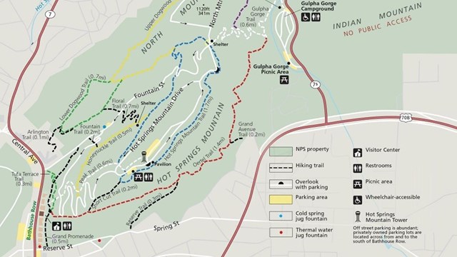
Hot Springs and North Mountain Trails
The trails on Hot Springs Mountain offer a great variety of opportunities to experience a lot of the Park. 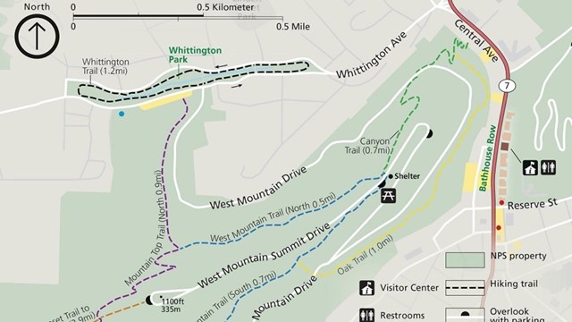
West Mountain Trails
Explore the Western half of the Park via the Canyon Trail, Mountain Top Trail, Oak Trail, Whittington Trail, or West Mountain Trail. 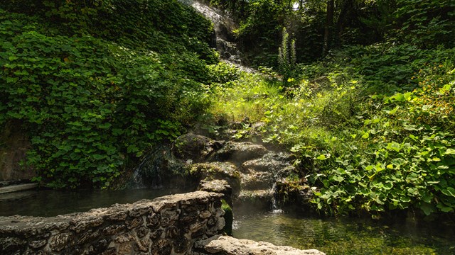
Experience the Water
Learn about the various ways that you can experience the thermal springs in the Park. 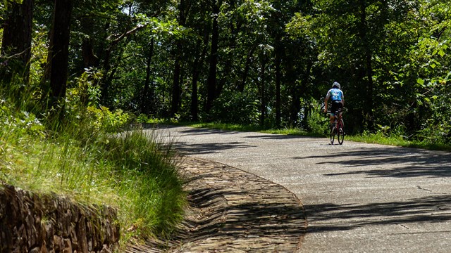
Biking in the Park
Learn about the opportunities and rules for biking in the Park! 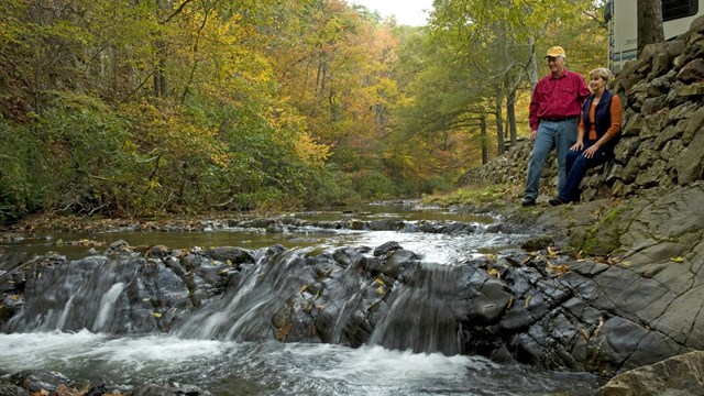
Gulpha Gorge Campground
With 40 sites right by Gulpha Creek, the Gulpha Gorge Campground is the perfect place to relax and enjoy the beauty of the Park. |
Last updated: October 2, 2020