|
Visit our keyboard shortcuts docs for details
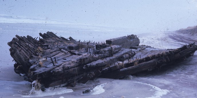
On February 6th, 1922, the Bessie A. White struck a sandbar off Fire Island. While there were no casualties, the ship and its cargo were a total loss. Over the years, the beached remains of a four-masted schooner, believed to be the Bessie A. White, have attracted local residents, casual visitors, and historians from across the world. If you are lucky, you may even catch a glimpse of the wreck on the beach near Watch Hill. Learn more about this astounding artifact and the science we're conducting on it. 
NPS Photo
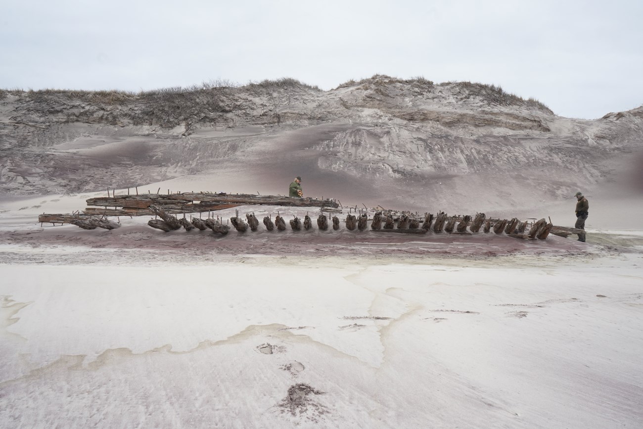
On February 6th 1922, the Bessie A. White, a four-masted Canadian coal schooner, was traveling from Newport News, Virginia to St. John, New Brunswick. As a dense fog rolled in, the schooner struck a sandbar hard, causing the ship to begin taking on water. Despite the efforts of the 20 men aboard, the Bessie White became stranded along the shore of Fire Island opposite the Smiths Point Coast Guard station, which unfortunately had just been deactivated. As the crew launched lifeboats to escape to safety, Seaman James Rynburgh struck his head on a stanchion and fell unconscious into the surf. Rynburgh was rescued by his crewmates who then carried him eight miles to the Bellport Coast Guard Station for medical attention. While there were no other casualties, the ship and its cargo were a total loss. The rights to the wreckage were soon purchased by Foster Stills and Harry Paine of Patchogue, who oversaw the salvage and distribution of key components of the ship. The engine was returned to the manufacturer, while the four masts were distributed to towns across the east end of Long Island for use as flagpoles. Like other wrecks along Fire Island’s shores, salvage operations were challenged by theft and the constant tide. A dory full of movable equipment, including the ship’s compass, was stolen one night during stormy weather and rough waves. On one occasion, men working on the salvage were rescued after getting trapped aboard the wreck during high tide. While salvaging what they could from the ship, Stills and Paine explored the possibility of selling the wreck to a film production company, with the idea that it could be blown up to provide some realism for “some movie thriller.” Negotiations fell-through, however, and the remainder of the ship's hull was abandoned to the sand and the tide. The remaining wreckage sat just 400 feet from the shore and could easily be walked onto during low tide, making it a popular attraction for visitors and residents alike. And, while the wreckage did eventually sink into the shifting sands of the Great South Beach, we know this is not the end of the story of the Bessie A. White. What brings the Bessie White into Fire Island lore is what is believed to be the presence of a large part of the ship's hull within the Otis Pike Fire Island High Dune Wilderness, near Long Cove. The weathered expanse of wood and nail were unearthed and became completely visible in 2012 due to Hurricane Sandy. As wind and waves shape the beach, the ship's skeleton is covered and uncovered, periodically unearthing large portions of the fascinating artifact. While the remains are thought to be the Bessie White, it is difficult to say with any certainty that it is indeed part of the almost one hundred year old schooner. The uncovering of this wreckage following Hurricane Sandy made national headlines. Despite the sudden uproar of media attention, the appearance of the Bessie White from the carved out dunes of a Fire Island beach surprised few long-time island visitors. This was not the first storm to uncover the wreck. In fact, the Bessie White was a regular beach goer, appearing often every few years following powerful winter storms. What makes this artifact so special is not necessarily the story behind the wreck, its salvage, or its discovery. What makes it special is its relative accessibility. Just hike a few miles from Watch Hill, a popular visitor site within the National Seashore, and you might catch a glimpse of the wreck yourself. Be aware, she does like to play hide and seek. The Bessie White, then, helps visitors connect to the Island’s long and rich maritime history. And, when the bones of the ship poke out from beneath a dune, history becomes real as stories are told through the wood and iron of its hull.

NPS/Sucena 100 Years LaterWhen what is believed to be the wreck of the Bessie A. White reappeared on the sandy face of Fire Island in 2021, she presented the National Seashore with an interesting dilemma. How can we balance preservation, education, and scientific exploration? Is there value in studying the wreck in the place where it sank instead of in a lab, even when leaving it in place can contribute to its loss? Immediately, there were fears that the wreck could begin breaking apart. While the story of the Bessie A. White is typical of other wrecks along the shore of Fire Island, it is neither remarkable enough to preserve in a museum, nor mundane enough to remove. So, what opportunities did this wreck present? That year Fire Island National Seashore and the National Park Service’s Submerged Resources Center became involved in an exciting new program to mark and track shipwrecks. Developed by the Florida Public Archeology Network, or “FPAN”. The Shipwreck Tagging and Archeological Management Program, or STAMP, is a public engagement program focused on documenting and monitoring shipwreck sites and disarticulated shipwreck timbers, utilizing citizen science to better document and understand these historic features. With the help of FPAN and the new STAMP program, Fire Island National Seashore Rangers worked with curatorial staff to affix special STAMP tags to various parts of the shipwreck. These STAMPS include unique QR codes which allow visitors to input photographs, GPS coordinates and other data into the STAMP database, allowing the National Park Service and FPAN to monitor the site in order to see how it changes over time. As citizen scientists, visitors can now both enjoy the wreck, and contribute to our understanding of its evolution. The resulting data will give us a glimpse, not only into the shipwreck's change over time, but also into the evolution of Fire Island, as the natural forces of storms, wind, and waves work to very slowly move the wreck year after year. This data may also be used in the future to help track down other shipwrecks in waters across the United States! The wreck of the Bessie A. White provides us with so many unique opportunities. From the opportunity to engage with and enjoy our maritime history, to the opportunity to better understand the natural evolution of shipwrecks, the Bessie White is truly unique in its own right. As the Bessie once again returns to its sandy grave, we wait eagerly for its next appearance. Here’s to 100 years! 
NPS/Sucena |
Last updated: February 4, 2022
