News Release

NPS
|
Subscribe
|
Contact: Abby Wines (NPS), 760-786-3221
Contact: Matthew Lamar (NPS), 760-786-3284
Contact: Christopher Andriessen (Caltrans)
DEATH VALLEY, Calif. – Caltrans and the National Park Service (NPS) announced that parts of State Route 190 (CA-190) and Death Valley National Park are tentatively scheduled to reopen on October 15. The only access into the park will be from the west via Lone Pine, CA.
This reopening date depends on several factors, including future weather events and the availability of materials to fix the road. When this section of CA-190 reopens, drivers should anticipate multiple 24-hour traffic control points where repair work is ongoing.
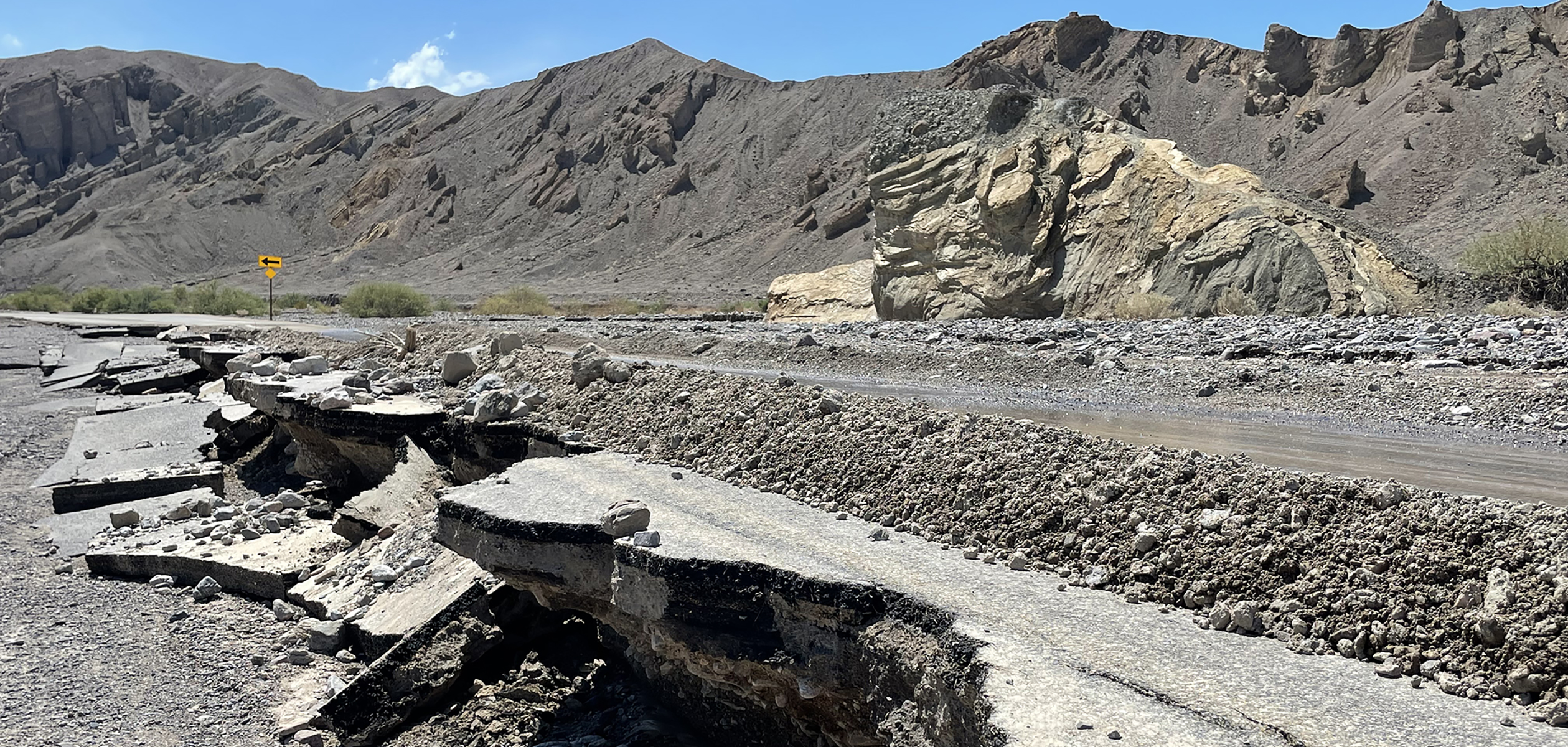
The national park and state highway have been fully closed since August 20, due to extensive flash flood damage caused by the remnants of Hurricane Hilary. Death Valley received more than a year’s worth of rain in a single day. Flash floods undercut pavement and left collapsed roads parkwide.
Lodging, food, and fuel will be available at Panamint Springs Resort, Stovepipe Wells Village, and The Oasis at Death Valley. Some NPS campgrounds will open at the same time.
The park’s eastern entrances will remain closed on October 15. Some hiking trailheads will be available, but most secondary roads in the park will still be closed.
“Thank you to Caltrans, Federal Highway Administration, and NPS staff and contractors for their hard work to reopen areas of the park,” said Superintendent Mike Reynolds. “We look forward to once again welcoming back visitors. We thank everyone for their patience, especially people traveling from Las Vegas or anywhere east of the park.”
Death Valley National Park is the homeland of the Timbisha Shoshone and preserves natural resources, cultural resources, exceptional wilderness, scenery, and learning experiences within the nation’s largest conserved desert landscape and some of the most extreme climate and topographic conditions on the planet. Learn more at www.nps.gov/deva.


This is a map that shows the route from the west into Death Valley's entrance on CA HWY 190. The map shows the park boundary in green.

This map has a highlighted pink route from Las Vegas that leads north on US HWY 95 to NV HWY 266 west to CA HWY 168, then south on US HWY 39

This map has a highlighted pink route from Los Angeles using CA Highway 14 to US HWY 395 to Lone Pine, CA.
August 2023 Flooding
Photos, Videos and News ReleasesLast updated: September 13, 2023
