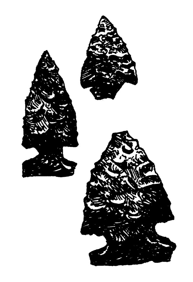
The Shoshone-Bannock PeopleThe Shoshone-Bannock homeland in southern Idaho is an area with limited resources. To find enough food to survive, they traveled more than 1200 miles every year. The local and seasonal availability of various foods determined their movements. Their annual migration began each spring near Fort Hall where they grazed their horses on the luxuriant grasses. In early summer they headed north across the Snake River Plain for the Camas Prairie, near present day Fairfield. There they spent the summer digging camas bulbs. This onion-like plant was the staple of the Shoshone-Bannock diet until autumn. They supplemented their diet of camas bulbs with strawberries, currants, grasshoppers, and pine nuts. They made bread from sunflower seeds and cakes from serviceberries. They also took rodents and an occasional large mammal, such as bighorn sheep, mule deer, or elk. But with the camas crop depleted, it was time to move again. The Shoshone-Bannock spent fall on the Boise and Snake Rivers harvesting salmon. When the salmon run ended, they returned to Fort Hall to fatten their horses on the last grass of the year. With their horses in peak condition, the Shoshone set out to hunt buffalo and elk in what is now Wyoming and Montana. They wintered along the Yellowstone River, subsisting on meat from the fall hunt. With the arrival of spring, they returned to Fort Hall and the cycle began once more. 
Why did the indigenous people venture onto the harsh lava fields? The scarceness of water and rugged terrain made travel extremely arduous. A few waterholes exist, but they are not reliable. Perhaps they were hunting game-although mule deer, bighorn sheep, bison, and elk were probably never abundant on the lava. Maybe they sought tachylyte, a dense form of basalt used for arrow points and stone tools. Or perhaps, like us, they were motivated by simple curiosity. Whatever their reasons for visiting the area, the Shoshone-Bannock may actually have witnessed eruptions at Craters of the Moon. The most recent eruption here occurred 2,000 years ago. These people have oral traditions indicating that their ancestors observed the fiery events that created this landscape: The Angry Serpent
A Serpent trying to nap on the mountains above the Snake River was angered by lightning that disturbed its sleep. It coiled around and squeezed the mountain until pressure caused rocks to crumble, stones to melt, and fire to shoot out of the cracks. Liquid rock flowed from the fissures and the mountain exploded. The heat killed the slow-moving serpent and the hot rock roasted its flesh. Today, we see the ashes (cinders) and charred bones (pahoehoe lava) of the serpent on the landscape. The Medicine Man The routes which the Shoshone-Bannock used to move from one food source to another were later adopted by white travelers. Explorers and trappers, then emigrants and miners, crossed Shoshone-Bannock territory in the mid-1800s. Unlike the native people before them, they avoided the rugged lava and traveled along its edges. 
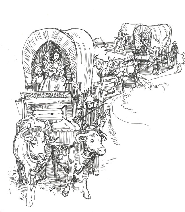
The Oregon Trail: Goodale's CutoffFrom the 1840s through the 1860s tens of thousands of emigrants passed through southern Idaho on their way to fertile farmland to the west or to the gold fields north of Boise. The traffic peaked in 1864 when 40,000 people traveled the Oregon Trail. The main trail followed the course of the Snake River, about 100 miles south of the monument. John Jeffrey began promoting a spur trail which followed Shoshone migration routes in 1852. He wanted to generate business for his Snake River ferry at the mouth of the Blackfoot River. This cutoff received some use from 1852-1854, but not until 1862 did a large percentage of Oregon Trail traffic choose the route. The Northern Shoshone and Bannock tribes were growing resistant to emigrants intrusion into their homeland. In August of that year, a group of Shoshone ambushed a wagon train at Massacre Rock, killing 10 people. Increasing hostility along the main trail resulted in demand for an alternate route safe from attack. An emigrant party asked a guide named Tim Goodale to lead them west from Fort Hall on the cutoff pioneered by Jeffrey. They hoped the alternate trail would be safer and enable them to reach the Salmon River gold fields more directly. Goodale succeeded in leading the largest wagon train ever to cross any section of the Oregon Trail safely from Fort Hall to Boise. The group consisted of more than 1,095 people, 338 wagons, and 2,900 head of stock. It took this enormous train over 3 hours to get into or out of camp. Following this endeavor the route came to be known as Goodale's Cutoff. In 1863, seven out of every ten wagons reaching Fort Hall en route to Boise took Goodale's Cutoff instead of the main Oregon Trail. The 230-mile spur began at Fort Hall, then headed north toward Big Southern Butte, a conspicuous landmark on the Snake River Plain. From there it passed near the present town of Arco, wound through the northern part of Craters of the Moon, went southwest to Camas Prairie, and ended at Fort Boise. This journey typically took two to three weeks. Goodale's Cutoff was a difficult route, and took its toll on the travelers and their wagons. The rugged lava restricted travel to one lane, so progress was slow. The path along the edge of the lava flows was circuitous and demanding. The emigrants typically passed through in late July, the hottest part of the summer. Wood dried out in the desert air and shrank, causing wheels and boxes to come apart. Some pioneers wrote of finding pieces of broken wagons littering the trail. The impressions of some of these early travelers are preserved in diaries they kept of their trips. Julius Merrill, who crossed in 1864, described the lava landscape at Craters of the Moon: "As far as the eye can reach there is nothing but this black volcanic rock. This region must have received some terrible scorchings and shakings years ago... The man whom Aesop described as being chained in a pool of water with an apple dangling above his head and being unable to quench either thirst or hunger was in a Paradise in comparison to him who drives a 'Bull team' across such places... Great must have been the relief of the volcano, powerful the emetic, that poured forth such a mass of 'Black Vomit'." For nearly 50 years, migrating pioneers used Goodale's Cutoff. Later, miners moving ore to railroad depots and stage coaches carrying passengers to the towns of southern Idaho took the route. But the advent of the railroad and automobile led to the demise of Goodale's Cutoff as a wagon route. Today, modern highways, including US 20, follow sections of Goodale's route. Now when people travel this road, they need not concern themselves with survival and can take time to appreciate the unique beauty of the harsh landscape. 
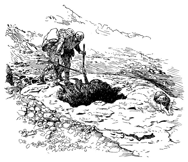
Robert LimbertThe first documented exploration of the edge of the Craters of the Moon region occurred with Captain Benjamin Bonneville's mapping expedition in 1833-1834. The physical beauty of the area did not impress him. He wrote, "...nothing meets the eye but a desolate and awful waste; where no grass grows nor water runs, and where nothing is to be seen but lava." Other explorers and geologists followed. None could match the enthusiasm and the daring exploits of Robert W. Limbert. Limbert came west in 1911 at the age of 26. He was a taxidermist by trade, and an avid outdoorsman. He explored the Craters of the Moon lava field many times and became a strong promoter of the area. He played a critical role in gathering public support for establishing Craters of the Moon National Monument. Limbert's first major exploration of Craters of the Moon occurred in 1920 when he and a friend embarked on a 17 day, 80 mile trek across the lava. They carried bedding, an aluminum cook outfit, camera and tripod, binoculars, and two weeks of supplies. They also brought along a camp dog, a decision they were to regret. After three days of travel over the rough lava the dog's feet were cut and bleeding. For the remainder of the trip, Limbert and Cole had to carry the dog or wait for him to pick his way tortuously across the rugged rock. Throughout the trip, Limbert photographed the volcanic landscape. He also named many of the natural features they encountered, including Big Cinder, Trench Mortar Flat. Echo Crater, and Yellowjacket Water Hole. Limbert used his knowledge and experiences to promote the Craters of the Moon area. In 1921 he led 10 scientists and civic leaders into the lava fields and argued for protection of the area's volcanic features. He also wrote a series of newspaper and magazine articles. The most influential of these appeared in National Geographic in 1924. Limbert vividly described the spectacular and unusual landscape. "Stretching to the southwest for a distance of about 11 miles, we saw perhaps one of the most remarkable lava flows in the world. Its color is a deep cobalt blue with generally a high gloss, as if the flow had been given a coat of blue varnish. The surface is netted and veined with small cracks, having the appearance of the scales of some prehistoric reptile." Limbert also sent President Calvin Coolidge a scrapbook with pictures and narration detailing his trips across Craters of the Moon. On May 2, 1924 President Calvin Coolidge created Craters of the Moon National Monument. He said: "... this area contains many curious and unusual phenomena of great educational value and has a weird and scenic landscape peculiar to itself..." About 1,500 people traveled over the gravel and cinder roads to attend the dedication ceremony on June 22, 1924. Limbert continued to guide tours through the new monument. He even repeated his south to north traverse of the lava field with a group of friends. Their journey ended with an all-town welcome from the people of Arco, complete with a brass band. Limbert believed that Craters of the Moon had the potential to attract large numbers of tourists. He never saw this dream realized, although today more than 200,000 people visit the monument each year. During his life, though, he made great strides in promoting the fantastic Craters of the Moon landscape as well as other areas in Idaho. Recognizing Limbert's importance to the creation of the Monument, the National Park Service dedicated the Visitor Center to his memory in 1990. ConclusionThe Shoshone-Bannock people, emigrants on Goodale's Cutoff, and explorers like Robert Limbert, all contributed to the history of Craters of the Moon National Monument. What does the future hold for this strange volcanic landscape? What impact will we have on it and how will it affect people in the years to come? The National Park Service is charged with preserving Craters of the Moon National Monument unimpaired for future generations. Park Service management of the area rests on sound scientific information and federal law. But ultimately the preservation of this monument, and every unit in the National Park System, depends on each of us. With parks facing increasingly complex threats, like deteriorating air quality, preserving park resources will require everyone's involvement. By helping to support and preserve Craters of the Moon National Monument, all of us can play a small role in its ongoing history. |
Last updated: August 24, 2021
