|
The 360-degree panoramas available here require Quicktime Player (a free download) for viewing. Use your mouse (click, hold, drag) to scroll through the panorama. The '+' and '-' buttons allow you to zoom in and out of an image. The images available here are guaranteed royalty-free. Their use is not limited; however, please credit "National Park Service Photo" where appropriate. 
Homesteaders and ranchers occupied Anderson Bottom from the early 1900s until the mid-1960s. For many years, Anderson Bottom was the overnight camp for the Friendship Cruise, an annual two-day outing in which hundreds of boats motor from Green River to Moab. Some signs of these activities remain, including a spring which still delivers fresh water to river runners. Photos taken at the edge of the spring on October 22, 2007. 
Constructed roughly 1,000 years ago, Fort Bottom Ruin remains one of the more dramatic reminders of ancestral Puebloan culture along the Green River. Amazing 360-degree views greet visitors willing to make the climb. Just above river level, an historic cabin (not visible) lends Fort Bottom its name. Photos taken on October 21, 2007. 
Perched at the southern tip of the Island in the Sky mesa top, Grand View Point offers views of Monument Basin, the White Rim Road, the Needles and much more. Photos taken just before sunrise on September 13, 2007. 
Just beyond the Willow Flat Campground, Green River Overlook is one of the few places where one of the rivers is visible from the scenic drive at the Island in the Sky. Beyond the river lies the Maze and the Land of Standing Rocks. Photos taken just before sunrise on September 27, 2007. 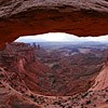
Next to Delicate Arch at Arches National Park, Mesa Arch may be the most photographed arch in southeast Utah. This location is especially popular at sunrise, when groups of photographers often lay in wait for the glow of sunrise on the bottom of the arch. Photos taken at sunrise on October 17, 2007. 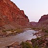
From this vantage point in Cataract Canyon, boaters can contemplate one of the greater challenges along this stretch of the Colorado River: Big Drops One, Two and Three. In the panorama, the river is flowing from right to left. Scout Rock is between Big Drops One (upstream) and Two. Photos taken just before sunrise on October 27, 2007. 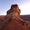
Turks Head marks yet another impressive meander along the Green River, with just a thin wedge of mesa separating the upstream (on the right) and downstream channels. Nearby ancestral Puebloan rock art and granaries (not visible) make this a popular stop for river runners. Photos taken just before sunrise on October 24, 2007. |
Last updated: April 4, 2019
