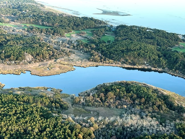
Friends of Herring River/Erika Pfammatter Project SynopsisMill Creek, which flows through the town of Wellfleet, is a tributary of the Herring River and is located several hundred meters upstream of Chequessett Neck Road. Historically, the area surrounding Mill Creek was healthy saltmarsh, much like the rest of the Herring River estuary. However, due to the restriction of tides caused by the dike at the mouth of Herring River, invasive plants and upland vegetation, such as common reed, black cherry, winterberry holly, and highbush blueberry, have taken over what used to be saltmarsh in the low-lying areas around Mill Creek. The growth of these plants, especially common reed, has become excessive, and often blocks the flow of water through the creek. This has restricted the natural tides even further, made it difficult for water to properly drain, and prevented the species that should occur there naturally from thriving in the area. After the Herring River was cut off from the tides by the dike in 1909, portions of the Mill Creek area were developed into private residences and the Chequessett Club golf course. As part of the Herring River Restoration Project, tides are set to return to Herring River estuary. These tides will bring back the saltwater, oxygen, and nutrients necessary to restore the saltmarsh and improve water quality. With the return of tides, some properties surrounding Mill Creek could be affected by tidal water. These areas need to be protected from flooding before tidal flow can be restored in Mill Creek. A new water control structure is being constructed by the National Park Service within Cape Cod National Seashore to manage tides entering Mill Creek and prevent flood tides from impacting low-lying areas. The structure will be composed of a steel sheet pile wall with five adjustable tide gates. The tide gates are designed to completely open during low tide periods, ensuring that water will drain properly from the basin, but will control the extent of high tide that would otherwise impact properties. During the initial phase of the Herring River project, the Mill Creek water control structure will be managed to limit tidal flow to about 22 acres of the Mill Creek floodplain. Pending future design work and permitting, the Mill Creek water control structure could be managed to eventually facilitate natural tidal flow to Mill Creek. Even with limited tidal flow in Mill Creek, the water control structure is essential in order to achieve the significant ecological benefits generated by full tidal flow to all of the Herring River salt marsh system. Project UpdatesThe Mill Creek water control structure project will begin with clearing of vegetation in the area and the construction of an access road. 
Friends of Herring River/Erika Pfammatter PartnersFunding support from the Natural Resources Conservation Service (USDA – NRCS) and the National Park Foundation (NPF) has been essential to the Mill Creek project. Technical support is provided by the MA Division of Ecological Restoration, National Oceanic and Atmospheric Administration, U.S. Fish & Wildlife Service, the Town of Wellfleet, and Friends of Herring River. |
Last updated: March 7, 2024
