NPS photo
Where is this site?
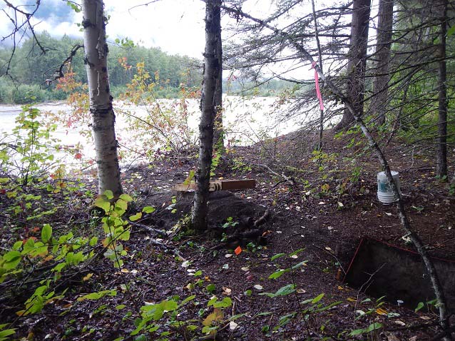
The Kinney Bridge archeological site is located near the Chilkoot Trail a few miles from the trailhead.
Why is this site being excavated?
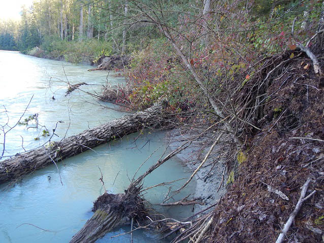
This site is located very close the the Taiya River which has been shifting recently and is eating away at the bank near known archeological features.
In 2011 a local river guide let the park know that a large artifact was sticking out of the river bank in the park. Archeologists were dispatched and discovered massive erosion at this archeological site. Since then, park archeologists have closely monitored the effects of the Taiya River on the site by mapping and measuring how much erosion encroached on the site. During 2014 the river significantly eroded the bank causing trees to fall in the river. Park archeologists decided that this was an imminent threat to the archeology and it was time to act before all the the archeological information was lost.
NPS photo
More about this site
The original wagon road traversing the first few miles of the Chilkoot Trail began in Dyea on the west side of the Taiya River, and then ran north through the town crossing over the Taiya on the Kinney toll bridge. From a very limited number of historic photographs, we know there was a small settlement of 7 to 10 buildings on the east side of this toll bridge. In 1986 archeologists found 16 archaeological features dating from the gold rush in this area and have labeled the site Kinney Bridge complex. Since 1986 this area has been part of the park's archeological monitoring program.
NPS photo
What did the park find during this excavation?
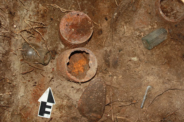
We found artifacts like a lot of old cans, small containers, glass bottles, shoe bits, axe heads, and like most gold rush excavations, nails.
Two interesting things found at this site were the legs of a stove and a small stoneware container.
Stoneware container
NPS photo
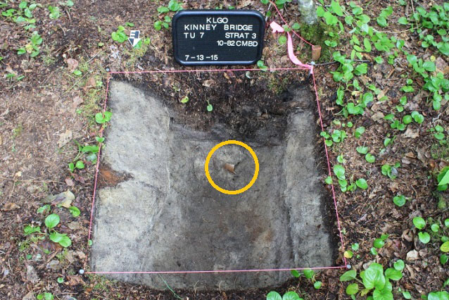
Unit 7 was selected for excavation because archeologists could see that at some point a building had been at that spot. Inside of the footprint of this structure was an rectangular pit. Was this pit a food storage area? Part of a cellar area? Or something else?
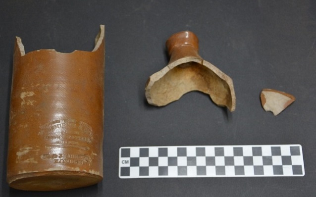
As the archeologists dug in to this area first they had to work through a couple of feet of organic matter-leaves, cones, and loose dirt. Next they found a very sandy level. Most likely this was an alluvial deposit, a large amount of sand in one area that was brought in by the river. At the base of this sand layer they found a bottle, a metal chisel, some nails, and a small stoneware container.
NPS photo/S. Jones
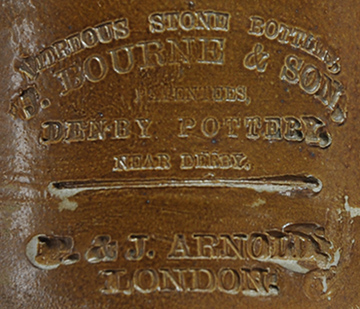
A stamp on the side reads:
J. Bourne & Son,
Patentees
Denby Pottery
Near Derby
_________
P. & J. Arnold
London
This container is an ink container. Because of its size, over 8 inches tall, this container was most likely used to fill or refill smaller personal ink containers. Ink could be used in a lot of important ways along the trail. It could record sales of goods, record tolls paid for the Kinney Bridge, or be used for personal writing.
Perhaps stampeders using ink from this container wrote letters home to assure their family that they were safe? Maybe they wrote a journal or diary recording their adventures and daily progress on the trail.
See a similar ink container found during an excavation at Fort Smith National Historical Site in Arkansas.
NPS photo
Last updated: March 17, 2021
