")
NPS photo
Over 170,000 cubic kilometers (105,633 mi) of basaltic lava, known as the Columbia River Basalts, covers the western part of the province. These tremendous flows erupted between 17 million - 6 million years ago. Most of the lava flooded out in the first 1.5 million years - an extraordinarily short time for such an outpouring of molten rock.
Over 300 high-volume individual lava flows have been identified, along with countless smaller flows. Numerous linear vents, some over 150 km (93 mi) long, show where lava erupted near the eastern edge of the Columbia River Basalts, but older vents were probably buried by younger flows.
In an effort to determine why there was an unusually large outpouring of lava so far from a plate border, scientists established hardening (cooling) dates for the lavas. They found that the youngest rocks were grouped around the Yellowstone plateau, with lavas increasing in age to the west. This evidence suggests that a concentrated heat source is melting rocks at the base of the lithosphere underneath the Columbia Plateau province.
Although scientists are still gathering evidence, a probable explanation is that a hot spot, an extremely hot plume of deep mantle material, is rising to the surface beneath the Columbia Plateau Province. The track of this hot spot starts in the west and sweeps up to Yellowstone National Park. The steaming fumaroles and explosive geysers are ample evidence of a concentration of heat beneath the surface.
Educational Resources
Volcano Models
- Ready to erupt your own volcano? Hotsed by the Department of Geoscieces at Oregon State University, Volcano World lists different models of every skill level and variety to model volcanic processes.
A Glacier Ran Through It
- This activity, posted through the NY Times' "The Learning Network," gives students an understanding of basic geological concepts while they research how the plateau of the Columbia Basin was sculpted by ice age floods.
Columbia River Basalt Province
- Learn about the geology, age, and extent of the Columbia River Basalts from the Idaho State University Department of Geosciences.
Liquid Rock
- In this activity students learn about the properties of lava by experimenting with liquids having varying gas contents and viscosities.
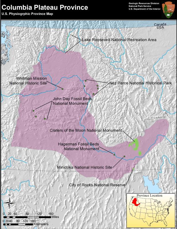
Columbia Plateau Parks

NPS photo
- City of Rocks National Reserve, Idaho—[Geodiversity Atlas] [Park Home]
- Craters of the Moon National Monument and Preserve, Idaho—[Geodiversity Atlas] [Park Home]
- Hagerman Fossil Beds National Monument, Idaho—[Geodiversity Atlas] [Park Home]
- John Day Fossil Beds National Monument, Oregon—[Geodiversity Atlas] [Park Home]
- Lake Roosevelt National Recreation Area, Washington—[Geodiversity Atlas] [Park Home]
- Minidoka National Historic Site, Idaho & Washington—[Geodiversity Atlas] [Park Home]
- Nez Perce National Historical Park, Idaho, Montana, Oregon, & Washington—[Geodiversity Atlas] [Park Home]
- Whitman Mission National Historic Site, Washington—[Geodiversity Atlas] [Park Home]
Part of a series of articles titled Physiographic Provinces.
Previous: Colorado Plateaus Province
Next: Great Plains Province
Last updated: April 30, 2018