Last updated: June 14, 2024
Article
Landscapes of Change: Cape Hatteras Lighthouse

NPS
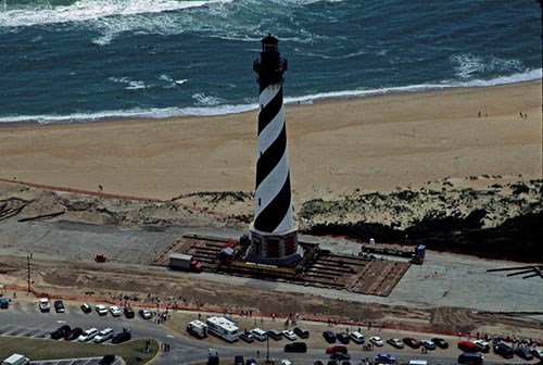
With shoreline erosion threatening the Cape Hatteras Lighthouse, the decision was ultimately made to move the 4,830 ton brick structure inland. In the summer of 1999, the NPS undertook a lighthouse move on a scale never before attempted in order to preserve the historic structure. Aspects of the light station cultural landscape were also preserved through the transformation.
Cape Hatteras Light Station

NPS / Cape Hatteras National Seashore
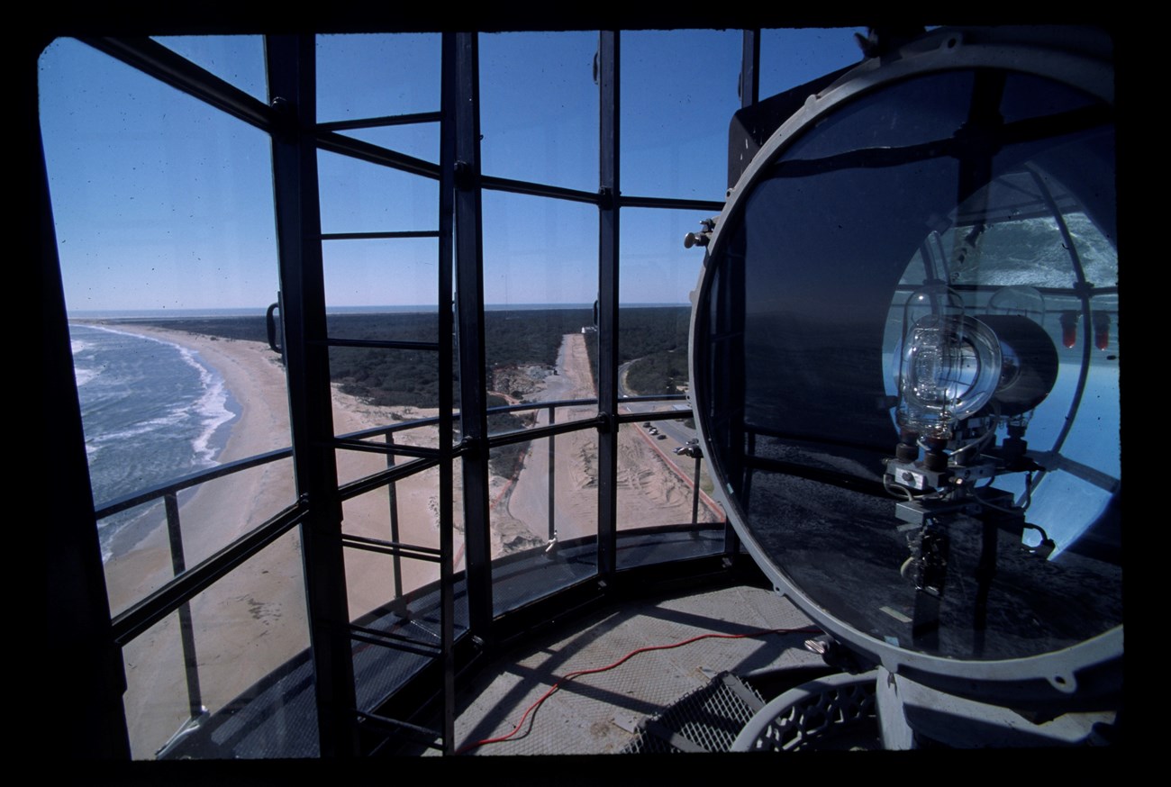
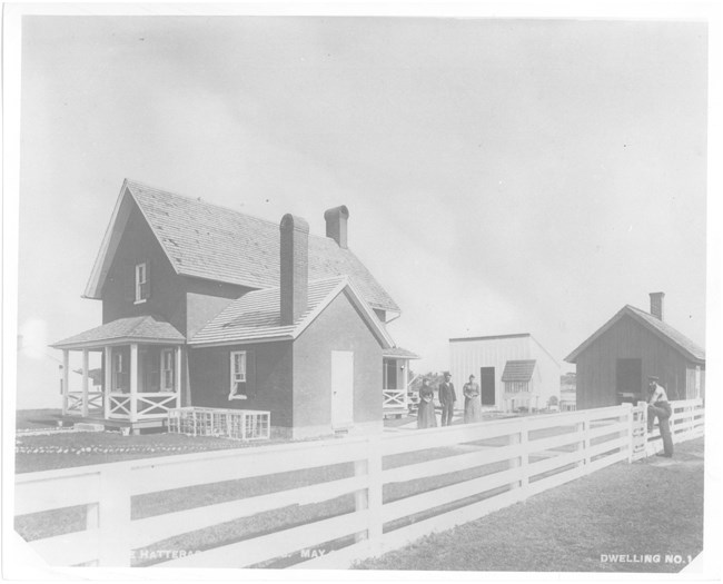
The Cape Hatteras Lighthouse was built on Hatteras Island in Buxton, North Carolina, in 1870. At 193 feet in height, it was the tallest brick structure at time of construction and remains the tallest brick lighthouse in the United States. The black and white spiraled lighthouse was a crucial navigation aid along a hazardous stretch of the Atlantic Coast. The lighthouse is an iconic part of the Cape Hatteras Light Station, which includes three additional historic structures: the Double Keepers' Quarters, Principal Keeper's Quarters, and Oil House.
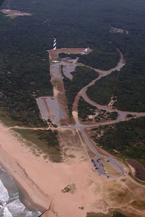
The barrier islands of the Outer Banks have experienced a gradual westward migration over the past several thousand years, with sand being redeposited during storm events from the ocean side to the sound side. When it was constructed, the Cape Hatteras Lighthouse was about 1500-1600 feet from the shoreline, but by the 1970s, it measured only 120 feet from the water. Threatened by continuous shoreline erosion, the lighthouse would be lost to the ocean without drastic mitigation efforts.
Addressing Coastline Erosion
Attempts had been made to slow coastline erosion on Hatteras Island around the lighthouse in the 1930s, with additional stabilization efforts in the 1960s. Nonetheless, the sandbar that separated the sea from the lighthouse continued to diminish. In 1975, the lighthouse was closed to the public when cracks were discovered in the tower. In 1980, as the shore continued to erode and the structure was approximately 50 feet from the water, the NPS began concerted planning efforts, guided by the National Environmental Policy Act, to address shoreline erosion around the Cape Hatteras Lighthouse. Initially, relocation of the structure was discussed and quickly dismissed. Following public meetings and consideration of the best options, construction of a sea wall revetment was chosen as mitigation.
The choice to move the lighthouse was determined to be the option with the least environmental impact and greatest protection for the resource, complying with the NPS mission of both historic preservation and coastal protection. Nonetheless, the decision was highly contested and closely scrutinized by the public and other stakeholders, who feared that the lighthouse would not survive the move.
The Move of the Century

NPS

NPS, 2015
The lighthouse was reopened to the public on November 13, 1999. The bold undertaking earned a national engineering award and the lighthouse returned to its role, now more protected from the ever-shifting shoreline. The navigational icon and marvel of engineering continues to stand as a shoreline sentinel and a focal point of the Cape Hatteras Light Station cultural landscape that was preserved through this undertaking.
While other examples of building moves can be found in previous decades and even centuries, the Cape Hatteras Lighthouse relocation twenty years ago stands out for its large scale and as a particularly complex and controversial decision in a dynamic environment. Today, the practice of moving historic structures is more common and there are also alternatives to structural moving. Increasingly, a range of strategies and approaches may be considered to respond to sea level rise, flooding, and erosion to protect vulnerable cultural resources, preserving both individual historic structures as well as larger districts or landscapes.
Source: NPS DataStore Collection 7646 (results presented are a subset). To search for additional information, visit the NPS DataStore.
- National Park Service. “Moving the Cape Hatteras Lighthouse,” Cape Hatteras National Seashore.
- Quine, Katie. “How the Cape Hatteras Lighthouse Was Moved,” Our State, May 2016.
- “The Move of the Millennium: Moving the Cape Hatteras Lighthouse,” The Coastal Cottage Company.
- National Park Service. "Cape Hatteras National Seashore to Celebrate 20th Anniversary of Cape Hatteras Lighthouse Move on July 1," Cape Hatteras National Seashore, April 2019.
- Cape Hatteras National Seashore website
- More about NPS Cultural Landscapes


