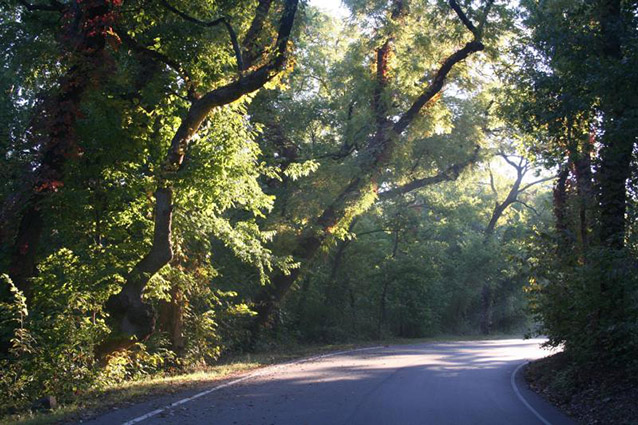
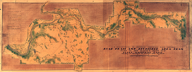
The Perimeter Road is the primary vehicle access within the Platt National Park National Historic Landmark District, part of Chickasaw National Recreation Area in eastern Oklahoma. The curvilinear alignment of the perimeter road, which extends about 6.3 miles, responds directly to both overall and local topography. This is particularly evident in steep areas such as Bromide Hill, where the road follows the contours as it wraps around the hillside.
Although located in a landscape rarely associated with “important” wilderness or remarkable scenery, Platt National Park (1906-1976) as developed by 1940 was one of the most complete executions of the landscape design vision of the NPS. From the National Historic Landmark nomination for the Platt Historic District

NPS / K. Ruhnke
The road is generally twenty feet wide, with shoulders generally three to five feet wide. Small concrete and limestone masonry culverts are typical drainage features along the roadway. Highway 177 provides access to the Perimeter Road, bisecting the Perimeter Road in the midpoint of the park and creating the major north and south park entrances.
Prior to 1933, the road system consisted of an east-west route crossed by a north-south route with a few spurs located off these main roads. This was drastically changed during the 1930s, when the Civilian Conservation Corps constructed a loop road encompassing the entire park. The new loop road utilized much of the old east-west route, but connected the two ends with additional road running along the southern boundary of the park. Though it was constructed in pieces between the years 1933-1936, the road was designed as a whole, linear landscape which provided access to the park’s sites and features, and which orchestrated the visitor experience.

NPS
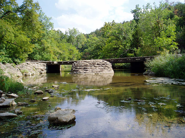
Originally paved in gravel, the road was repaved in asphalt in 1938-1940, with repaving projects occurring a few times since. Similarly, original wood guard rails, constructed in the early 1930s, were replaced with boulders to control parking by 1940. Other structures associated with the Perimeter Road include a series of bridges and box culverts over the large creeks along the perimeter road. These bridges are generally concrete structures with limestone ashlar masonry veneer. The bridge masonry is typical of NPS Rustic style; stones are irregular, and the structures are generally buttressed at their bases.
The Perimeter Road is significant for its relationship to the former Platt National Park (a National Historic Landmark District), which is now encompassed within Chickasaw National Recreation Area. Although located in a landscape not often mentioned among wilderness or scenic parks, the district was one of the most complete executions of the landscape design vision of the National Park Service as promoted by the philosophies of designers like Daniel Hull, Thomas Vint, and Herbert Maier. The extant plan and features of the former Platt National Park show the full range of National Park Rustic design principles, from overall planning to detailed architectural features.

NPS / Park Archives
The former Platt National Park is also one of the finest manifestations of the collaboration between the National Park Service and the Civilian Conservation Corps during the 1930s. Platt National Park’s New Deal re-development was one of the most encompassing of such works in the national park system. Among the many state and national parks designed during this period, Platt is particularly significant because of its extensive period development and the exceptional quality of its original design and planning.
Platt was the only national park rebuilt entirely from boundary to boundary during this decade of profound attention to the entire system. Because of its lack of majestic scenery, Platt National Park was viewed as a blank slate where National Park Service park design principles could be fully applied. Thus, Platt’s landscape most clearly demonstrates the full and intentional application of Rustic design principles in the creation of a complete national park landscape, organized recreational activities as well as scenery.
Quick Facts
- Cultural Landscape Type: Designed
- National Register Significance Level: National
- National Register Significance Criteria: A, C
- National Historic Landmark
- Period of Significance: 1933-1940
Landscape Links
Part of a series of articles titled Cultural Landscapes of Chickasaw National Recreation Area.
Last updated: December 30, 2019
