Last updated: October 15, 2021
Article
Virginius Island Cultural Landscape

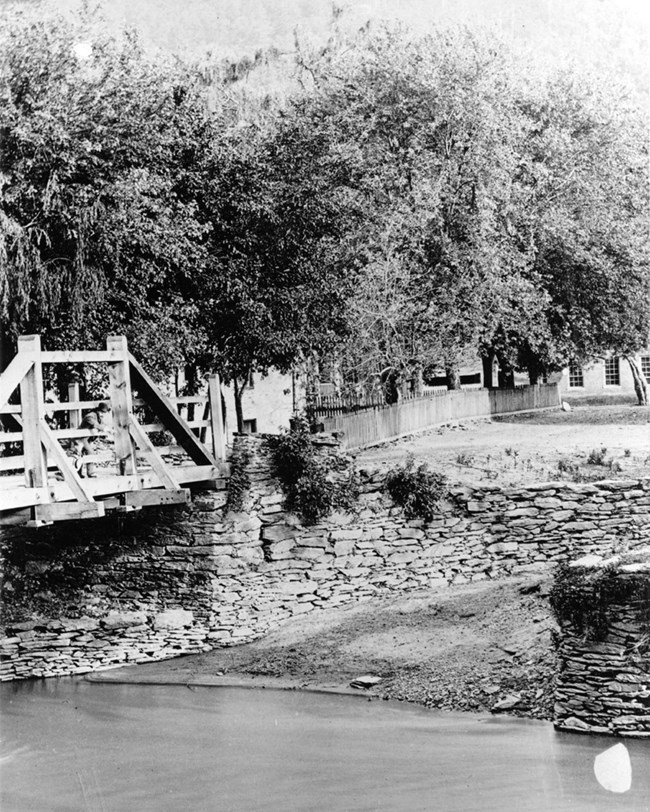
NPS (Harpers Ferry National Historical Park HF532)

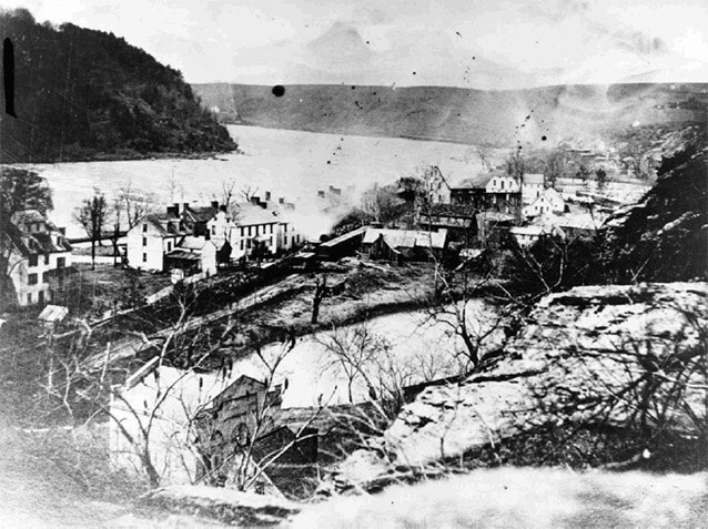
NPS (Harpers Ferry National Historical Park HF774)
Virginius Island is located in Harpers Ferry Historical Park, at the confluence of the Shenandoah and Potomac Rivers. The thirteen-acre landscape, located entirely in West Virginia, was once the location of a rail line, road systems, residential and manufacturing structures, orchards, and gardens. The island is currently treated as an archeological preserve containing evidence of the area's industrial and residential development during the 1800s.
Landscape History
Beginning in the 1700s, the power of the Shenandoah and Potomac Rivers was harnessed to provide energy for industry and transportation. Due to its position at the river confluence, the town of Harpers Ferry became an important manufacturing center.
During the 1800s, residential communities developed on the eastern end of the Island of Virginius, adjacent to Lower Town, Harpers Ferry. The first recorded structure on the island was a gristmill, with grinding stones powered by a waterwheel. By 1830, a bridge, mill, mill house, and machinery stood among the trees of Virginius Island. Remnants of historic structures associated with these development periods are still visible in the landscape.
The cultural landscape of Virginius Island is considered historically significant under National Register criteria during three time periods:
-
1750-1820: The Shenandoah Canal was established and the first mill on the island was constructed.
-
1820-1855: The island was organized into smaller parcels of land, the majority of structures were constructed, and the milling industry was established.
-
1855-1890: The island community was consolidated under one owner and experienced destruction caused by the Civil War and floods.

NPS (Harpers Ferry National Historical Park HF987)

NPS (Harpers Ferry National Historical Park HF987)
Landscape Description
In The Black Book; or, A Continuation of Travels in the United States, newspaper editor and travel writer Anne Royall observed, “A road leads up the Shenandoah as well as the Potomac, and, also has a ferry; both roads are much travelled, and both rivers are navigated by light boats. There is a small island in the Shenandoah some hundred yards above the chasm, which contains several houses" (Royall 1828, 283).
Virginius Island is surrounded on three sides by distinct “heights”: Maryland Heights, Loudon Heights, and Bolivar Heights. The course of the Shenandoah River, with its falls and natural channels, played a role in determining the spatial arrangement of structures on the island as well as the topographic form of the island itself. The characteristics and use of specific construction materials reveal the close ties between the landscape of the island and the evolution of its industrial and residential development.
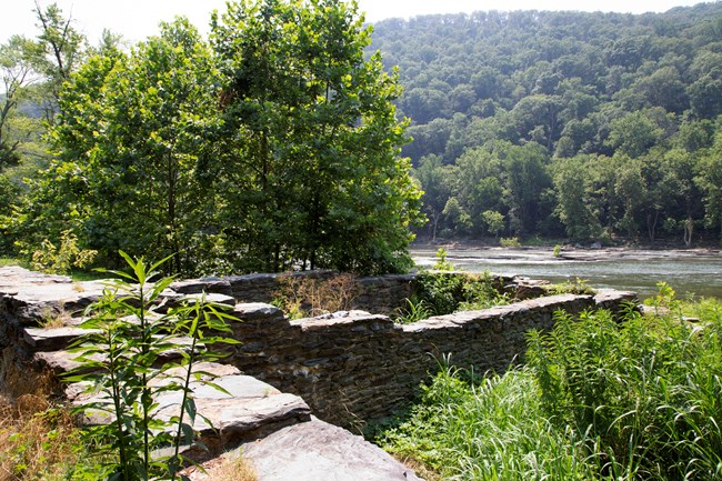
Despite frequent flooding, remnants of features illustrating historic development remain visible on the island. These include industrial ruins of cotton and flour mills, remains of historic waterways, and residential structures. The historic road system and shoreline trails create a circulation network, weaving together the ecological, social, and industrial history of the island.
A branch of the CSX follows the original 1836 rail alignment. Water intake tunnels, canals, raceways, and head gates constitute the remnants of the original water system designed for transporting goods and powering the mills. Foundations from two cotton mills, a flour mill, and a pulp mill are the only remaining structures of the once prosperous industries. Foundations of five individual dwellings and rubble of the row house complex comprise the ruins of former residences on the island.
Landscape Preservation
The National Park Service began managing Harpers Ferry National Monument in 1955. The initial concentration was on the John Brown Raid and the Civil War activity in the area, with particular focus on the preservation and restoration of the Lower Town area. Over time, more emphasis has been given to the historic cultural resources of Virginius Island. The preservation program for the site incorporates archeology, stabilization, and limited restoration.

NPS
A Cultural Landscape Report for Virginius Island was written in 1993, using a range of historic records to develop a narrative landscape history and an analysis of existing conditions at the site that address the evolution of the physical landscape. The report is a management document that guides the stabilization and interpretation of the cultural landscape based on the integrity and significance of the resources.
In 1996, two major floods inundated the island. They caused major damage to the shoreline ruins, eroded away part of the trail system, and toppled trees. Flood debris accumulated on the island and caused the park to close the island to visitors for several years. By 2003, the park completed stabilization of the shoreline mill ruins and water systems to protect these structures from the effects of future floods and rapid vegetative growth.
The NPS continues to do routine vegetation clearing throughout the island and periodically removes silt from the canal. The park is currently stabilizing the seven stone masonry flumes at the pulp mill foundation ruins, and similar work to stabilize the cotton mill foundation ruins is planned for 2022.

NPS
Quick Facts
- Cultural Landscape Type: Vernacular
- National Register Significance Level: National
- National Register Significance Criteria: A,B,C,D
- Period of Significance: 1750-1890
