Last updated: January 22, 2026
Article
Ways to Map Your Journey
Mapping your journey can go in many different directions. Whether heading to a national park or staying in your neighborhood, find suggestions to map trips, history, nature, or your own story.

NPS / Matt Turner
1. Grab a Map
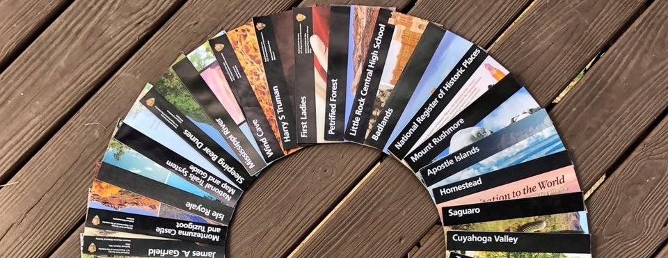
If you are visiting in person, most parks have maps on their official park brochures and websites. Some parks also have ADA-accessible maps for visitors with vision impairments. Find even more map options to explore parks across the country.
2. App Your Journey
Download the free NPS App for interactive maps to use while visiting national parks. Many parks include places of interest, self-guided tours, and suggested trip itineraries included on their maps.
3. Share #YourParkStory
Each person has their own special connections with places in national parks or in communities where National Park Service programs and partners help preserve places of nature, culture, and recreation. Follow National Park Service staff’s park stories on social media using #YourParkStory and share your own using #MyParkStory.
4. Set a Personal Goal
Make a personal checklist of national parks that you will visit this year and track your progress. Choose a history or nature topic, recreation or fitness goals, every park in your state, or a set number, then set off on your adventure.

NPS Photo
5. Collect Passport Stamps
The Passport To Your National Parks® program is offered by our official partner America’s National Parks™ to encourage visiting national parks and preserving memories. How many can you find? (Tip: Use the NPS App to find passport stamps in national parks.)
6. Start a Travel Journal
Compile your pictures, souvenirs, brochures, maps, photos, videos, and stories to chronicle your journeys to national parks. Use them to make a written journal, scrapbook, blog, or series of social media posts.
7. Make a Your Own Map
Are you a mapmaker? The NPMap suite of web map tools enables National Park Service employees and partners to tell the story of the nation's most cherished places using innovative mapping techniques and technologies. Not a mapmaker? Learn more about mapping and cartography to give it a try.
8. Get Started with Some Trip Ideas
Not sure where to start planning a trip to parks? Browse self-guided trip ideas and things to do prepared by rangers to help plan a trip that maximizes your visit tailored to your available time and interests.

Photos courtesy of A. Fawcett (left) and Jen Johnson (right)
9. Share Then with Now
Pull out the old family photos from your childhood or from your parents and grandparents to recreate some memories magic. Revisit places that were family favorites and try to recreate historic photos today.
10. Try Finding Your Way
Finding your way without a phone or GPS is a skill. Learn how to use old-fashioned paper maps to navigate reading the landscape or marked landmarks. Make your own compass and practice using it in your yard or neighborhood before you try a bigger adventure like backpacking in Alaska.
11. Take a Virtual Trip
Not visiting a national park in person? We’ve got you covered with ways to Find Your Virtual Park to stay connected with parks and other places of natural and cultural importance across the country.
12. Connect History
Discover our shared heritage with travel itineraries focused on history topics that you can use for in-person or virtual trips. Explore thousands of places significant to American history and culture in national parks and communities on the National Register of Historic Places.

Asahel Curtis, 1928 (Yellowstone National Park postcard collection)
13. Send a Postcard
Sending postcards to family and friends has been a tradition since national parks were created. Mail a postcard or share digital postcards to track your trips.
Antietam National Battlefield antique postcard collection
Appomattox Court House National Historic Site historic postcard collection
First State National Historical Park biodiversity postcard
Fort Smith National Historic Site vintage postcard collection
Hawai'i Volcanoes National Park historic postcard collection
Valley Forge Naitonal Historical Park historic postcard collection
Yellowstone National Park audio postcard collection
Yellowstone National Park historic postcard collection
14. Create Your Own Postcards
Use memories from your trips to national parks to create your own unique postcards of national parks. Be creative with what you use to make 2-dimensional or digital postcards, maybe even creating a game or postcard exchange with family and friends.
15. Map Games
Create your own game based on locations, maps, topics of interest, or other features in parks, such as interesting sights and sounds. Games can be played verbally, in writing, on devices, or on social media. Share your game on social media for others to try.
Map and Location-Based Games
Devils Tower National Monument: Map Scavenger Hunt
First State National Historical Park: Plaques, Plaques Everywhere!
Florissant Fossil Beds National Monument: Virtual Night Sky
Hopewell Culture National Historical Park: Travel or Trade?
Timucuan Ecological & Historic Preserve: Online Photo Scavenger Hunt
Where the "Park" Am I? Round 1, Round 2, Round 3
16. Navigate Lesson Plans
Whether learning from home or in a classroom, visit the Educators Portal to find lesson plans and other educational materials using maps or mapping to learn about history and nature.
Map and Location-Based Lesson Plans
Four Parks: How Did You Get to Hawai'i?
Cowpens National Battlefield: Mapping the Battle of Cowpens
Cumberland Island National Seashore: Dungeness Map Scavenger Hunt
Dayton Aviation Heritage National Historical Park: Mapping a Neighborhood
Fort Necessity National Battlefield: Traveling the National Road
Glacier National Park: Boundaries and People
Glacier National Park: You Are Here
Haleakala National Park: Map Analysis
Prince William Forest Park: Introduction to Basic Orienteering
Tuzigoot National Monument: History Detective Scavenger Hunt
