Article

Landmark Highlights 2020

Large rocks in foreground with trees and title of report
Figure 1. Bear Rocks and Allegheny Front Preserve NNL,WV. Photo by Kent Mason.

Welcome

There is no way to sum up the world in 2020 that would even come close to encapsulating the multitude of ways everyone experienced the events of the year. Perhaps the one common thread felt by all was change. Heartfelt condolences go out to everyone whose change included loss. This report hopes to inject pinpoints of light, stories of success, hard work that aided conservation, reminders of the strength in and importance of connections, and ultimately gratitude for the benefits derived from experiencing and appreciating our nation’s diverse and beautiful natural heritage. The sampling of landmark highlights from Fiscal Year 2020 are shared to inform, generate connections, and honor those working hard to manage and conserve these significant places, even in the face of great challenge.

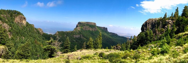
Grass in foreground with flat top mountain in background.
Raton Mesa NNL, CO.

Science and Conservation in Action

🙤 A portion of the Raton Mesa NNL, an ancient peneplain preserved under a thick lava cap, is now part of Fishers Peak State Park, Colorado’s newest and second largest state park. While much of the NNL, which consists of Fishers Peak and Fishers Peak Mesa, is within the adjacent John M. James State Wildlife Area, establishment of this new state park opens additional opportunities for public exploration, recreation, and education, and triples the size of the connected lands. Made possible through a collaboration between the City of Trinidad, The Nature Conservancy, the Trust for Public Land, Great Outdoors Colorado and Colorado Parks and Wildlife, this partnership has initiated a Master Plan process to guide long-term management and development for the park. Considering input from the local community, regional and state-wide stakeholders, subject-matter experts, and on-the-ground data, master plan objectives will strive to balance protection of the area’s rich resources, with the opportunity for meaningful and sustainable access and enjoyment. Learn more...
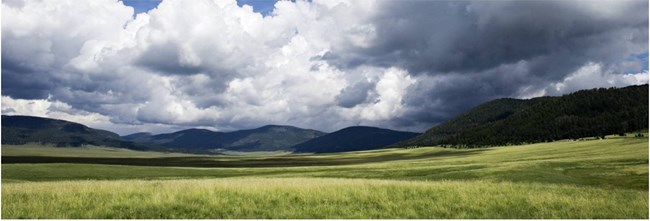
Grass in foreground with rolling mountains and cloudy sky
Valles Caldera NNL, NM. Photo by Rourke McDermott.
🙤 Valles Caldera, designated an NNL in 1975, is one of the world’s largest volcanic craters. This 1.25-million-year-old caldera includes large grassland meadows, forested volcanic domes, meandering creeks, and one of New Mexico’s largest elk herds. The site’s fascinating geology and diverse natural features are combined with an interesting and complex history of land use and management including the many American Indian tribes and pueblos with a strong cultural and historic connection to the site, the Spanish and early Mexican land grants and settlements, and modern practices of cattle grazing, timber harvesting, hunting and geothermal exploration. Transferred to the National Park Service (NPS) in 2013, managers are focused on ecological restoration to regain the balance between human use and natural processes. In early 2020, the final steps fell in place to bring the remaining 40-acre private inholding under NPS ownership. Support from a host of partners and fund sources helped secure this valuable parcel, which contains stunning geothermal features, including sulphuric acid fumeroles, hot springs and mud pots. Efforts are underway to survey, restore and plan for management and visitation of this areas sweltering resources. Learn more...
Collage of three pictures including walrus, sea lions, and common murres.
Pacific walrus, Steller sea lion and common murre at Round Island within Walrus Islands NNL, AK. Photos by Alaska Department of Fish and Game.
🙤 2020 was the final year of a 5-year agreement between NPS and Alaska’s Walrus Islands State Game Sanctuary to help support the site’s resource protection and visitor use program. While the visitor use program was curtailed due to the pandemic, new interpretive panels for the Walrus Islands NNL were developed and wildlife monitoring efforts continued. Sanctuary staff conducted the normal Pacific walrus and Steller sea lion census monitoring and protection surveys, Steller sea lion brand resights and entanglement surveys, and seabird colony monitoring. Staff also conducted black-legged kittiwake, common murre and pelagic cormorant phenology and productivity surveys. All three species continued to show some nesting improvement over the last few seasons. While production on the Common murre and Blacklegged kittiwake plots was low, there was some production evident from chicks and fledglings scattered around the island. Pelagic cormorants did not nest on the plots this year; however, pelagic cormorants were successfully nesting at other locations on the island. Click here to listen to Pacific walrus chiming and clacking sounds.
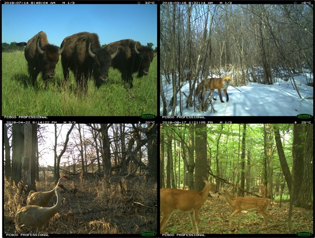
Collage of four trail camera images showing wildlife
Bison, fox, sandhill cranes and deer captured on remote cameras as part of the Eyes on the Wild Project at Cedar Creek NNL in MN. Photos from the Cedar Creek Ecosystem Science Reserve.
🙤 Cedar Creek Natural History Area-Allison Savanna NNL, located in east central Minnesota, is a relatively undisturbed area where three of America’s largest biomes meet (tall grass prairie, eastern deciduous forest and boreal coniferous forest). Designated in 1975, this landmark supports over 60 species of mammals and nearly 200 species of birds and is a nationally and internationally renowned research center. Despite dozens of long-term plant and soil biodiversity projects that have taken place within the Cedar Creek Ecosystem Science Reserve, investigations into the interactions of the diverse faunal communities on these ecosystems remain under-explored, and thus Eyes on the Wild was born. Consisting of a vast network of over 100 motion- and body heat-triggered cameras placed throughout the site, this project seeks to gain a glimpse into the “secret lives” of the animal community, capturing high resolution data on the movement and activity patterns of over a dozen species. Combining photo data with Cedar Creek’s existing collection of plant and soil data survey will help managers better understand how predators are helping shape these ecological communities. To help sort through the hundreds of thousands of images and classify animals captured, the managers have enlisted the services of citizen scientists called “Biodiversity Detectives” who volunteer their time to be a part of this important project. Learn more...
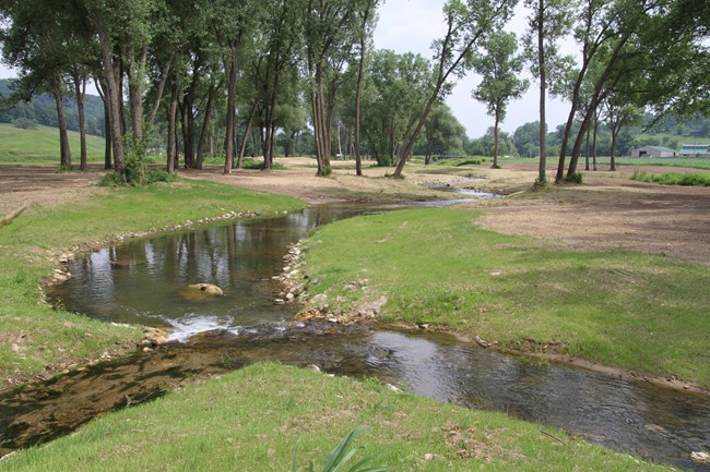
Small creek traversing through short grass area with trees in background
Restored Weister Creek within the Kickapoo River Natural Area NNL, WI. Photo courtesy of Wisconsin DNR.
🙤 Over a decade after project inception, restoration of nearly 3 miles of Weister Creek in the Driftless Area of southwest Wisconsin has been completed and is viewed as a model for success. Long stretches of this spring-fed stream, severely impacted from back to back floods in 2007-2008, have now been cleared of invasive vegetation and sloped banks now take some of the energy off powerful storms, resulting in suitable habitat for native species and a rebounded trout fishery. Put to the test by historic flooding in 2018, the system remained fairly unscathed. With funding and in-kind support received from numerous organizations, this collaborative project was also used as a demonstration for practices that enhance biological diversity and sustainability. Some of the practices included providing still-water wetland habitat, incorporating natural elements for reptile and amphibian basking and egg laying, retaining snags, protecting sandbars and planting prairie grasses and flowers to create up to 200-feet of stream buffer. An important tributary of the Kickapoo River, Weister Creek is located within the Kickapoo Valley Reserve, an 8,600-acre natural area managed by the Kickapoo Reserve Management Board and the Ho-Chunk Nation. Much of the Reserve is within the Kickapoo River Natural Area NNL, recognized for its large concentration of exposed seeping sandstone, many entrenched meanders, and a multitude of diverse microhabitats that support many flora species, some of which are endangered.
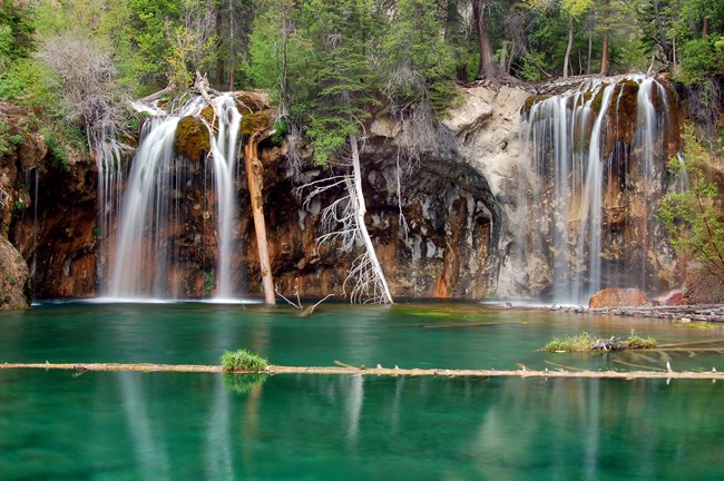
Green calm water in foreground with waterfall in background
Hanging Lake NNL, CO. Photo by Debra Miller.
🙤 Hanging Lake NNL, the stunning natural lake and waterfalls that are perched on a cliff-side travertine deposit near Glenwood Springs, CO, was nearly destroyed by the 2020 Grizzly Creek Fire. Initial reports and fire GIS data included the lake within the burn area; however, helicopter reconnaissance showed that the lake, waterfalls and Spouting Rock had avoided direct impacts from the 32,631-acre fire. Firefighters and the U.S. Forest Service made protecting the lake a priority. Fortunately, their efforts were successful, which was no small feat given the steep terrain and intensity and speed at which the fire burned across the landscape.

Collaboration and Connected Conservation

Connected Conservation

🙤 Despite challenges encountered in every aspect of our world in 2020, seven NNL sites still managed to get into the field looking for dragonfly larva, successfully obtaining samples at 12 locations. Collected as part of the Dragonfly-Mercury Project, this marks the fourth year NNL sites have been contributed to this long-term, collaborative project. In addition to Bear Meadows Natural Area, PA, East Inlet Natural Area, NH and Battle Creek Cypress Swamp, MD, we were thrilled to welcome four additional NNL sites willing to tromp about in muddy waters in search of dragonfly larva, including Fort Worth Nature Center and Refuge, TX, Lilley Cornett Woods, KY, Fish Slough, CA and Ell Pond, RI. Thanks go out to all the staff, partners and volunteers at each of these sites for your time and efforts to add to this nationwide project. Learn more...
Collage of two images depicting person taking notes and two people walking in a swamp.
Battle Creek Cypress Swamp, MD – dragonfly mercury sampling in 2020. Photos by Kim Curren.
Collage of two photos depicting person with net in swamp and child looking at insect samples
Bear Meadows NNL, PA – dragonfly mercury sampling in 2020. Photos by Betsy Leppo.
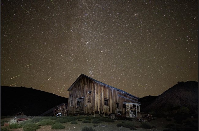
Wooden structure surrounded by starry night sky
Night sky at Ichthyosaur NNL. Photo by Greg McKay, Las Vegas Astronomical Society

Collaborations

🙤 For over 30 years, scientists from all over the world have collaborated on a movement to protect dark night skies from light pollution through the International Dark-Skies Association. One tool to specifically engage with local communities, parks and protected areas, is the International Dark Sky Places Program. Founded in 2001, this program consists of five types of designations recognizing places where protection of night skies is a priority as shown through rigorous community support. There are currently over 60 such designated areas in the US alone, including NNL sites like Anza-Borrego Desert State Park, CA and Enchanted Rock, TX.

🙤 Furthering the efforts to promote landscape-scale night sky conservation, especially throughout the western US, which harbors some of the best places to observe the Milky Way and star-studded night skies, are the Basin and Range and Colorado Plateau Dark Sky Cooperatives (DSC). These voluntary collaboratives link local, state and federal agencies, tribes, businesses, nonprofits, educational institutions and community partners to celebrate, protect and restore the view of the cosmos. Recent efforts have sought to connect NNL sites situated within the DSCs. By working together, NNL managers and night sky advocates can promote and celebrate amazing night skies!

NNLs within the Basin and Range Dark Sky Cooperative include: Amboy Crater NNL, CA, Cinder Cones Natural Area NNL, CA, Deep Springs Marsh NNL, CA (no public access), Eureka Sand Dunes NNL, CA, Fish Slough NNL, CA, Fort Rock State Monument NNL, OR, Grapevine Mesa Joshua Trees NNL, AZ*, Hot Creek Springs and Marsh NNL, NV, Ichthyosaur Site NNL, NV, Mitchell Caverns and Winding Stair Cave NNL, CA, Ruby Marsh NNL, NV, Timber Mountain Caldera NNL, NV (no public access), Turtle Mountains Natural Area NNL, CA, and Valley of Fire NNL, NV*.

NNLs within the Colorado Plateau Dark Sky Cooptative include: Barringer Meteor Crater NNL, AZ, Cleveland-Lloyd Dinosaur Quarry NNL, UT, Grants Lava Flow NNL, NM, Grapevine Mesa Joshua Trees NNL, AZ*, Joshua Tree Natural Area NNL, UT, Kaibab Squirrel Area NNL, AZ, Little Rockies NNL, UT, Ship Rock NNL, NM, and Valley of Fire NNL, NV*. (*NNLs in both cooperatives)
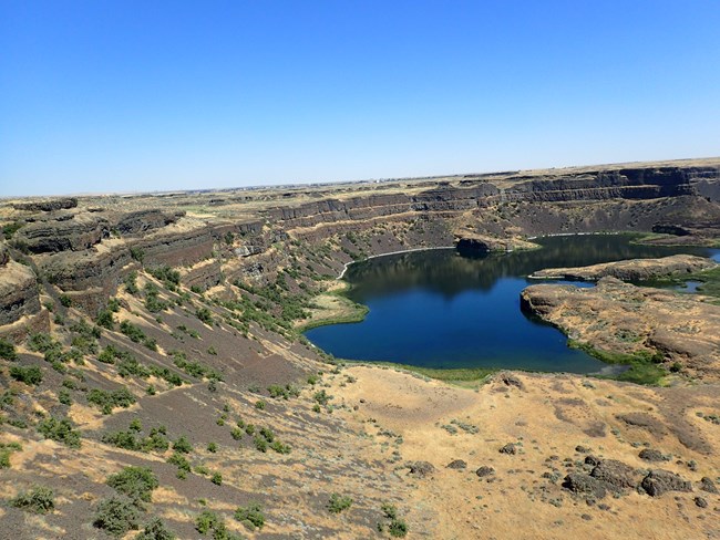
Arid landscape with small lake
Grand Coulee NNL, WA
🙤 During the last Ice Age, 18,000 to 15,000 years ago, a series of cataclysmic floods transformed the landscape of the northwest region of the United States. At one time, the massive Cordilleran continental ice sheet covered the northern parts of Washington, Idaho, and Montana. The ice sheet caused a giant ice lobe to form, damming up the Clark Fork River near the Montana-Idaho border creating the 200-mile-long, 2,000-feet-deep Glacial Lake Missoula. Rising lake levels caused the ice blockage to episodically fail, sending 500 cubic miles of flood water tearing across Idaho, Eastern Washington, and Oregon, eventually reaching the Pacific Ocean via the Columbia River. Moving at 65 miles per hour, these flood waters profoundly altered the landscape and forever added cataclysmic flooding to the North American natural heritage script. The Ice Age Floods National Geologic Trail (IAFNGT), consisting of 16,000 square miles and nearly 3,400 miles if traveled by vehicle, commemorates this dramatic series of events. Included in the dozens of sites that illustrate this largescale natural event, are the following eight designated NNLs, listed roughly from east to west: Glacial Lake Missoula, MT, Wallula Gap, WA, Drumheller Channels NNL, WA, Grand Coulee NNL, WA, The Great Gravel Park of Moses Coulee NNL, WA, Ginkgo Petrified Forest NNL, WA, Crown Point NNL, OR, and Willamette Floodplains NNL, OR.
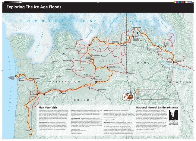
Map depicting route of Ice Age trail
Brochure map of sites along the Ice Age Flood National Trail
Through establishment of the IAFNGT in 2009, the NPS is charged with coordinating the planning, development and interpretation of the floods among the many public and private partnerships associated. In cooperation with partners, a Foundation Document was created in 2014, establishing a shared understanding of what is most important about the trail. Recent efforts have been underway to develop the traditional NPS “unigrid” brochure to help tell and raise awareness of the story behind this unique landscape.

Making Connections

🙤 In 2019, the NNL Program established an NNL Owners and Managers Group within the NPS’ Common Learning Portal (CLP). This new online communication and networking platform allows partners internal and external to the NPS to access and engage in the site. Outreach and invitation efforts resulted in a near quadrupling of members in 2020 to the site, which now has around 50 NNL site owners, managers and partners on board. NNL Program staff continue to use this an outlet for broad dissemination of information and materials that are likely of interest to the group, such as:

  • a running list of conservation focused webinars,
  • one-page guides, including care and maintenance of bronze NNL plaques, the program at a glance and program talking points,
  • links to digital resources created about NNL designation, and
  • an introduction to Dark Sky Cooperatives.

We encourage NNL owners and managers to use this platform as a means to ask questions and seek commonalities and connections to other landmark sites. For instructions on how to join this group, please email your regional NNL staff contact.
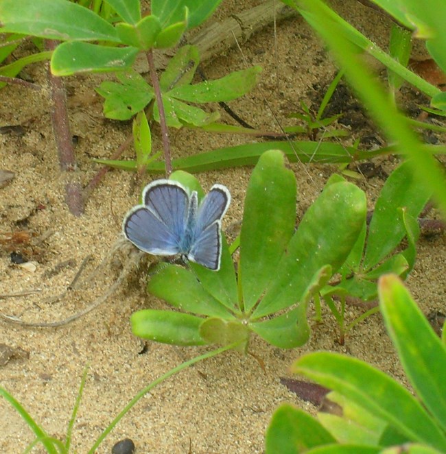
Blue butterfly on a plant
Karner blue butterfly at Albany Pine Bush NNL, NY. Photo by M. Brickle, University of Richmond.

NNLs Making a Splash

🙤 The summer of 2020 brought something of a population explosion for the Karner blue (Lycaeides melissa samuelis) butterflies at the Albany Pine Bush NNL in eastern New York. The Albany Pine Bush Commission has utilized controlled burning, forest thinning, restoration seeding and education to help this small, colorful butterfly that was listed as endangered in 1992 due to habitat loss. As a result of their efforts, Karners at the Pine Bush have rebounded from just a few hundred to over 7,000 - where the population has remained for the last seven years. With butterfly numbers in 2020 far exceeding those seen in any of the survey’s decade-long history, preserve staff believe that the perfect combination of protection from weather, predation and disease might have existed to help females successfully produce hundreds of offspring. A bright spot in a tough year indeed! Learn more...
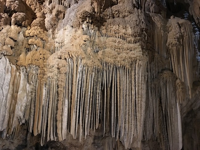
cave features
Lake Shasta Caverns NNL, CA
🙤 In addition to their beauty and the sense of awe they can engender, stalagmites at Lake Shasta Caverns NNL in northern California are also helping paint a picture of the region’s paleoclimate. Geochemical properties, including the stable isotopes of oxygen and carbon, were measured in the cave’s stalagmites by researchers from Vanderbilt University. Results are being used to help understand how the region’s climatic and environmental factors changed during and after the last ice age and how the state’s rainfall may be tied to changes in climate around the world. This could help inform or provide clues for what might be coming in the future. Learn more...

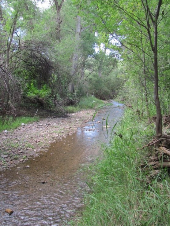
Small creek traversing through forested area
Patagonia-Sonoita Creek Sanctuary NNL, AZ

Celebrating Landmarks

Quinquagenary Anniversaries

🙤 Designated in 1970, a half dozen landmark sites saw their golden anniversary in 2020.
  • Patagonia-Sonoita Creek Sanctuary, Arizona
  • Allerton Natural Area, Illinois
  • Madison Boulder, New Hampshire
  • Moggy Hollow Natural Area, New Jersey
  • Sunfish Pond, New Jersey
  • Fall Brook Gorge, New York
Collage of three images depicting people standing next to sign and a panoramic view of Caribbean landscape
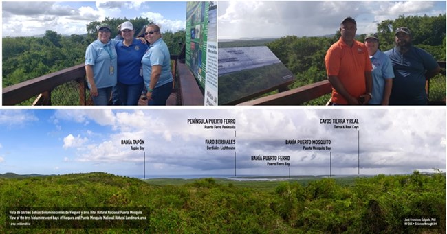
Staff from PR Department of Tourism, USFWS, PR National Parks and the PR DRNA during the inauguration of the Puerto Mosquito NNL Observation Platform and trail, January 2020. Photo by USFWS.

Raising Awareness

Interpretive Displays

🙤 Located on the south side of the beautiful island of Vieques, Puerto Rico, Puerto Mosquito NNL is managed by the Vieques National Wildlife Refuge (NWR) and the Puerto Rico Department of Natural and Environmental Resources (DRNA). One of 3 luminescent bays in Puerto Rico, Puerto Mosquito was designated an NNL in 1980 as it supports the highest concentrations of dinoflagellates, the single-celled aquatic organisms responsible for lighting up the bay, thus making it the brightest and best example of a bioluminescent bay. TICATOVE, a local Vieques conservation group, received a 2019 Mercy Corps grant to construct an observation platform, educational exhibits, and a short trail, offering a panoramic view of the site and surrounding areas to visitors before or after they visit the bay. The project brought together Vieques NWR, PR DRNA, schools, colleges, local nature outfitters, and volunteers. The work was completed by the USFWS and local young adults in the TICATOVE “Green Crew”, while other agencies and NGOs supported the project by donating photos used in the interpretive exhibits and assisting in other ways. This project brought much attention, outreach and education to the community and visitors. The observation platform is the first of its kind on the island of Vieques and has quickly become a popular destination.
Watercolor paintings of trees and rocks
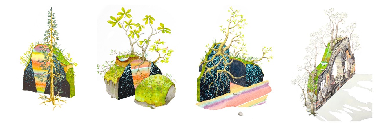
Watercolor paintings of Dismals and Cathedral Caverns NNLs in Alabama by Bryce Lafferty.

Illustrating America's Natural Heritage

🙤 Inspired by a trip to the Dismals NNL in Alabama, Bryce Lafferty, a Painting and Drawing Professor at Jacksonville State University, is creating a series of watercolor paintings of Alabama NNLs. Funded through a research grant, Lafferty hopes to raise awareness of these amazing natural places by exhibiting and publishing some studied and imaginative paintings. To date he has completed a series of small pieces based on Dismals Canyon and one larger piece based on Cathedral Caverns.

At Dismals, Lafferty sought to represent the site’s fantastic trees, the natural architecture of the canyon and boulders, the green vine, moss, and fern covered stone, and the canyon walls blanketed at night by glowing dismalites (Orfelia fultoni). Native to North America, O. fultoni is a small fly whose larvae are bioluminescent. The microclimate of Dismals Canyon provides the perfect habitat for these insects and this site harbors the largest known population in the U.S. For Cathedral Caverns NNL, Lafferty wanted to represent the volume of space below ground (the fantastic natural architecture of stalactites, stalagmites, flow stone, rubble, etc) and the connection that volume has to the environment above ground. Lafferty plans to continue painting the remainder of Alabama’s seven NNL sites and possibly venturing into neighboring states.
Two graphic illustrations. One of a lizard in the desert the other of a bluebird with volcano in background
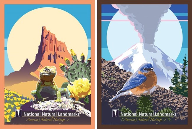
Illustrations representing Deserts and Volcanoes, artwork by Dennis Caldwell.
🙤 The NNL Program was pleased to release the third set of artwork pieces in 2020, which illustrate deserts and volcanoes. Along with the illustrations of caves, waterfalls, swamps and prairies, these eye-catching graphic pieces visually portray the beauty and broad diversity of outstanding biological and geological features represented at NNL sites across the country. These works, along with information about the natural feature and places where they can be found, are included on the NNL Program website.
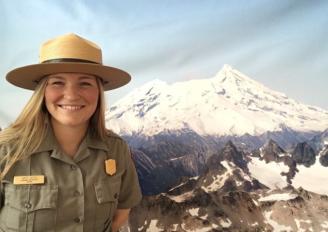
Woman in uniform with volcano in background
Ranger Anne from Lake Clark National Park and Preserve with Redoubt Volcano in the background.

Educational Programs

🙤 During the COVID-19 pandemic, Lake Clark National Park and Preserve initiated distance learning programs to local priority education audiences. With support from the NNL program, the lesson on Redoubt Volcano NNL (located within the park) was updated and adapted for delivery via distance learning to middle school science students who live immediately adjacent to Mt. Redoubt in the Kenai Burrough and Lake and Peninsula school districts. Comprised of two parts, the lesson included a mix of reading comprehension and verbal science communication. The first part is a pre-program reading comprehension activity where groups of students read a set of articles and identify key scientific findings from studies of the 2009 eruption of Redoubt. The second part of the lesson is a presentation by park staff walking through all the phases of the 2009 eruption. Where presentation topics overlap with assigned readings, students report out to the class their key findings. In 2020, this revamped Redoubt Volcano lesson was delivered virtually to 59 students at five schools, many of which are in small native villages off Alaska’s road system, providing an opportunity to connect these communities with a nationally significant resource right in their backyard.
text and graphics
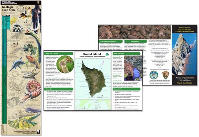
Geologic Time Scale featuring fossils found at NNL sites (left) and Round Island brochure (right)

Educational Products

🙤 The NNL program produced a new and beautiful take on an ancient topic - the geologic time scale. This educational poster, measuring 8x26”, is geared towards the general public and seeks to raise awareness of the diversity of significant fossil resources as represented through fossils at select NNL sites across the country. Spanning from Precambrian to Cenozoic, the poster tackles the complexity of the geological time scale by bringing fossils such as wooly mammoth, Hagerman horse, ichthyosaur, trilobite, allosaurus, and more to life through detailed illustrations created by Graphic Designer Dennis Caldwell. Please contact Heather Eggleston, NNL Program Manager, at heather_eggleston@nps.gov to receive a copy of the poster.

🙤 In partnership with the Alaska Department of Fish and Game, the NPS’ Science Communicator in the regional office in Alaska provided expert input to edit and layout a new brochure for Round Island (part of Walrus Islands NNL). The brochure provides important information about the sanctuary and how to visit responsibly.
photo of three printed documents
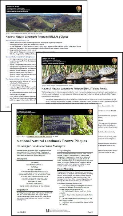
One-page briefs conveying information related to the NNL Program
🙤 In an effort to distill key pieces of information related to the program and site designation, and to make the information easier to find and use, the NNL Program is creating one-page briefs. The first three were produced in 2020.
  • NNL Program At-A-Glance is geared for general audiences, and provides succinct bullets about landmarks, the designation and the program.
  • NNL Program Talking Points is geared to landmark owners and managers and provides talking points and other information that can be used by site managers, as needed.
  • NNL Bronze Plaques is geared to landmark owners and managers, and provides tips on NNL plaque care, maintenance, and display.
Copies of each of these briefs can be found within the NNL Owners and Managers Group on the CLP or by contacting your regional NNL contact.
black and white image of woman with a hawk on her arm
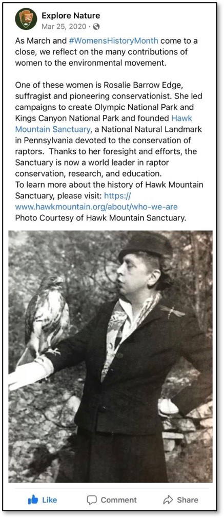
Facebook post in honor of Women's History Month

Digital Media

🙤 The NNL Program continues to seek and utilize new and existing digital media outlets to help advance the program’s goal of increasing the visibility, value, relevancy, and understanding of the NNL Program and landmark sites. A new external website, Projects in Progress on Connected Conservation (C2) was released by the NPS in 2020, providing the perfect platform to highlight NNLs and the NNL Program, along with other collaboratives and NPS community assistance programs.

The Spring 2020 edition of Park Paleontology News, a biannual newsletter produced by NPS’ Paleontology Program, provided a great outlet for sharing information about the diverse sites designated for the paleo resources and the tremendous influence they have had on science and culture within the U.S.

And what digital communication efforts would be complete without utilizing social media? Along with many other nature-related stories, the NNL Program utilizes the Explore Nature (@NatureNPS) accounts on Facebook and Twitter and naturenps on Instagram. We encourage all users of social media to check out and follow these accounts on your platform(s) of choice, utilize your own social media accounts to promote your landmark, and be sure to use #nationalnaturallandmark.
lake in foreground with fall color trees in background
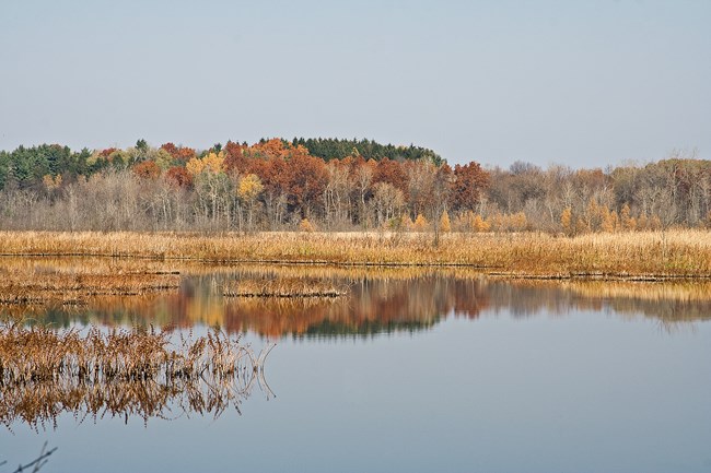
Mendon Ponds Park NNL, NY. Photo by Jay Greenberg

Project and Site Planning

Raising awareness about the presence and location of landmark sites can be valuable information for land-use and management planning efforts. Whether the intent is to elevate awareness to eliminate or mitigate potential impacts to NNL sites or add value to management planning efforts, NNL Program staff seek to ensure that project/planning managers are aware of nearby landmarks and the significant resources they contain. The following provide examples of planning efforts where NNLs were brought to light.

🙤 A Feasibility Study is underway for consideration of the Finger Lakes region of New York as a National Heritage Area (NHA). NHAs are large, lived-in landscapes where historic, cultural, and natural resources combine to tell a cohesive, nationally important story. They are supported by the NPS and locally managed, entirely non-regulatory, and involve no change in land ownership. They are built on public-private partnerships and collaboration to support communities in sharing their unique stories and maintaining resources that are relevant and matter to local interests and needs. The 2019 John D. Dingell, Jr. Conservation, Management, and Recreation Act directed the Secretary of the Interior to evaluate the natural, historic, cultural, educational, and recreational resources within 14 counties in the Finger Lakes and assess the demonstrated support of the community including businesses, residents, nonprofit organizations, and appropriate local, state and federal agencies. Included within the study area are seven designated NNL sites (Hart’s Woods, Mendon Ponds Park, Zurich Bog, Round Lake, Fall Brook Gorge, Montezuma Marshes, and McLean Bogs), several of which have significant resources that align with the proposed NHA theme of a glacier-shaped geological landscape. Information about the location and significant resources contained within these landmarks will be used as part of the assessments made in the Feasibility Study to determine if there is a unique nationally important story being told. The study’s findings, along with any Secretarial recommendations, will be reported to Congress, who ultimately has the authority to create a new NHA.
pond with lily pads surrounded by plants and trees
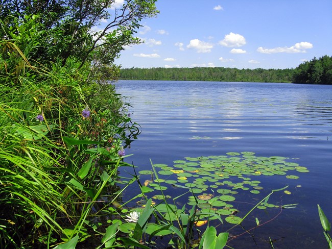
Lake Lacawac NNL, PA. Photo by Janice Poppich
🙤 Reduction in the height of a cell tower project avoided adverse impact to views from Lake Lacawac NNL in Wayne County, PA.  The Sanctuary serves as both a research facility and nature center and contains historic structures warranting its listing on the National Register of Historic Places.  Consulted per the National Historic Preservation Act, the PA State Historic Preservation Office requested the reduction in height of the originally proposed 199ft monopole.  After further balloon tests and photo-simulations, the resulting alternative design is a 160ft monopine with heavy density branches.  Additionally, ground level support equipment will implement International Dark-Sky Association guidelines for outdoor lighting.  Researchers and visitors alike will continue to enjoy the view from the shores of Lake Lacawac.

NNL Program Activities

NNL Site Designations

🙤 Following NNL Program Regulations, NNL staff work with partner scientists to have new sites evaluated for possible NNL designation. Once an evaluation report is completed, the National Natural Landmarks Committee (Committee), a sub-committee of the National Park System Advisory Board (Board), reviews the report and determines whether to recommend designation to the full Board. Members of this committee have expertise in biology, geology, oceanography or paleontology that facilitates their consideration of areas for NNL designation. The committee was re-established in January 2020 and includes the following members who were identified for excellence in their respective disciplines, and breadth of expertise as a group and will each serve 4-year terms.

  • William Gardner Hewes III (Chair, new member), Mayor, Gulfport, MS
  • Dr. Sylvia Earle (returning member), President and Chairman of Mission Blue/The Sylvia Earle Alliance; National Geographic Society Explorer in Residence
  • Dr. John Francis (returning member), recently retired Vice President for Research, Conservation and Exploration, National Geographic Society
  • Dr. Louis Jacobs (returning member), Emeritus Professor, Southern Methodist University
  • Dr. Arthur Middleton (new member), Assistant Professor, University of California, Berkeley, Department of Environmental Science, Policy and Management
  • Dr. Delores M. Robinson (new member), Professor, University of Alabama, Department of Geological Sciences   
  • Dr. Ester Sztein (new member), Assistant Director, Board on International Scientific Organizations, National Academy of Sciences
  • Dr. Gary Wein (new member), Executive Director, Highlands-Cashiers Land Trust, NC

During the summer of 2020, the Committee reviewed and recommended for designation three potential sites (Bear Rocks and Allegheny Front Preserve, WV; Sulphur Cave and Spring, CO; and Lanphere and Ma-le’l Dunes, CA). The designation process for these sites, including the Board’s review and final consideration by the Secretary of the Interior, continued into the new fiscal year.
screenshot of virtual meeting showing seven people
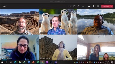
NNL Program Staff during virtual online work planning session.

NNL Program Staff

🙤 Seven NPS employees are committed to advancing the work of the NNL Program and supporting landmark owners.

  • Adrienne Lindholm, (AK)
  • Carolyn Davis, (AL, FL, GA, KY, MD, MS, NC, Puerto Rico, SC, TN, VA VI, WV)
  • Deb DiQuinzio, (CT, MA, ME, NH, NJ, NY, PA, RI, VT)
  • Jeff Orlowski, (AR, AZ, CO, KS, MT, ND, NE, NM, OK, SD, TX, WY, UT)
  • Laurie Lee Jenkins, (Am. Samoa, CA, Guam, HI, ID, NV, OR, WA)
  • Leo Acosta, (IA, IL, IN, MI, MN, MO, OH, WI)
  • Heather Eggleston, Program Manager

Full contact information can be found on the NNL Program website.


Part of a series of articles titled Landmark Highlights.

Last updated: February 7, 2022