Last updated: November 30, 2023
Article
El Camino Real de los Tejas: Texas-Louisiana Border Itinerary
El Camino Real de los Tejas, which began in Mexico, stretched east into Louisiana. This tangible borderland created by frontier forts and missions resulted in today’s multicultural Crossroads Region. These sites reflect the role of military and religious activity by three nations: Spain, France, and the United States.
This itinerary matches the content on the Find Your Park: Discover Your National Trail, Texas-Louisiana Border itinerary rack card.
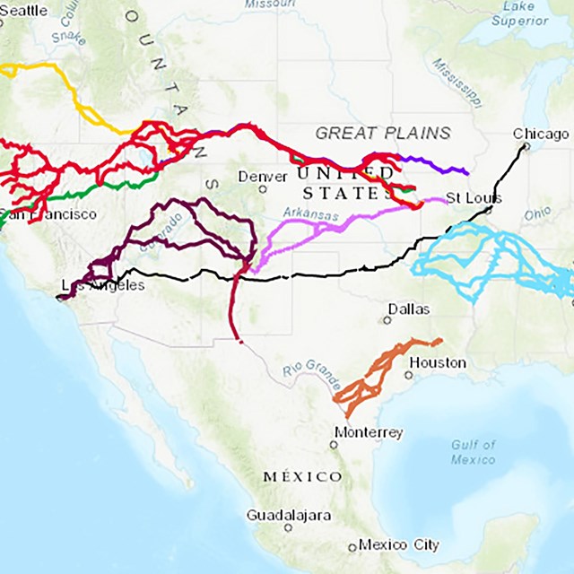
You can also learn more about these sites and their location using the interactive map for the trail.
Get more information and start planning your visit by clicking on the images for each stop:
Stop 1: Fort Jesup State Historic Site
- El Camino Real de los Tejas National Historic Trail
Fort Jesup State Historic Site
Stop 2: Los Adaes State Historic Site
- El Camino Real de los Tejas National Historic Trail
Los Adaes State Historic Site
Los Adaes, the symbol of New Spain in Louisiana, was once the capital of Texas. The founding of Natchitoches in 1714 by the French resulted in Spain's establishment, within two years, of six missions and one fort in east Texas. In 1719, a French attack on nearby Mission San Miguel alarmed the Spanish and they built a new presidio, or fort, to counter any further French intrusion into Spanish territory.
Stop 3: Fort St. Jean Baptiste State Historic Site
- El Camino Real de los Tejas National Historic Trail
Fort St. Jean Baptiste State Historic Site
On a mission to establish trading ties with Spain, French-Canadian trader Louis Juchereau de St. Denis encountered an impenetrable logjam on the Red River; at this spot he hastily built two crude huts, which become Fort St. Jean Baptiste and the town of Natchitoches, the oldest permanent settlement in what would become the Louisiana Purchase. St. Denis was named the commandant of the fort in 1722, and the colony thrived until his death in 1744.