Last updated: April 23, 2025
Article
Assessing the Effects of Traffic on the Behavior and Viewability of Grizzly Bears
Study Overview
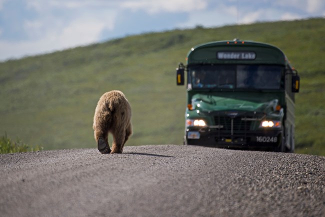
In 1917, Denali National Park and Preserve (then Mount McKinley National Park) became the first national park established to protect wildlife. Providing opportunities to view wildlife has continued to be a priority throughout the park's 100+ year history. As visitation has increased over the years, park managers have taken actions such as restricting private vehicle traffic along the Denali Park Road and establishing a bus system in order to protect wildlife and preserve wildlife viewing opportunities. Today, visitors to Denali continue to expect bus trips to provide world-class wildlife viewing. But despite a long history of studying traffic and wildlife, park managers don’t have a comprehensive understanding of how traffic patterns affect wildlife viewing opportunities, animal behavior, or habitat use. This type of deep dive into the relationship between wildlife behavior, wildlife viewing rates, and traffic patterns is an important part of Denali’s 2012 Vehicle Management Plan.
The current closure of the western half of the Denali Park Road at Mile 43, due to the Pretty Rocks Landslide, presents a unique opportunity to study these effects. This before-after-control-impact (BACI) study will assess changes in bear movement and habitat use along a 30-mile segment of the Denali Park Road. The non-traffic control period in 2023–24 will be compared to the impact period when high traffic levels resume in 2025, after completion of the Polychrome Area Project. Bear behavior will also be assessed along a non-impacted segment of the park road (where traffic continued throughout all years), east of the closure as a control site.

NPS Photo
Management History of the Denali Park Road
One of the biggest challenges in managing national parks is to balance protecting resources with making them available for people to enjoy. In Denali, park managers must maintain the opportunities to view wildlife, tundra ecosystems, and mountain scenery while protecting these same resources.
Since 1972, when the George Parks Highway was completed and connected the Denali Park Road to other highways in the state, private vehicle traffic has been limited and a bus system has been used to transport visitors through the park. As visitation continued to increase, there was a need for additional research and restrictions. The Denali Park Road Capacity Study began in 2006 and was completed in 2012. In 2012, an additional study on habitat use and movement patterns of grizzly bears relative to the road and the Vehicle Management Plan were published. While similar, this current bear study allows the unprecedented comparison of a no-traffic condition.
Human activity typically occurs along the entire 92-mile length of the road and has the potential to have wide-reaching, population-level effects on wildlife. To make future decisions, park managers need scientific data on the effects of traffic limits.
Previous Studies
Several previous studies have observed wildlife abundance and behavior along the park road1,2,3. But the results of these studies are inconclusive and may be biased because observations were only made from the road, not accounting for animals that may have been nearby but were obscured. In addition, previous studies only occurred during periods when the road was open to traffic. As visitation increases, managers face pressure to allow more traffic along the park road. The two-year closure of the western half of the park road provides an unprecedented opportunity to study the before and after effects of high traffic volume on grizzly bears. Determining whether bear behavior is altered and whether bear viewing opportunities are influenced by traffic along the park road will provide valuable information to inform future decisions about managing traffic, both in Denali and for other areas managing landscapes for wildlife (bear) viewing.
Grizzly Bear Behavior
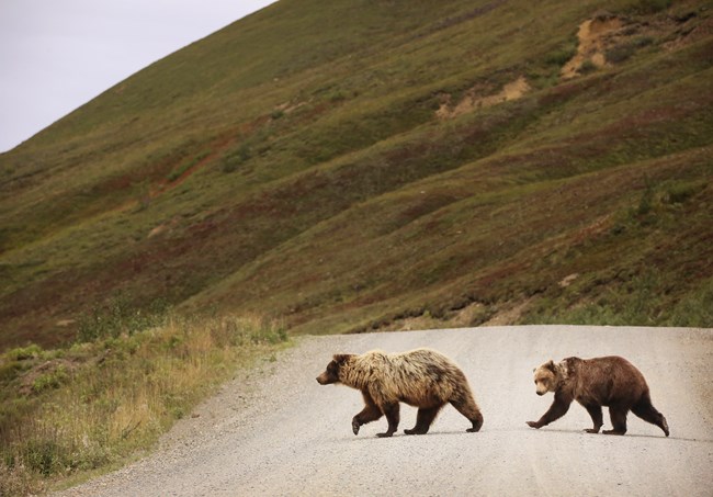
Grizzly bears in Denali are vulnerable to road effects for several reasons. Grizzly bears need to travel widely to forage and raise their young. Although they are not territorial, home range dynamics of individual bears and bears nearby can be disrupted when individual bears avoid specific areas. Avoidance of roads by grizzly bears has been demonstrated in Denali and elsewhere and bears may tend to stay further away from roads with more traffic. When bears avoid areas of high-quality habitat, their health may decrease and mortality may increase.
Objectives
This study aims to determine whether the natural movement, use of space, and patterns of habitat selection of grizzly bears are disrupted or change due to vehicle traffic on the park road by:
- Using GPS collars to track grizzly bear movement over time and space
- Assessing daily and seasonal movements of grizzly bears in relation to road traffic patterns on the Denali Park Road
Bear Collaring
This study involves some closures to allow park staff to attach radio collars on up to a total of 18 grizzly bears. Closures are implemented to keep people safe from encounters with recently immobilized bears and to minimize disturbance to those same bears. To date, brief closures were implemented in spring and fall of 2023 and spring of 2024. Bears were collared in both the control site area (where traffic will be continuous during all years) and the no-traffic/traffic study area (where the current no-traffic period will be compared to high traffic levels when they resume).
The next closure will begin on May 5, 2025 and last through May 12 at the latest. The Park Road and adjacent backcountry units will be closed from the Teklanika River bridge (mile 31) west to the Y in the road near Wonder Lake. The closure applies to all pedestrians, bicyclists, and backcountry users.

NPS Photo
Results
Movement data will be used to quantify patterns of habitat use within the Denali Park Road corridor in the presence and absence of traffic. These data will be compared with daily patterns of road traffic over the sampling period, so that interactions between wildlife movements and road traffic can be analyzed once traffic resumes with the same animals. Together with social studies and other logistic considerations, these data will be used to devise a model of traffic on the Denali Park Road, to better understand the constraints on road traffic.
Results will be published in scientific journals, presented at relevant meetings, and shared here. Check back in the coming years for updates.
References
1 Dalle-Molle, J.L., and J.C. Van Horn. 1989. Bear people conflict management in Denali National Park, Alaska. Pages 121 – 128 in Bromley, ed. Bear -- people conflict: Proc. of a Symp. On Manage. Strategies. Northwest Territories Department of Renewable Resources., Yellowknife.
2 Tracy, D.M. 1977. Reactions of wildlife to human activity along Mount McKinley National Park road. M.Sc. thesis, University of Alaska Fairbanks. 260 p.
3 Singer, F.J., and Beattie, J.B. 1986. The controlled traffic system and associated wildlife responses in Denali National Park. Arctic 39(3): 195-203.
