Last updated: August 2, 2023
Thing to Do
Moose-Wilson Road in Winter
Details
Activity
Skiing
Pets Allowed
Yes
During winter, pets are allowed on plowed roadways and parking areas, and the unplowed portions of the Teton Park and Moose-Wilson roads.
- Pets must be restrained on a leash (six feet or less) within 30 feet of roadway.
- Properly dispose of your pet's waste. Check at the trailheads for Mutt-Mitt stations.
Activity Fee
No
A general fee is charged to enter Grand Teton National Park.
Location
Moose-Wilson Road
The Moose-Wilson Road is a corridor road connecting the towns of Moose and Wilson.
Winter Trailhead Access
From Moose: Drive 3 miles (4.8km) south of Moose on the Moose-Wilson Road to the gate at the Death Canyon Road. Park on the west (right) side of the road.
From Teton Village: Drive north from Jackson Hole Mountain Resort, enter the park and continue north for one mile. Park at the Granite Canyon Trailhead
Reservations
No
Season
Winter

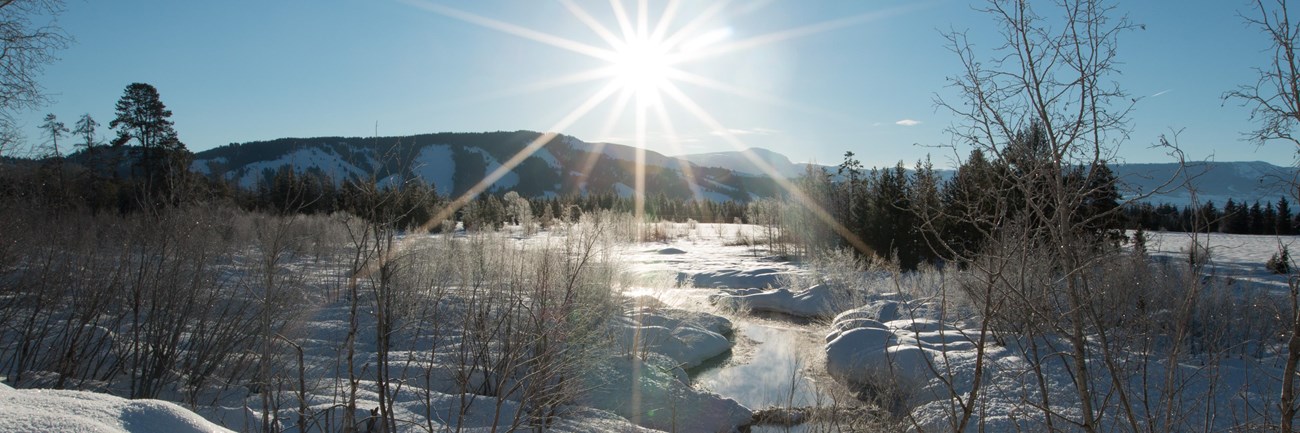
NPS Photo
The Moose-Wilson Road is a corridor road connecting the towns of Moose and Wilson. In the winter the road is closed from the south at the Granite Trailhead and from the north at the Death Canyon Junction, providing 3 miles (4.8 km) of walking, skiing, and snowshoeing. As you ski or snowshoe on the road you will wind through forest and marsh habitats, covered in deep snow and ice. Be aware that not all is frozen underfoot, as moving water under ice can be dangerous—use caution.

NPS Photo
Trails
Moose–Wilson Road
Easy, 5.8 miles (9.3 km) round-trip, total climbing: 500 feet (152 m).
From either the north, Death Canyon Road gate, or the south, Granite Canyon Trailhead Gate, the Moose-Wilson Road is a heavily skier, snowshoer, and walker tracked trail. It gains elevation generally from the south to the north, but has numerous ups and downs along the way. Many skier tracked trails lead off the road to different destinations, know where you are going and how to get back.
Phelps Lake Overlook (from north)
Moderate, 5.2 miles (8.7 km) round-trip, total climbing: 730 feet (222 m).
Start at the Death Canyon Road gate and head north 1.6 miles. You will pass the White Grass Road gate and continue on to the Death Canyon Trailhead. From the Death Canyon Trailhead it is 0.1 mile to the Valley Trail then head southwest, to the left, on the trail 0.9 miles to the Phelps Lake Overlook. Return by the same route.
Phelps Lake (from north)
Moderate, 4.0 miles (6.4 km) round-trip, total climbing: 300 feet (91 m).
Start at the Moose-Wilson Road gate and head south 1.2 miles. On the right side of the road near the entrance to the Laurance S. Rockefeller Preserve take the skier tracked trail up Wister Draw 0.8 miles to Phelps Lake. Return by the same route or make a loop by connecting to the old ranch road winter trail then go north on the Moose-Wilson Road.
Phelps Lake (from south)
Moderate, 4.6 miles (7.4 km) round-trip, total climbing: 450 feet (137 m).
Start at the Granite Canyon Trailhead gate on the Moose-Wilson Road. Head north 1.2 miles to a sharp turn in the road and go on a skier tracked trail along an old ranch road to the northwest. Climb moderately 1.1 miles to a stunning winter view of Phelps Lake. Return by the same route or make a loop by connecting to the Wister Draw winter trail then go south on the Moose-Wilson Road.
Moose-Wilson Road Winter Map

NPS Map
Directions
Death Canyon Road Gate
From Moose, Teton Park Road, drive 3 miles (4.8km) south on the Moose-Wilson Road to the gate at the Death Canyon Road. Park on the west (right) side of the road.Granite Canyon Trailhead Gate
On the Moose-Wilson Road, WY 390, drive north from Jackson Hole Mountain Resort (Teton Village), enter the park and continue north for one mile. Park at the Granite Canyon Trailhead.