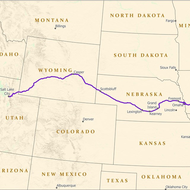
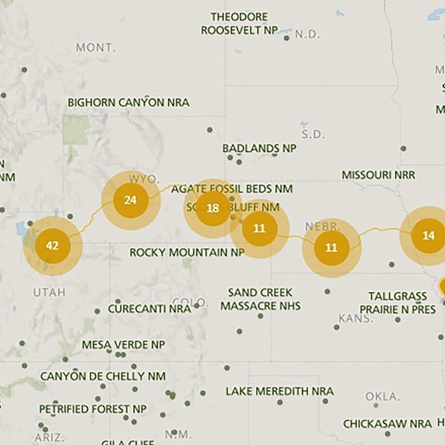
National Park Service LogoU.S. Department of the InteriorNational Park ServiceNational Park Service
National Park Service:  U.S. Department of the InteriorNational Park Service Arrowhead
Mormon Pioneer National Historic TrailAsh Hollow near Lewellen, Nebraska, where the Mormon Pioneers stopped to verify their location on the 1847 Trek to Utah.
view map
text size:largestlargernormal
printer friendly
Mormon Pioneer National Historic Trail
Directions

Five hundred covered wagons rolled northwestward out of Sugar Creek, Illinois on Sunday, March 1, 1846, heading across Iowa toward the Missouri River. The sketchy and oft-revised Mormon plan was to reach and cross the Missouri by mid-April. The bulk of the emigration would develop a string of farm-stations west of the river, to support the next wave of pioneers. Meanwhile, a “swift company” of select men would ride hard over the Rocky Mountains to their final destination to make preparations for a new life in the valley of the Great Salt Lake. The national historic trail route passes through five states from Nauvoo, Illinois to Salt Lake City, Utah. Those portions of the Mormon Pioneer National Historic Trail authorized by Congress include nearly 1,300 miles of historic trail and resources.

Auto Tour Route driving directions can be found on the Auto Tour Route map pages. These directions take visitors along modern highways that approximate the historic route taken by Mormon wagon trains during the 1846 - 1847 Pioneer trek.

The Links & Resources page will provide useful contact information for local land and/or site managing agencies and organizations along the route. It also has a bibliography of suggested reading materials that will be helpful to understanding the history and significance of this trek.

A page of Suggested Trail Sites to Visit will be of value for first time visitors. These are ten sites along the 1,300 mile route that maintain interpretive facilities or media that will enhance understanding of the trail's history.

Eventually, state by state Auto Tour Route Interpretive Guides (ATR IG) will be available at local state and private tourism centers. These guides will provide a regional interpretive history of the trail through each state and a listing of sites where trail related interpretive media and/or educational programs may be found. Some of these guides have also been published as an electronic publications in Adobe Acrobat Reader PDF format. Other state guides are currently being developed and will be posted as they become available.


Mewxican Hill near Guernsey, Wyoming.  

Did You Know?
To keep their wagons from rolling over their oxen teams, Mormon Pioneers found it necessary to lock the rear wheels of their wagons as they descended this steep, rocky road known as Mexican Hill near Guernsey, Wyoming. Image is courtesy of the Wagner Perspective.
more...

Last Updated: July 26, 2006 at 17:01 EST