Get the Right Angle

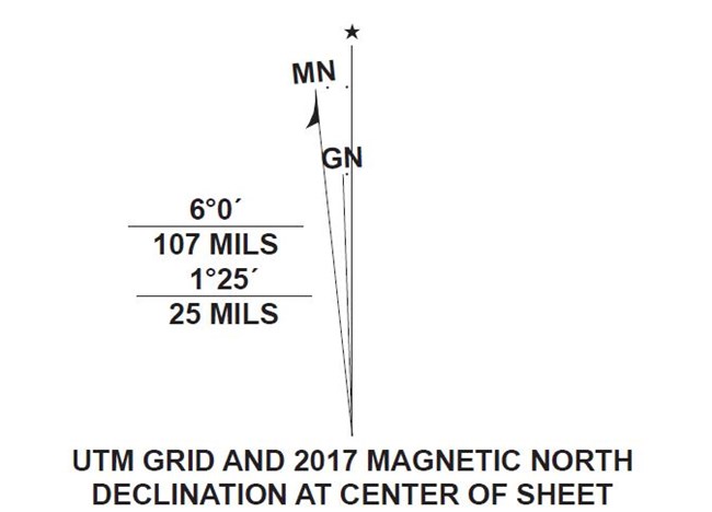
Two arrows showing difference between grid north and magnetic north.
Magnetic North versus True North at Clingmans Dome.

NPS

Do you follow the North Star? For those sunny days when you're hiking in the park where the night sky is unfortunately unavailble to assist you with navigation, make sure you're on the right heading with proper adjustment to your compass. Did you know your compass needle doesn't point directly to the north? The earths geomagnetic field exerts varying degrees of influence on your compass needle as it swings around in search of the elusive North Pole. Magnetic declination, a critical map tool for hikers in the know, is the angle of deviation between true north, and what your compass needle is pointing towards.The map below gives the magnetic declination for many areas in the park as of May 5th, 2021. Click on a dot to see the declination value.
 
 
Magnetic declination within the park is measured in the west, or negative direction, and ranges from -5.8 to -6.6 degrees. Most compasses do not have the ability to delienate tenths of a degree, so you'll have to "Kentucky Windage" your compass sightings to just to the right or left of the 6 degree mark. You will have to hike a very long distance, on a straight line, to realize any error manifested by a few tenths of a degree.

Maps published by the United States Geological Survey (USGS, 2016 series) and the National Park Service (NPS, 2017 series) have a magnetic declination diagram on the bottom map collar. Please follow these instructions to properly orient your topographic map to True North.

Last updated: May 6, 2021

Park footer

Contact Info

Mailing Address:

107 Park Headquarters Road
Gatlinburg, TN 37738

Phone:

(865)436-1200

Contact Us