|
The Marin Headlands houses an amazing richness of history and biological diversity due to the variety of habitats and unique geology of the area. A crown jewel of the Golden Gate National Parks abounding with places of natural wonder and beauty (Rodeo Lagoon/Valley, Gerbode Valley, Hawk Hill, Tennessee Valley) and remarkable historic sites (Point Bonita Lighthouse, Fort Cronkhite, Nike Missile Site, Battery Townsley).
Click and drag center circle back and forth, to compare then and now image.
Left image
Credit: GGNRA Park Archives
Right image
Credit: Ted Barone
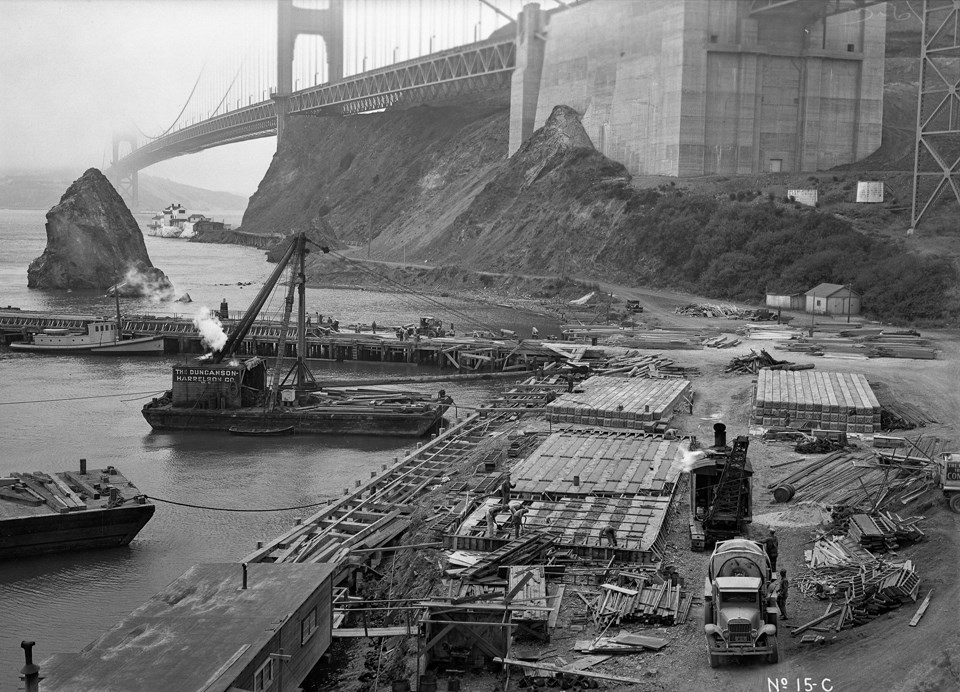
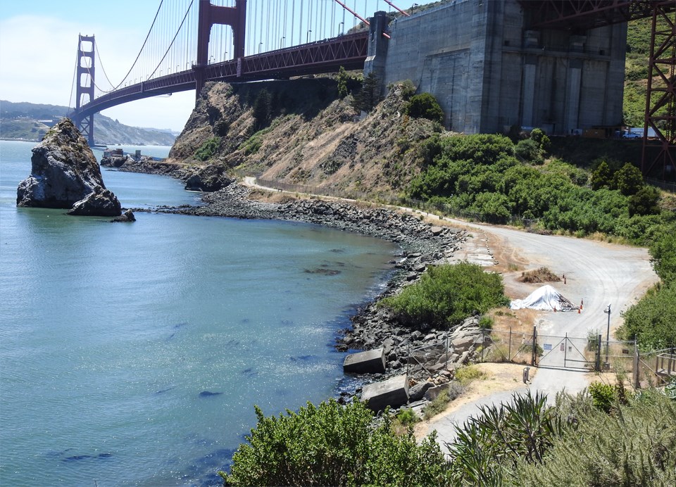
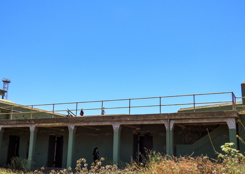
Submarine Mine Wharf and Casting Yard 1937
In the years leading up to World War II, the U.S. Armed Services established a submarine wharf in Horseshoe Cove in front of the Golden Gate Bridge’s northern anchorage, site of the old Engineer’s Camp. During the war, the wharf was expanded to service the mines that were placed outside the Golden Gate to ward off Japanese submarines. Japanese subs were known to probe the defenses but never actually entered the bay.
Left image
Credit: GGNRA Park Archives
Right image
Credit: Ted Barone
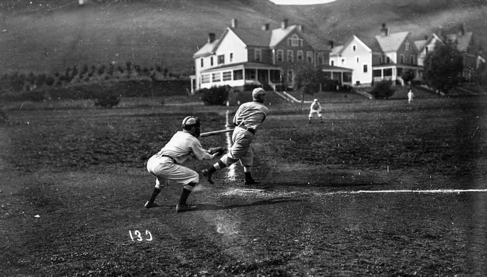
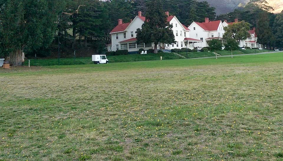
Baseball Game on the Parade Ground c1910
Fort Baker had its own teams for baseball, football, and basketball, playing teams from other posts and civilian teams. But in 1902, the parade ground was too muddy to be of much use for sports, much less military drills. To solve that problem, 25,000 cubic yards of fill were spread, and creeks were re-directed underground through a series of pipes and culverts. Water demands quickly outstripped supply from streams so until roads into the fort were built, water was supplied via barge as was done at Alcatraz.
Left image
Credit: GGNRA Park Archives
Right image
Credit: Ted Barone
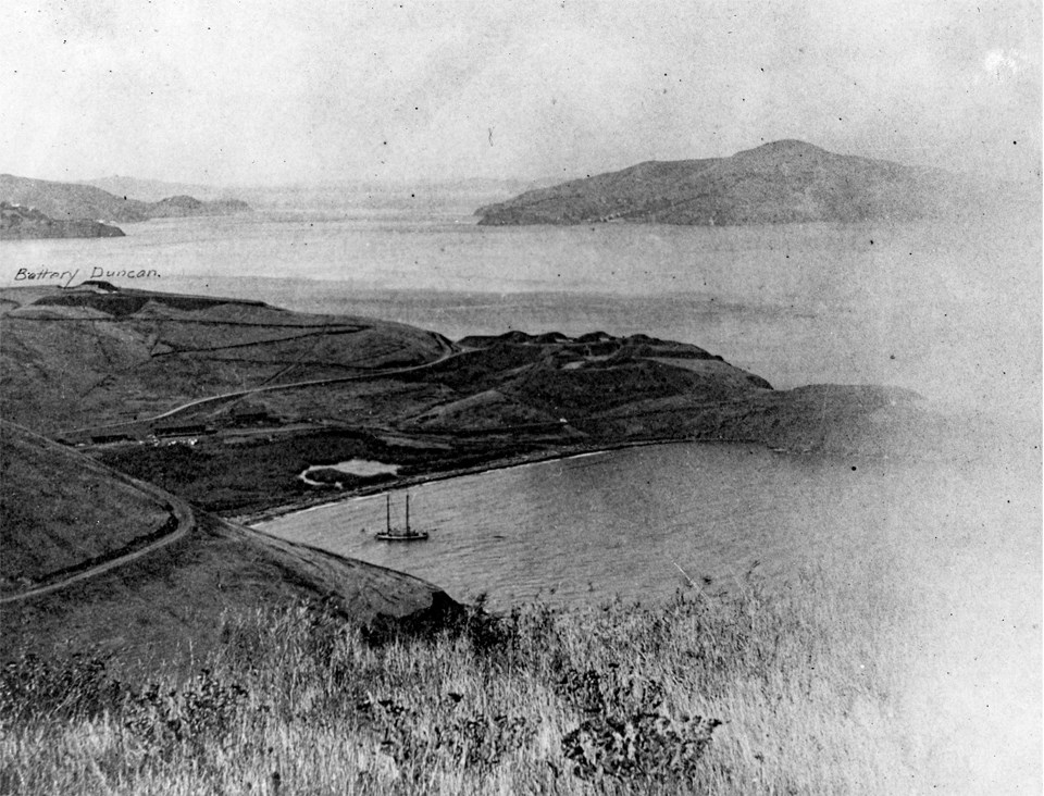
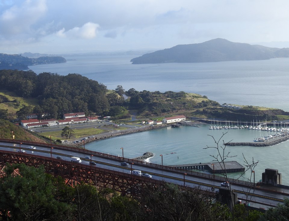
Horseshoe Cove, 1902
Horseshoe Cove, a natural bay, was the primary transportation link before roads were built into Lime Point Military Reservation for delivery of food, water, and supplies for the fort. Already by the beginning of the 20th century, barbette-style batteries Duncan and Cavallo were in place. Barbette batteries are those mostly fronted by earthen barriers.
The marsh at the head of horseshoe Cove was filled in with an 80,000 cubic yards of fill. During the Endicott period (1897-1916), multiple batteries were established including Batteries Cavallo and Duncan which are visible in this photograph. Coastal fortifications were dug into the earth armed with armor-piercing ordinance and shielded by steel armor-plated masonry. During this period, long-range rifled artillery was placed in massive reinforced concrete batteries constructed along the entrance to the Golden Gate including batteries at Forts Mason, Winfield Scott, Baker, Barry, and Angel Island. In 1913, more than 75,000 cubic yards of sandstone were removed from a quarry on the eastern edge of Fort Baker valley and barged across the bay to construct roads for the 1915 Panama Pacific International Exposition.
The Discovery Museum sits on the edge of the old marsh and lagoon visible in the 1902 photo.
Left image
Credit: GGNRA Park Archives
Right image
Credit: Ted Barone
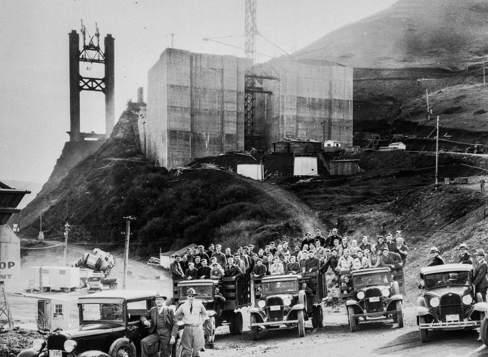
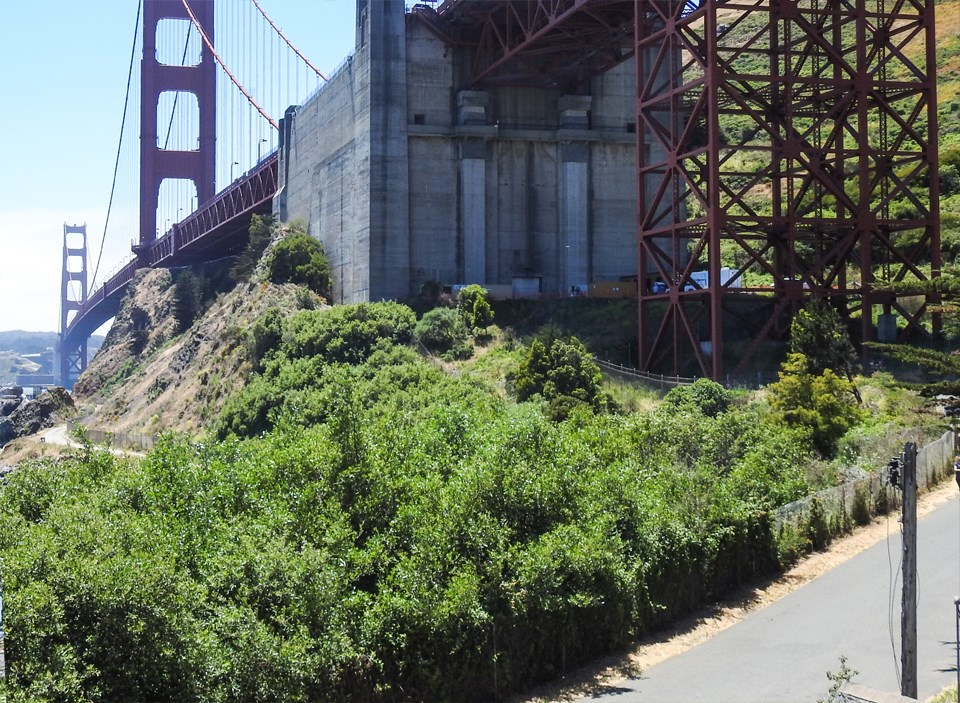
Citizens Conservation Corps at the Golden Gate Bridge
The building of the Golden Gate Bridge, completed in 1937, took advantage of the previous excavation of rock associated with building a fort and gun emplacements. The bridge builders added road cuts, fills, and subsequent stabilization efforts. The historic character of natural systems was significantly altered, including slopes, aspect, hydrology, and vegetation. A massive earthen dam was built to accommodate Hwy 101 on a steady grade as it approached Robin Williams Tunnel.
Left image
Credit: GGNRA Park Archives
Right image
Credit: Ted Barone
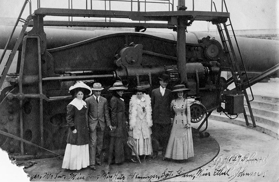
Battery Mendell 12” Disappearing Gun c1917
Battery Mendell was built in 1902, one of several Endicott-era batteries constructed at Point Bonita situated to engage enemy warships outside the Golden Gate. After firing, its recoil dropped the gun below the parapet making it invisible to enemy ships and protecting the crew during loading. However, as military technology advanced through the 1st World War, the battery’s fatal flaw was exposed. It was not invisible from airplane bombers above. The Endicott period lasted from 1897 to 1916 and was named for Secretary of War, William Endicott and his plan to modernize and restore coastal defenses in the era of iron cladding on ships.
Left image
Credit: GGNRA Park Archives
Right image
Credit: Ted Barone
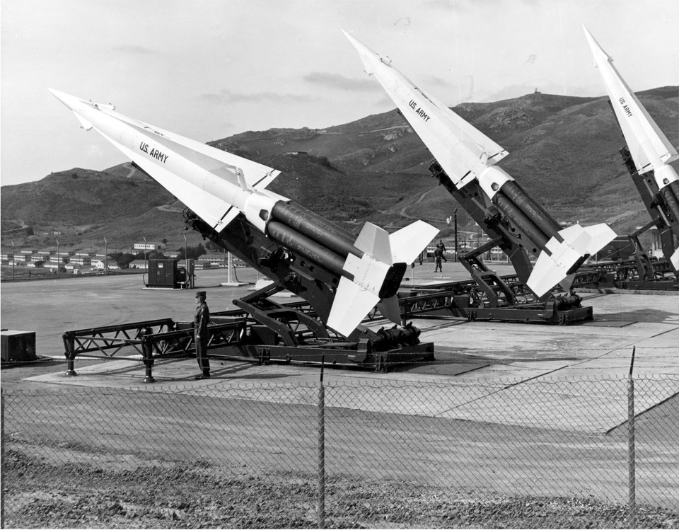
Nike Missiles 1959
The first generation Nike missile, the Ajax, was first deployed in 1953. It was designed to intercept and destroy Soviet manned bombers as a last line of defense for the population and industrial centers. It was the world’s first operational, guided, surface-to-air missile system with a range of 25 miles and top speed of Mach 2.3. The second generational Nike Hercules, deployed in 1958 could carry either nuclear or high-explosive, conventional warheads with a range of 100 miles and top speed of Mach 3.65. Alcatraz Island was believed to be a prime Soviet target with its 60 mile destruction radius Point Bonita YMCA was the barracks for officers from the launch area. Fun fact: the trash compacter sounds in Star Wars: a New Hope were recorded from Nike Site SF-88L’s bay doors opening and closing.
Left image
Credit: GGNRA Park Archives
Right image
Credit: Ted Barone
Group Posing 12-in Gun at Battery Mendell
Battery Mendell’s guns were scrapped in 1943 when the threat of imminent invasion subsided. Battery Wallace, located a few hundred yards to the east, had been reactivated after that battery was enclosed or casemated, rendering the open air battery obsolete.
Left image
Credit: GGNRA Park Archives
Right image
Credit: Ted Barone
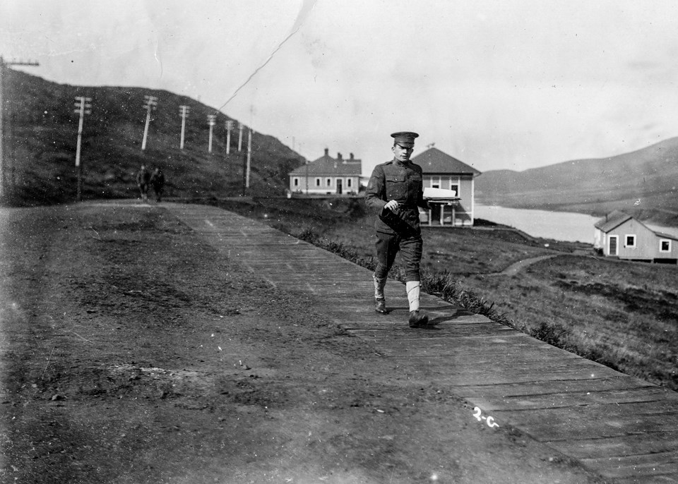
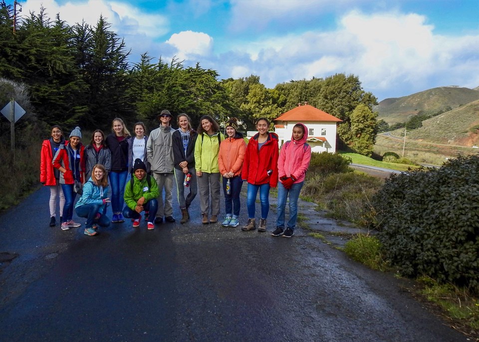
Soldier Walking on Wooden Walkway c1910
Rodeo Lagoon was substantially larger in 1910. A roadway and some fill have diminished its acreage. The modern-day group is from the Global Student Exchange program, one of many youth, educational, and corporate programs that work with the National Park Service and its partner organizations.. These students are from high schools in Nicaragua, Ecuador, and the United States, embarking on a day of park clean-up and habitat restoration.
Left image
Credit: GGNRA Park Archives
Right image
Credit: Ted Barone
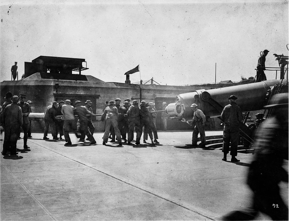
Loading Battery Mendell’s Disappearing Gun
Endicott-era fortifications, such as Batteries Mendell, Alexander, and Edwin Guthrie were dug into the earth, armed with long-range rifled artillery, armor-piercing ordinance, and shielded by steel armor-plated masonry. Mendell’s 58 ton tube was delivered by barge to the Engineer’s Wharf in Bonita Cove and then moved up the hill on rollers by heavy block and tackle.
Left image
Credit: GGNRA Park Archives
Right image
Credit: Ted Barone
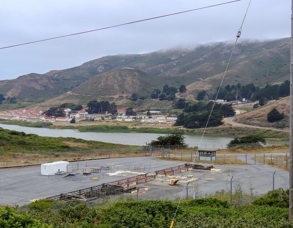
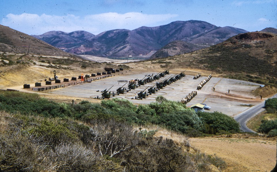
Anti-aircraft Artillery Units c1954
These artillery units in Rodeo Valley were part of the San Francisco Bay Area’s air defense network during the Cold War. The system relied early warnings from ground, sea, and air-based radars that would relay warnings to interceptor squadrons and anti-aircraft defenses. The Mill Valley Air Force Station on Mount Tamalpais served the joint Army/Air Force command post for coastal defense during the Cold War. Hamilton Field in Novato along with Travis AFB in Fairfield and Castle AFB in Merced housed interceptor squadrons.
Left image
Credit: GGNRA Park Archives
Right image
Credit: Ted Barone
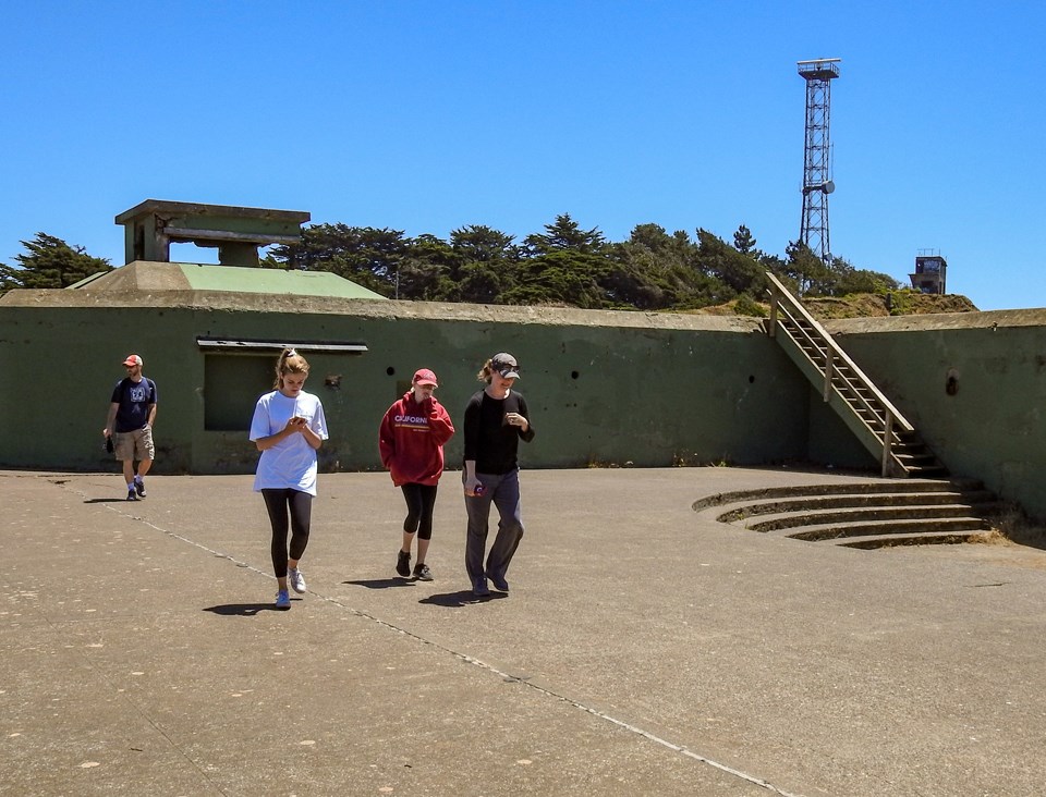
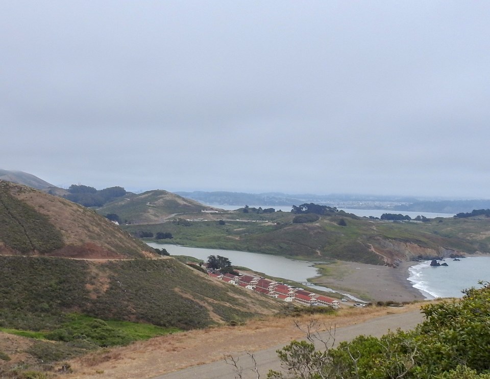
Fort Cronkhite 1937
Fort Cronkhite was established in the late 1930s and many temporary barracks, supply depots, recreation buildings, and a chapel were built quickly to house the Army’s growing ranks in the buildup to World War II. During the Cold War, Fort Cronkhite housed soldiers of the Nike Missile launch site nearby. The fort closed in 1974 and became part of the GGNRA. The “temporary” buildings now house environmental education programs and NPS staff. Rodeo Beach to the west is a popular surfing beach, particularly on its north end. Great hikes start at Rodeo Beach, particularly the hike up to Hill 88 for some of the most spectacular views in the entire region.
Left image
Credit: GGNRA Park Archives
Right image
Credit: Ted Barone
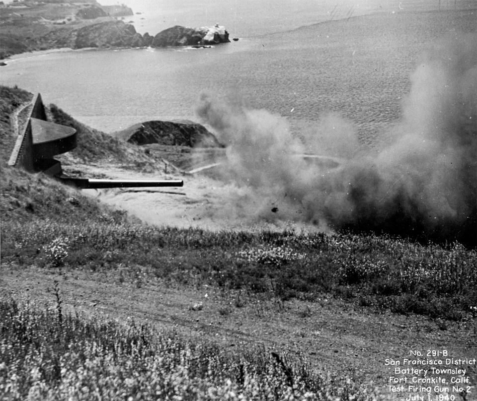
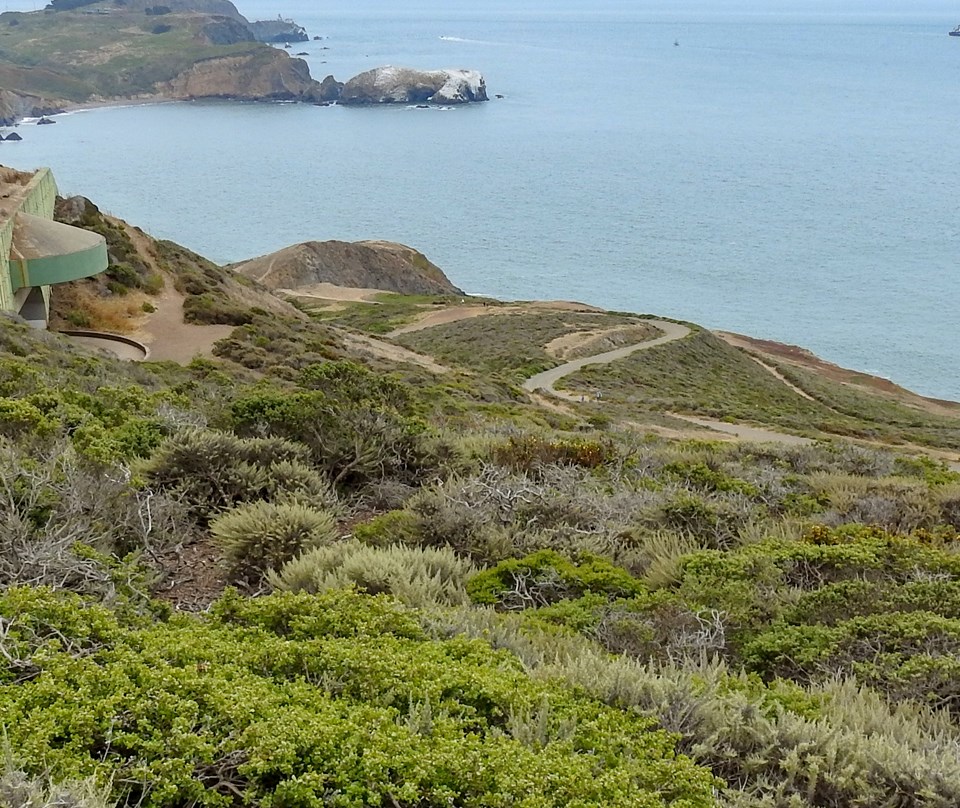
Battery Townsley Test-firing - July, 1940
Battery Townsley, a casemated battery, was completed in 1940. It had two 16-inch caliber guns battery and could shoot a 2,100 lb projectile 25 miles out to sea. It is one of two 16-inch batteries protecting the entrance to San Francisco Bay. The other was Battery Davis at Fort Funston. They were scrapped in 1948 as the technology of high-altitude bombers made a gun that could shoot ships at sea somewhat obsolete.
Left image
Credit: GGNRA Park Archives
Right image
Credit: Ted Barone
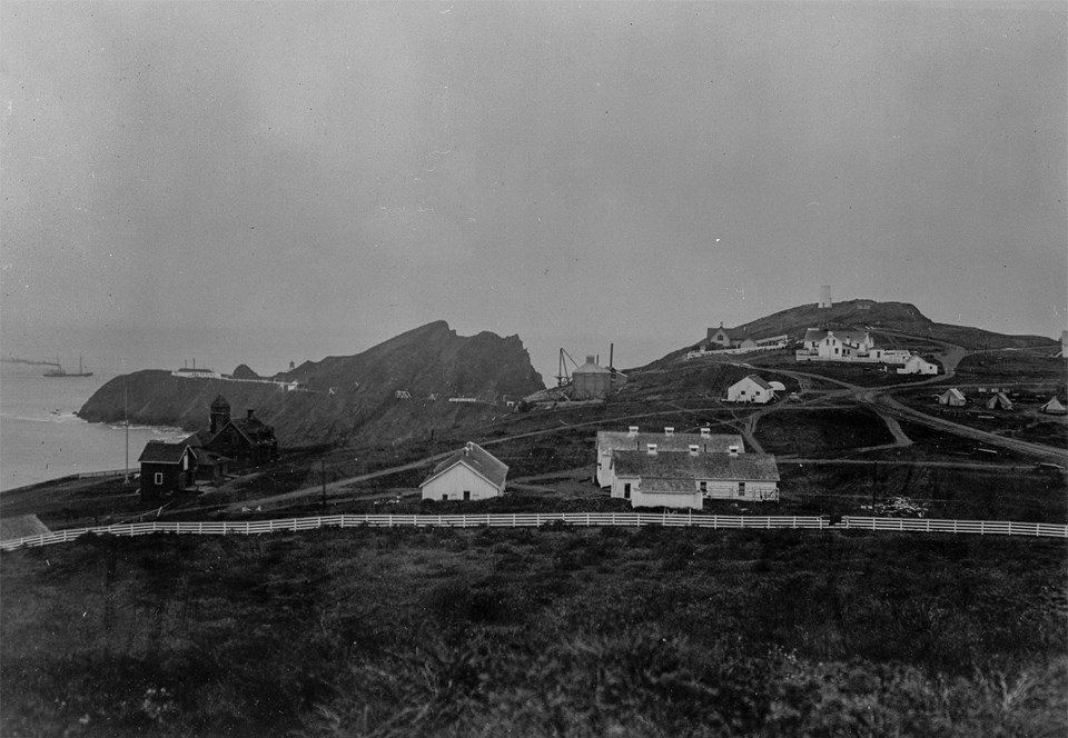
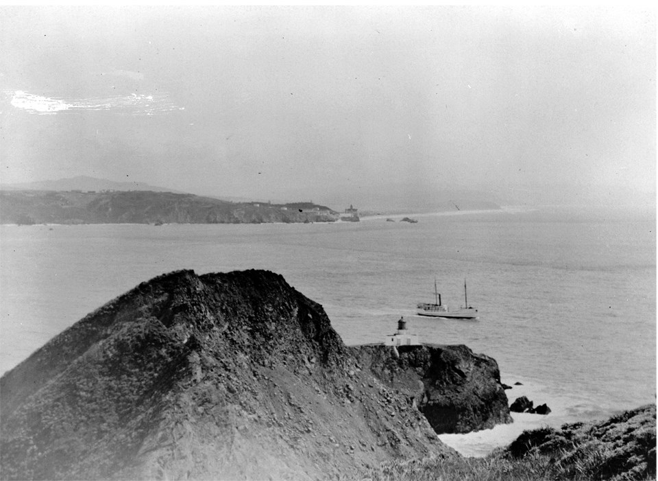
Point Bonita Reservation c. 1915
In 1915, there was the lifesaving service station (far left), the Army Corps of Engineer bunk houses and mess hall at the left, the concrete plant in the middle, army stables right middle and lighthouse keepers’ residences on the right. The lighthouse in the distant left center was constructed in 1855 and decommissioned in 1877 when the light and lens were moved to its current location to the south. It was the third lighthouse on the West Coast.
Left image
Credit: GGNRA Park Archives
Right image
Credit: Ted Barone
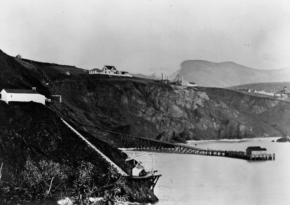
Lighthouse Service Boat Dock and Engineer’s Dock
A lighthouse service dock and tramway was built in 1871 to move materials and equipment from Bonita Cove to a path that led to the lighthouse building site out on the point. After the lighthouse became operational in 1877, but before roads were built from the east side of Marin, supplies and people were still transported by boat to the point.
Left image
Credit: GGNRA Park Archives
Right image
Credit: Ted Barone
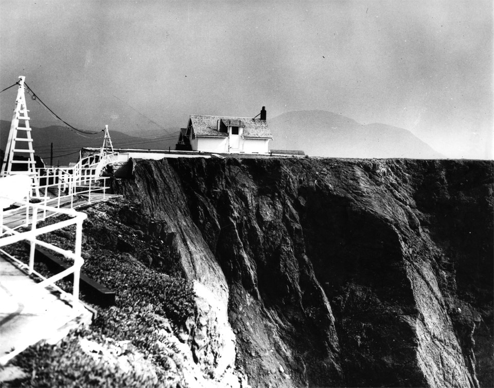
Point Bonita Lightkeeper’s Cottage c1909
When the first Point Bonita lighthouse was placed in operation in 1855, the keeper’s house was located within a few hundred feet. However, the move of the beacon to its current location in 1877 required the keeper to walk down 180’ and a ½ mile to get to work. In 1906, the house was completely destroyed in the great San Francisco Earthquake and then rebuilt. In 1926, the lighthouse was electrified, strengthening it to 40,000 candlepower. Converting from oil to electricity for the beacon and fog-signal decreased the need for maintenance and the necessity of four keepers.
Left image
Credit: GGNRA Park Archives
Right image
Credit: Ted Barone
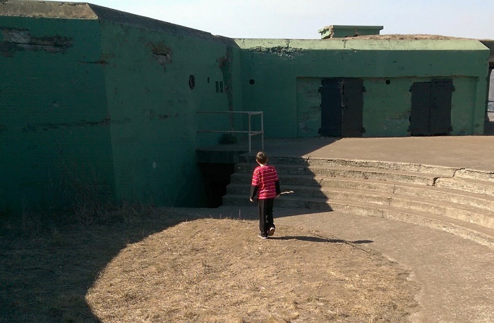
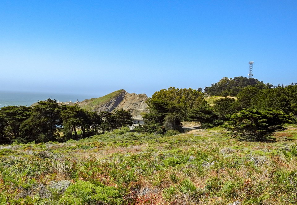
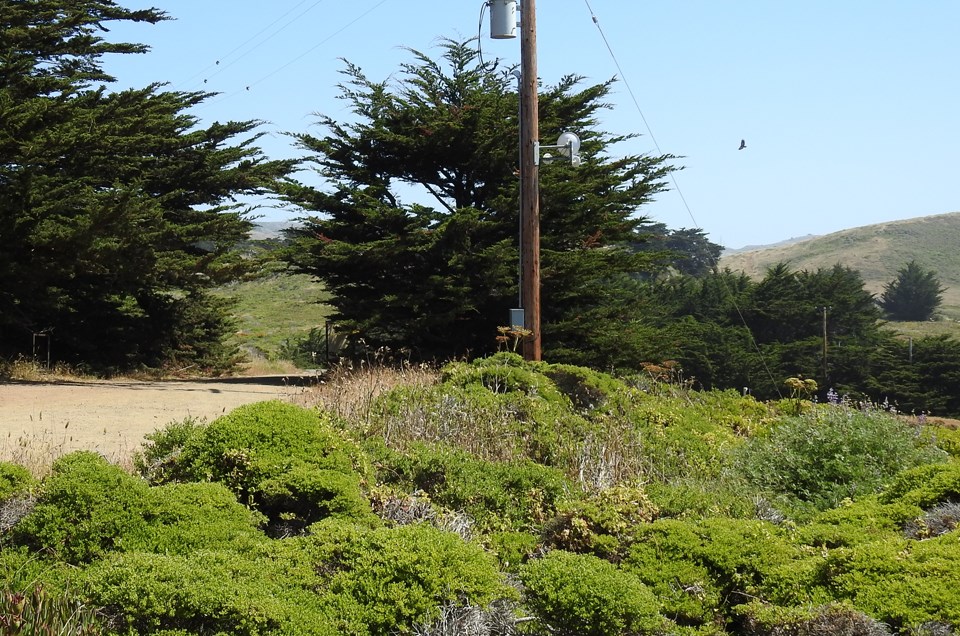
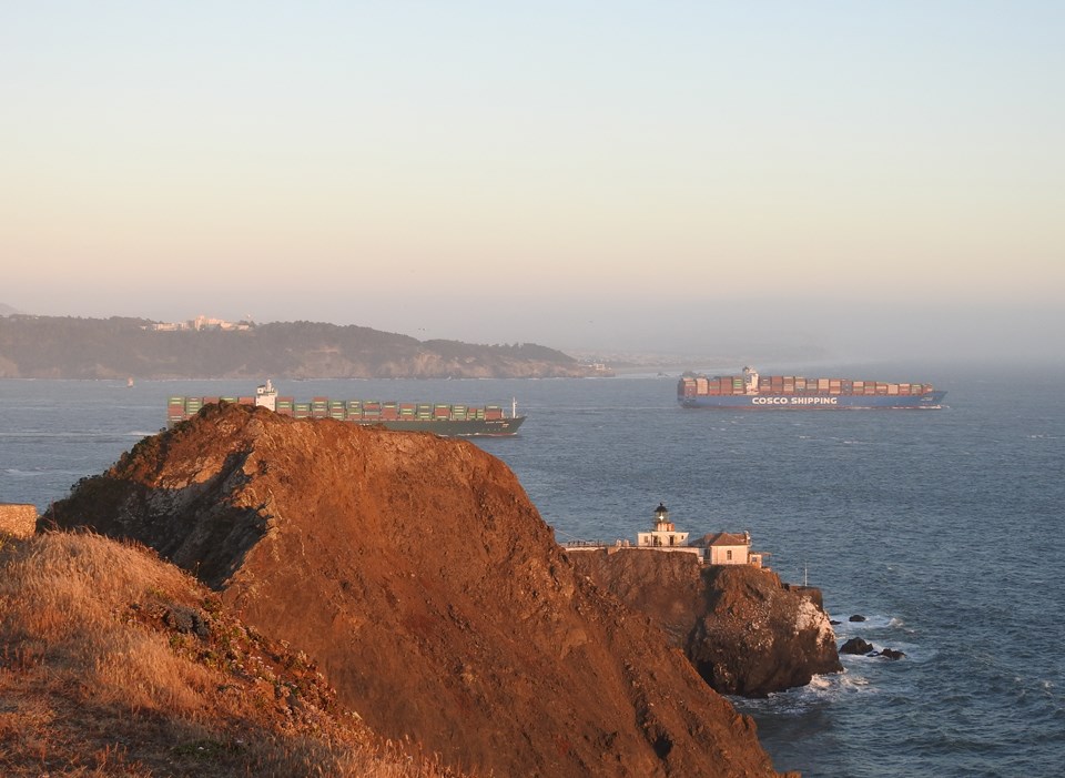
Point Bonita
The original pedestrian access to the lighthouse and fog-signal building at the tip of Pt. Bonita skirted the sheer cliff on a gallery or cliff-hanging platform. Landslides regularly damaged the gallery so in 1876, Chinese workmen hand dug the 100’ long tunnel through solid rock.
Left image
Credit: GGNRA Park Archives
Right image
Credit: Ted Barone
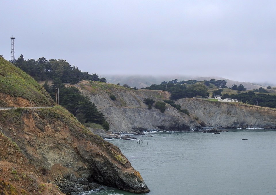
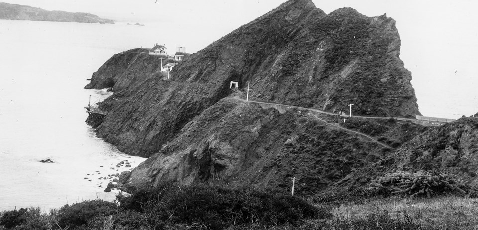
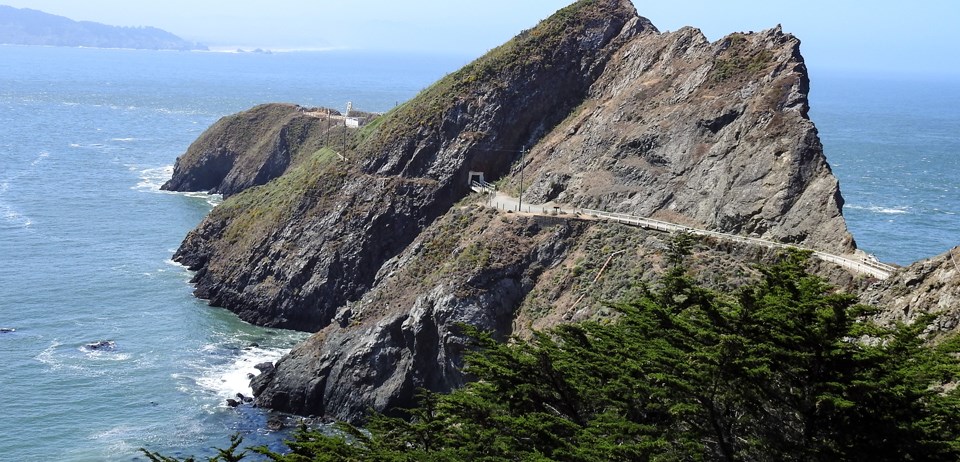
Point Bonita from the Original Lighthouse
These photos are taken from the location of the original lighthouse constructed in 1855 at an elevation of 306 feet above sea level. It was moved to its current location in 1877 because fog often obscured the light at that elevation while it was clear closer to the water. The original lens, a 2nd order Fresnel lens, was repositioned at the new location while the tower was maintained as a daytime coastal marker. It was torn down by the Army prior to WW2 because of fears the enemy might use it to establish their location on the California Coast. Notice the 2nd Cliff House and its Victorian style across the Golden Gate strait in San Francisco.
Left image
Credit: GGNRA Park Archives
Right image
Credit: Ted Barone
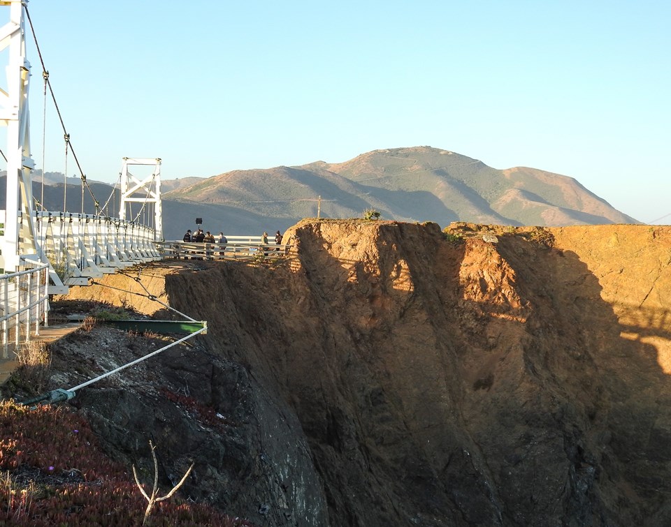
Fog Signal Building from the Lighthouse
Point Bonita is the only lighthouse in the U.S. approached by a suspension bridge. Originally, a land bridge connected the lighthouse with the fog signal building at the bridge’s east end. However, the land bridge was wiped out by a landslide in the 1940s. A wooden walkway was installed but that became too treacherous so a suspension bridge was constructed. The fog signal building was used as the Assistant Keeper’s house after 1906. The current bridge was built at a cost of $2.5 million.
Left image
Credit: GGNRA Park Archives
Right image
Credit: Ted Barone
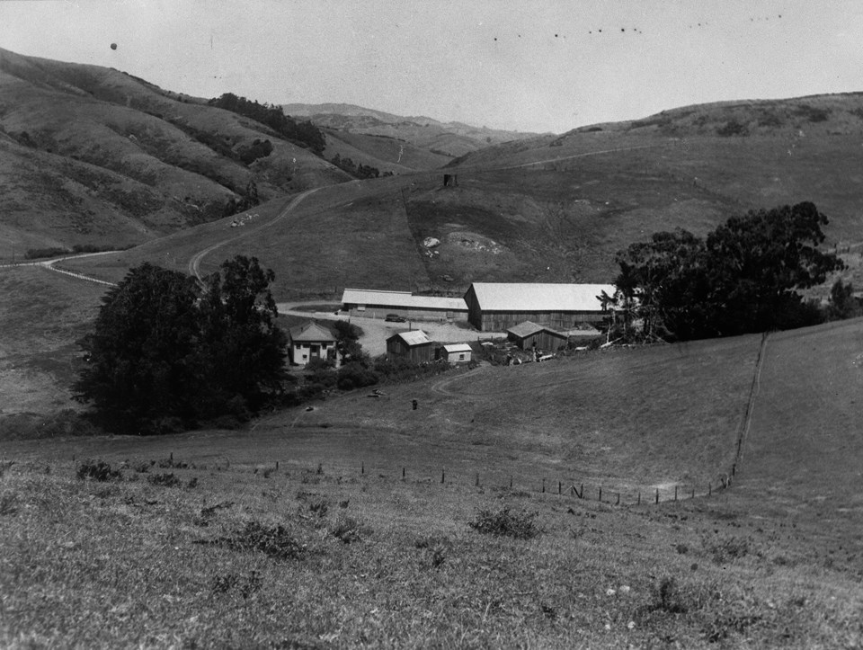
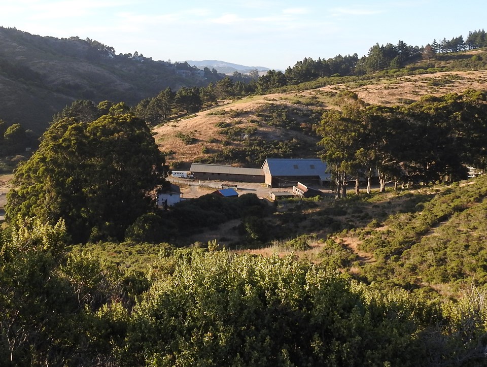
Tennessee Valley - The Cunha Dairy Ranch c1900
Manuel Ferreira Da Cunha was born in the Azores in 1849 and is buried in Fernwood Cemetary. He was a tenant rancher on the property owned by and purchased 170 acres for $12,150 in gold coin in 1903. The Cunha Dairy delivered milk in the 1920’s and 30’s by driving a route around Sausalito by horse and wagon with milk in 10 gallon cans. They also transported their product to a milk stop platform where Marin Dell trucks picked up the cans to transport them to San Francisco creameries.
Left image
Credit: GGNRA Park Archives
Right image
Credit: Ted Barone
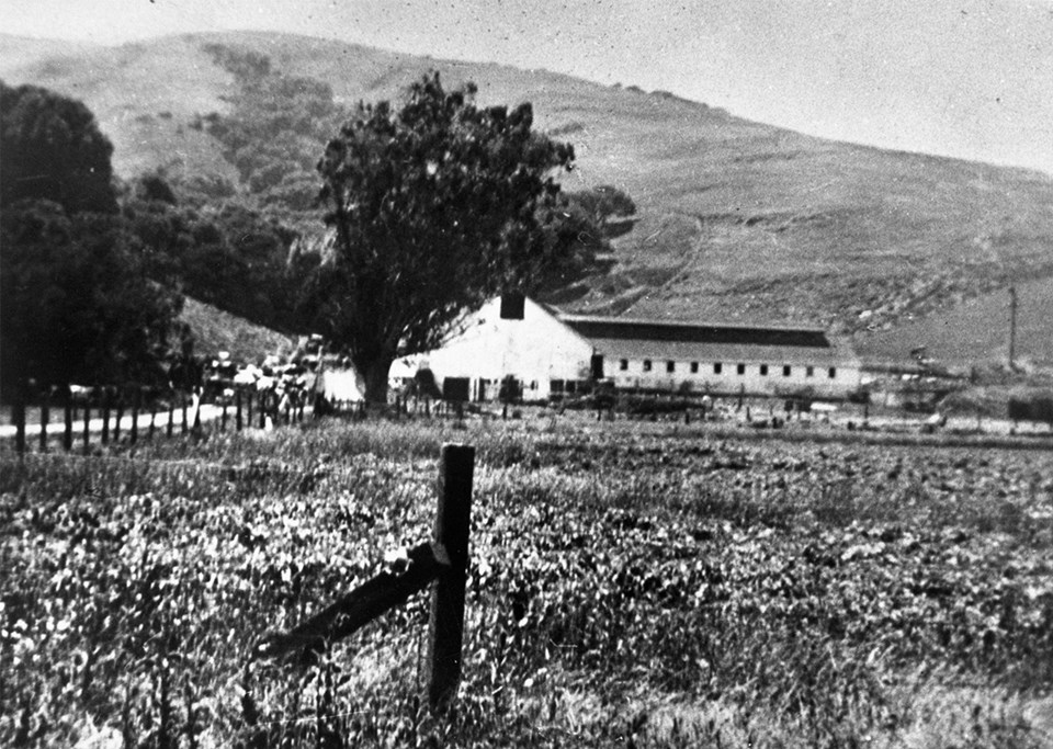
Silva Dairy Ranch in Tam Valley c1930s
The Silva family first established their ranch at the eastern end of Tennessee Valley (then called Elk Valley), near the junction with Tamalpais Valley (originally Coyote Hollow) around 1870. At the time, the road to Tennessee Valley was dirt with portions from Tam Junction skirting the marsh and often impassable in winter. This location is now the Tam Valley Elementary School.
Left image
Credit: GGNRA Park Archives
Right image
Credit: Ted Barone
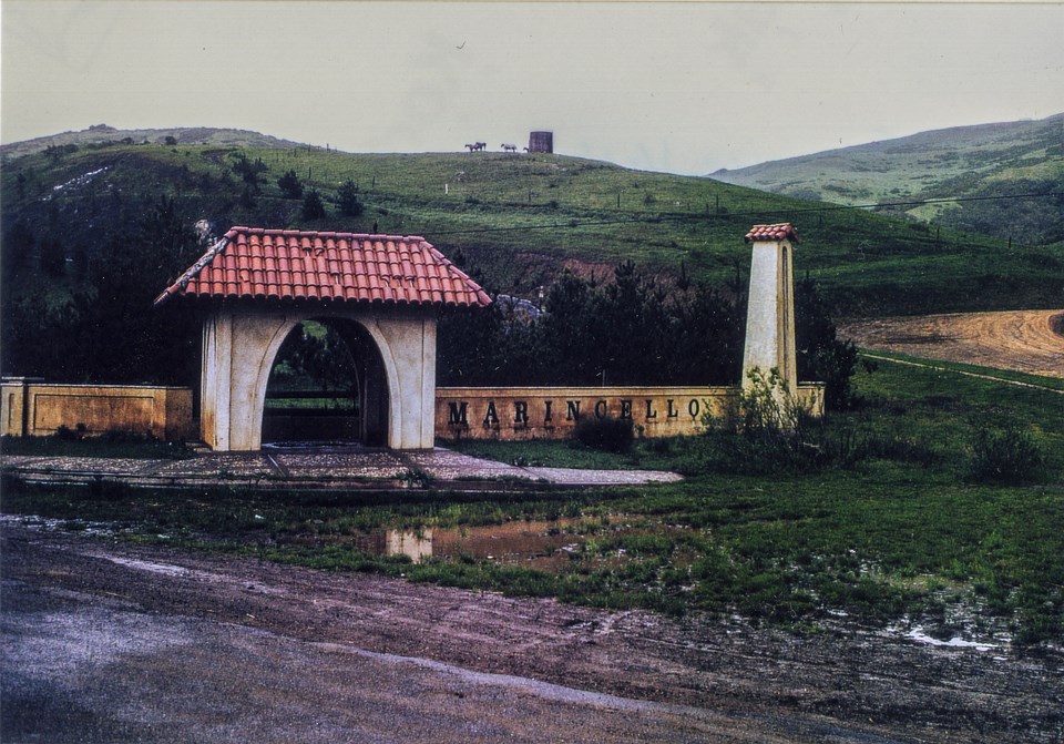
Marincello Gate 1973
During the Cold War, population growth led to increasing pressure on open space and the Army began to consider disposal of non-essential military land, including a proposal to develop much of Marin Headlands for housing. This project was opposed by conservationists, open space advocates, and historic preservationists. Their opposition led to the creation of the GGNRA in 1972 as part of a national movement to create National Parks in urban areas. The new GGNRA included all of the former Lime Point Military Reservation. In 1995, the Army transferred Fort Baker land to the National Park Service and the last soldiers left in 2000.
|