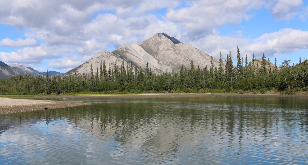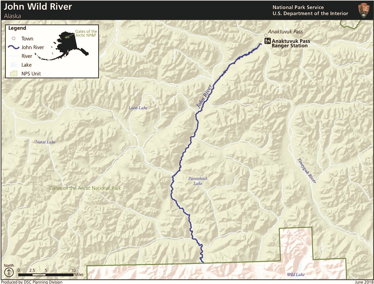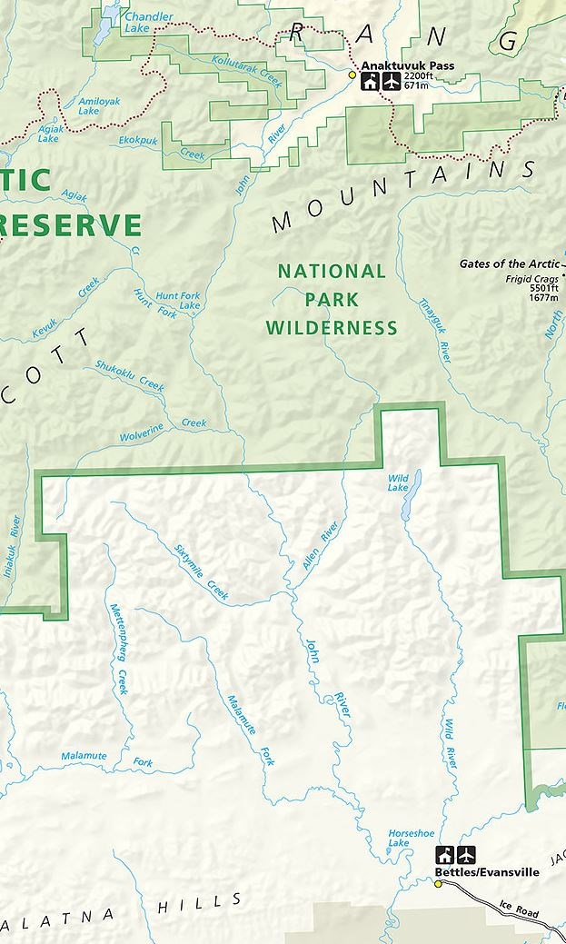
NPS/Steve Behrns The John River flows 136 miles from the 6,000-foot-high Endicott Mountains to its confluence with the Koyukuk River.From its origin at Soakpak Mountain, the John River flows through Anaktuvuk Pass and then south through the Brooks Range's alpine tundra and forested valleys to the Koyukuk River just below Bettles Field/Evansville. The river’s notably low valley and narrow corridor contribute to its unique character, through beautiful areas and a variety of ecosystems. 
Approximate Length52 mi / 84 km inside Gates of the Arctic National Park & Preserve Scenic QualityThe dramatic John River corridor is one of the most scenic in the entire Brooks Range. Features such as high relief, remarkable plant diversity, exposed rocks, cliffs, and rock outcroppings provide desirable and unique scenic qualities along the John River. Additionally, diverse ecosystems provide the user with ever-changing surroundings. Proximity from the river to adjacent mountains and the notably low valley provide outstanding views within the middle and upper portions of the river. Between the Hunt fork of the John River and the mainstem of the John River, a distinct mountain provides outstanding views of Gray Mountain, Boreal Mountain, and many other peaks that characterize the Brooks Range. From certain sloped areas, sweeping vistas provide exceptional views into the relatively scenic Pamichtuk Lake drainage. The John River drainage is uniquely narrow, about 1 mile wide, with mountain slopes directly bordering the corridor. During autumn, willows and cottonwoods present striking gold coloration. The section of river near the Sheep Creek confluence is exceptionally scenic and provides impressive views of Gunsight Mountain. Near the river’s lower sections, impressive rock outcroppings can be viewed along with highly eroded banks. Recreational OpportunitiesThe upper portions of the river provide a class 2 to class 3+ float when water is high enough. The lower reaches make an excellent family float. There is excellent hiking and backpacking in upper river area, though intially the river runs through Nunamiut Corporation land. Geologic FeaturesThe river flows through wide glacial valleys dissecting central Brooks Range. It is lined with interesting bluffs in the lower reaches. Natural ResourcesThe John River is one of the primary migration routes of three herds of caribou, the western Arctic, the Central Arctic, and the Teshekpuk. Anaktuvuk Pass, part of the John River valley, is a primary migration route for three herds of caribou—the western Arctic, Central Arctic, and Teshekpuk herds. While many rivers in this region serve as migration corridors for one or more caribou herds, the unique qualities of the John and its valley make it a particularly attractive route for an unusual number of herds. Cultural ResourcesThe archeology of the John River corridor straddles both the Inupiat and Athapaskan spheres and the river has continued cultural significance into contemporary times. Due in part to its role as a major route for caribou migration, the John River has long been an important focus of human activity, as demonstrated by a dense accumulation of regionally and nationally significant archeological sites and cultural properties. Although only cursorily inventoried for archeological resources, at least 96 historic and prehistoric archeological sites are known in the John River corridor within Gates of the Arctic National Park and Preserve. The sites represent nearly all phases of human occupation known for the region and represent the Paleoindian, Paleoarctic, Northern Archaic, Arctic Small Tool, and Late Prehistoric Periods; these sites include villages, house remains, game-drive systems, blinds, caches, and numerous stone-tool scatters. The valley straddles both Inupiat and Athapaskan cultural spheres; as such, it has high value for anthropological and archeological studies of prehistoric cultural relations. Sites in and around Anaktuvuk Pass at the head of the John River valley represent an internationally significant archeological district that contains a long and continuous record of human habitation spanning at least 8,000 years and includes several key type sites for archeological cultures that have been defined for northern Alaska. Ethnohistoric sites in the area—and the ethnoarcheological research conducted at the sites—were the basis for major developments in American archeology; these sites continue to hold high research potential and represent continued cultural importance to the inhabitants of Anaktuvuk Pass. A major site complex at Publituk (Puvlatuq) Creek has been used for centuries by Nunamiut people and has high potential for recognition as a significant cultural landscape. |
Last updated: June 30, 2020

