Crater Lake bathymetry

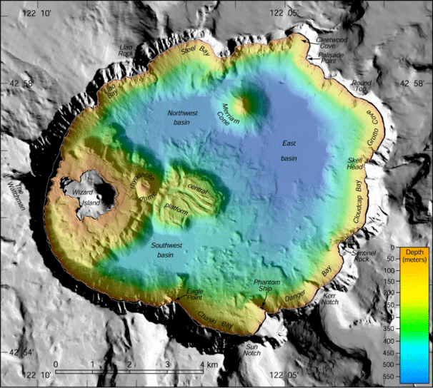
Image of the bathymetry of Crater Lake.
Rendering of the Crater Lake bottom contours using multibeam sonar. The colors in these images represent depths of the crater bottom, with reds being the shallowest and blues being the deepest; gray colored areas are above lake level.

US Geological Survey, USGS

The underwater landscape of Crater Lake was mapped in 2000. this collection imagery and data was a cooperative effort between the U.S. Geological Survey's Pacific Seafloor Mapping Project, the National Park Service, and the Center for Coastal and Ocean Mapping at the University of New Hampshire. A state-of-the-art multibeam sonar system collected high-resolution bathymetry, and calibrated co-registered acoustic backscatter to support both biological and geological research in the area (aquatic biology, geochemistry, volcanic processes, etc). This survey collected over 16 million soundings and the resulting data portrays the bottom of Crater Lake at a spatial resolution of 2 meters.
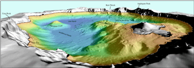
"The bathymetry data was converted from water depths to elevations using a lake level of 1882.6 m above sea level at the time of the multibeam survey. This was done because the lake level fluctuates seasonally and annually." USGS

 
a side-view of a sonar created image of Crater Lake contours
This view of the lake bottom shows the massive scale of Wizard Island. The distance across the bottom of this cinder cone is about 3.7 mi (6 km).

US Geological Survey, USGS

The cinder volcano named Wizard Island grew as the lake filled. Older submerged shorelines of the island can be seen where lava flows shattered after entering the lake, creating steep underwater talus slopes. The gently sloping bench around Wizard Island consists of lava flows that were later drowned by the rising lake. Submerged near the center of Crater Lake is the central platform volcano, which also has breaks in its slopes that indicate the location of shorelines. Below its steep north and east flanks, however, are sinuous lava flows that apparently flowed underwater, down over the shattered older lava.

The above information is copied from the USGS website. Additional photos and explanations of underwater formations as seen through the Crater Lake bathymetry study can be found on the USGS website.


The requested video is no longer available.

Last updated: October 27, 2022

Park footer

Contact Info

Mailing Address:

Crater Lake National Park
PO Box 7

Crater Lake, OR 97604

Phone:

541 594-3000

Contact Us