
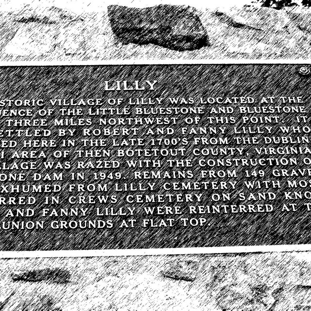
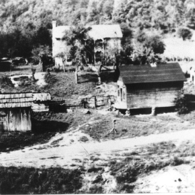
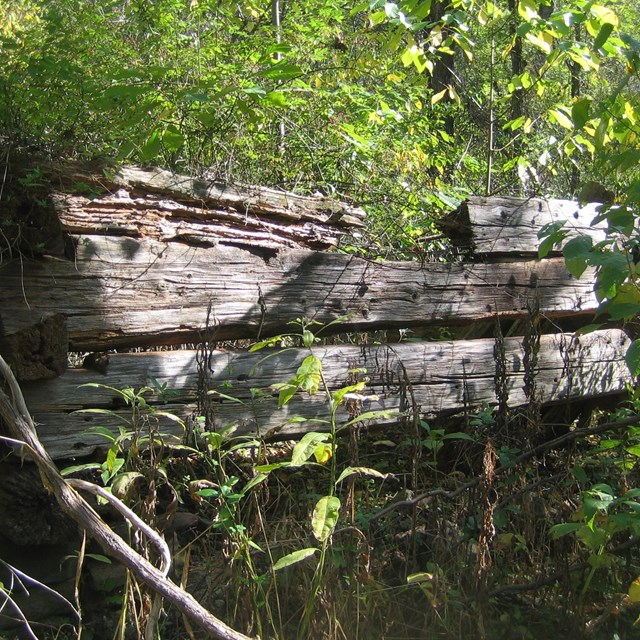
NPS photo/Dave Bieri American Indians called the Bluestone River "Momongosenka" (Big Stone River) supposedly inspired by their travels along ancient pathways through the boulder strewn lower gorge. Many native prehistoric sites, from nomadic Paleo-Indian hunting camps dating back to the times of Ice -Age mammoth and mastodon, through hundreds of generations of village and burial sites of the Archaic and Woodland cultures, to the Delaware, Cherokee and Shawnee tribes of the 1600 and 1700s, have been documented throughout the Bluestone River watershed. In the mid 1700s European and African peoples began to explore and establish subsistence homesteads along the river. Settlers at the rivers headwaters, in present day Tazewell County, Virginia named the river Bluestone for the waters course over the blue limestone streambed. At the confluence of the Bluestone and Little Bluestone Rivers in the National Scenic River near Bluestone State Park, the lost community of Lilly once flourished before its condemnation and removal prior to the construction of Bluestone Dam. The Bluestone Turnpike, a riverbank road that evolved from the original Indian trail through the gorge, was used by those who farmed and timbered the area until the 1940s, and still serves today as the main trail access for park visitors.
|
Last updated: February 14, 2020